GPRS’ innovative infrastructure mapping platform helped Idaho’s largest university obtain an accurate picture of its buried electrical infrastructure.
GPRS Project Manager Elias Iske worked with Cator Ruma & Associates, and engineers from Boise State University to accurately locate and provide depths for the primary electrical lines that service the 192-acre campus.
“Boise State has a separate power grid to Idaho Power, the local power company,” Iske explained. “GPRS worked alongside the school’s electrical engineers and Cator Ruma’s engineers to accurately locate and provide depths to the electrical lines.”

Boise State was founded in 1932. Originally a junior college, it became a four-year institution in 1965 (Boise College) and a university in 1974. By 1989, it had the highest enrollment of all Idaho colleges and universities.
The Broncos are known for their school spirit and engaging in student life on campus. College ranking and review site, Niche, ranked Boise State as Idaho’s top college for student life, and as the 89th-best college campus out of 1,373 nationwide.
Of course, it’s hard to maintain a vibrant campus ecosystem if sections of the campus must be regularly shut down to repair damage from utility strikes. And striking a buried utility when excavating not only causes these interruptions to daily life; they can also endanger the surrounding community, derail your project’s schedule, and torpedo your budget.
Boise State wanted to be proactive in obtaining accurate existing conditions documentation of their buried electrical lines, so that they could avoid them when breaking ground during future operations & maintenance projects.
GPRS uses electromagnetic (EM) locating and ground penetrating radar (GPR) in concert to conduct utility locates.
True to their name, EM locators detect the electromagnetic signals radiating from metallic pipes and cables. These signals can come from the current flow in a live electrical cable, or a conductive pipe acting as an antenna and re-radiating signals from stray electrical fields and communications transmissions. They can also be created by the locator’s transmitter applying current to the pipe.
GPR scanners emit radio signals into the ground or a concrete slab, then detect the interactions between these signals and any buried objects such as utilities, underground storage tanks, or structural supports like rebar and post tension cable.
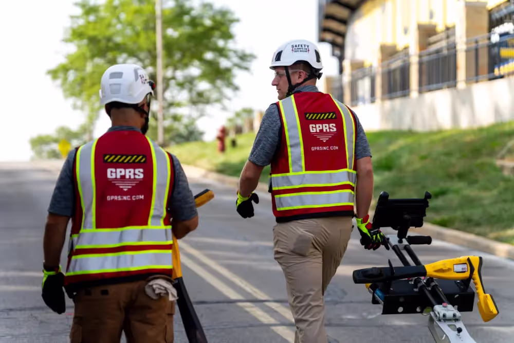
Iske deployed EM locating and GPR scanning to map Boise State's electrical lines. Typically, GPRS’ SIM-certified Project Managers use spray paint to mark their findings directly on the ground. BSU, however, requested we only mark with small red dots to limit the amount of paint on the campus grass, sidewalks, and roads.
Whether we mark with spray paint, chalk, flags, or whatever other medium a client prefers, GPRS knows that all these physical indicators of a buried location disappear over time. That’s why we created SiteMap®, (patent pending), a GIS-based project & facility management application that provides accurate existing condition documentation to protect your assets and people.
Accessible 24/7 from any computer, tablet or smartphone, SiteMap® is a single source of truth for your historical data and the field-verified data collected by GPRS’ nationwide team of Project Managers.
Iske’s accurate map of Boise State's buried electrical infrastructure was uploaded into SiteMap® so that Cator Ruma and the campus’ engineers and related staff can plan, design, manage, dig, and ultimately build better.
“Boise State was pleased that GPRS did not need to open transformers and switches to locate [the lines],” Iske said. “In the end, the SiteMap® (data) provided for Cator Ruma and Boise State had over 1,000 points of information to inspect, and dozens of electrical lines with various depths. The information provided was even more detailed than they expected. They were pleased with how quickly we were able to accomplish the work.”
In a statement provided to GPRS, Cator Ruma said: “The information as extensive, detailed and highly useful for the client.”
From electrical lines to sewer laterals, to skyscrapers and beyond, GPRS Intelligently Visualizes The Built World® to keep your projects on time, on budget, and safe.
What can we help you visualize?
Frequently Asked Questions
What are the Benefits of Underground Utility Mapping?
Having an updated and accurate map of your subsurface infrastructure reduces accidents, budget overruns, change orders, and project downtime caused by dangerous and costly subsurface damage.
How does SiteMap® assist with Utility Mapping?
SiteMap®, powered by GPRS, is the industry-leading infrastructure management program. It is a single source of truth, housing the 99.8%+ accurate utility locating, concrete scanning, video pipe inspection, leak detection, and 3D laser scanning data our Project Managers collect on your job site. And the best part is you get a complimentary SiteMap® Personal Subscription when GPRS performs a utility locate for you.
Click here to learn more.
Does SiteMap® Work with my Existing GIS Platform?
SiteMap® allows for exporting of data to SHP, GeoJSON, GeoPackage, and DXF directly from any user’s account that either owns or has a job shared to their account. All these file formats can be imported and utilized by other GIS packages if manually imported by the user. More information can be found at SiteMap.com.