

.svg)
As-Built creation
Eliminate Clashes & Rework Above and Below-Ground with Accurate As-Builts from GPRS

///WHAT IS AN AS-BUILT?
As-builts can be updated throughout a project’s life cycle. They can be generated during construction to document design changes from the original plans. They can also be produced at the end of a job, during closeout, often referred to as final as-builts or record drawings. An accurate record of existing conditions expedites project planning and decision making.
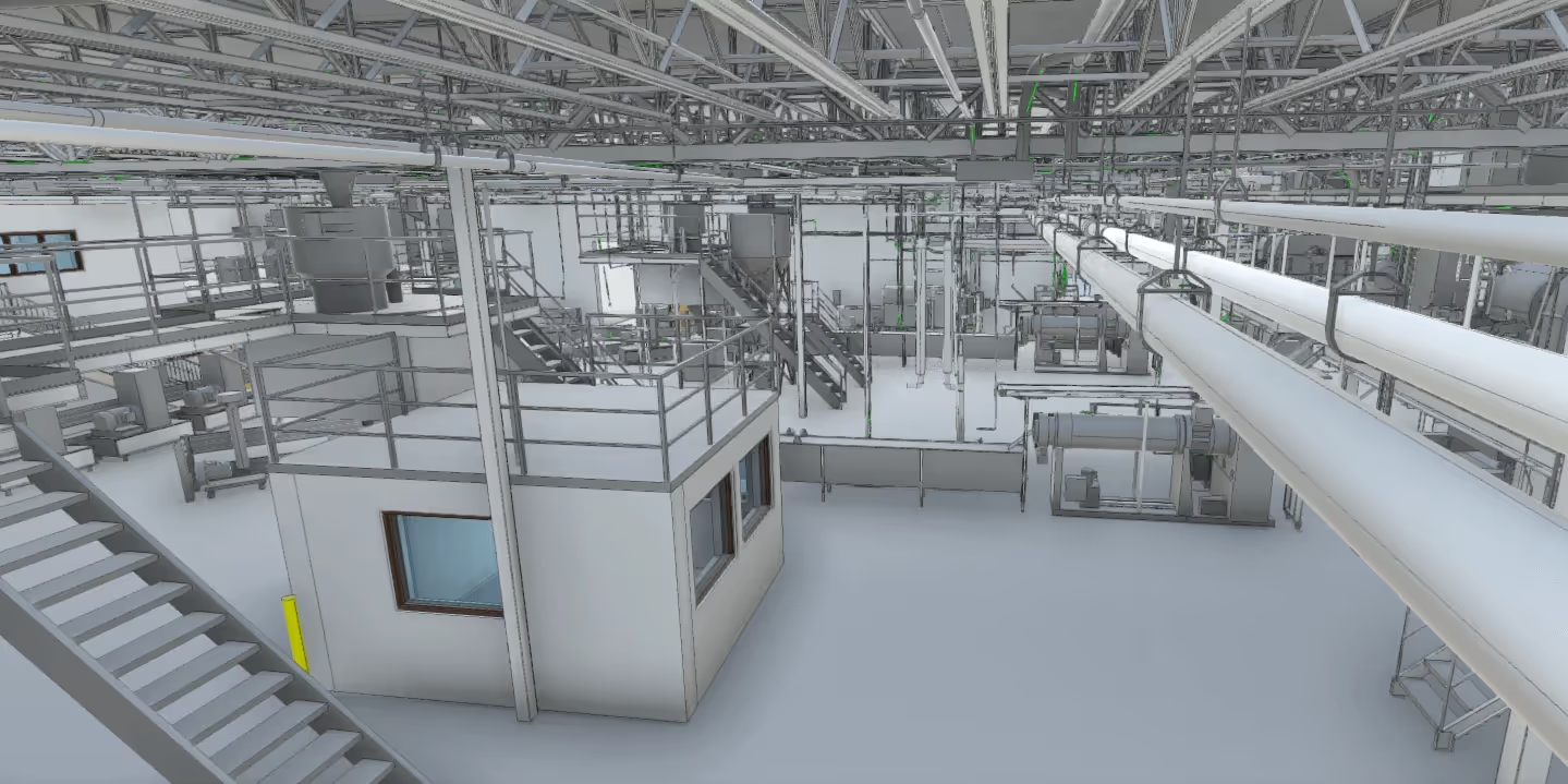
Renovations or modifications can proceed smoothly when teams have architectural, structural, and MEP system specifications. Accurate as-builts reduce delays and costs from mistakes and reworks made from working with outdated plans.


///EVERY DETAIL Matters
You can’t afford clashes, mistakes, and reworks… Neither can we. That’s why accurate existing conditions documentation and as-builts matter because they help you avoid
- Eliminate Miscommunications - When everyone on your team has access to the same accurate information, it creates a more dynamic and flexible working environment because everyone starts on the same page. Precise as-builts decrease calls, emails, messages, and site visits by providing a single source of truth.
- Eliminate Project Planning & Design Errors - Accurate measurements mean accurate plans, designs, material orders, and workflows because you’ve already detected potential clashes. So, you can execute your project with fewer mistakes, delays, and bottlenecks.
- Reduce Budget Overruns - Change orders, miscommunications, and accidents all cause delays and delays cost money. Accurate as-builts serve as a single source of truth to reduce errors and dial in cost estimates.
- Reduce Change Orders, Clashes, Damages, and Reworks – The surest way to reduce damages, change orders, clashes, and reworks is to eliminate them out of the gate with precise measurements and easily accessible objects that everyone on your team can use to design, plan, and build better. As-builts are one of a variety of visualization tools available from GPRS.
- Eliminate Workflow Bottlenecks – Order, plan, and schedule efficiently with accurate, layered, digital project details to allow for task stacking and construction progress that can be easily tracked and reported to stakeholders and off-site collaborators via ProCap and Walkthru 3D photogrammetry and virtual tours.
///TRUBUILT: ACCURATE AS-BUILTS PROVIDED BY GPRS MAPPING & MODELING SERVICES

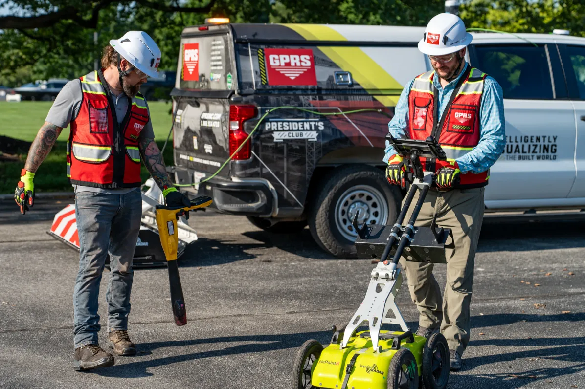
Because what sets GPRS apart is our commitment to quality and consistency. Our 99.8% accuracy rate demonstrates that our equipment, training, and methodology consistently deliver high-quality results nationwide. All 500+ GPRS Project Managers utilize the industry-leading specification called Subsurface Investigation Methodology (SIM) when conducting utility mapping, concrete scanning, sewer camera inspection, or 3D laser scanning.
.webp)
///PROJECT CYCLE SOLUTIONS
.svg)
Planning & Design
- Capture complete & accurate existing conditions above and below-ground including depths, where available.
- Integrate your accurate as-built conditions into architectural plans & design models to avoid clashes and reworks before you break ground.
Construction
- Utilize secure, shareable, digitized utility maps, structural drawings, reports and models to minimize information bottlenecks, inaccuracies, and mistakes.
- Track and report construction progress to stakeholders and your team via ProCap Progressive Capture and WalkThru 3D virtual tours.
O&M/Remodel
- Access the accurate comprehensive layered plan views, annotated record drawings, maps, models, and reports for your project via SiteMap®, so anyone on your team can find what they need when they need it.
- Control the quality of your project or facility data so you can control damages to keep everything running smoothly.

Build at the speed of
.svg)
.svg)
.svg)
.svg)
.svg)
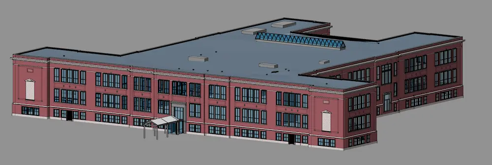
///AS-BUILT VS AS-INTENDED DRAWINGS

As-Intended

As-Built
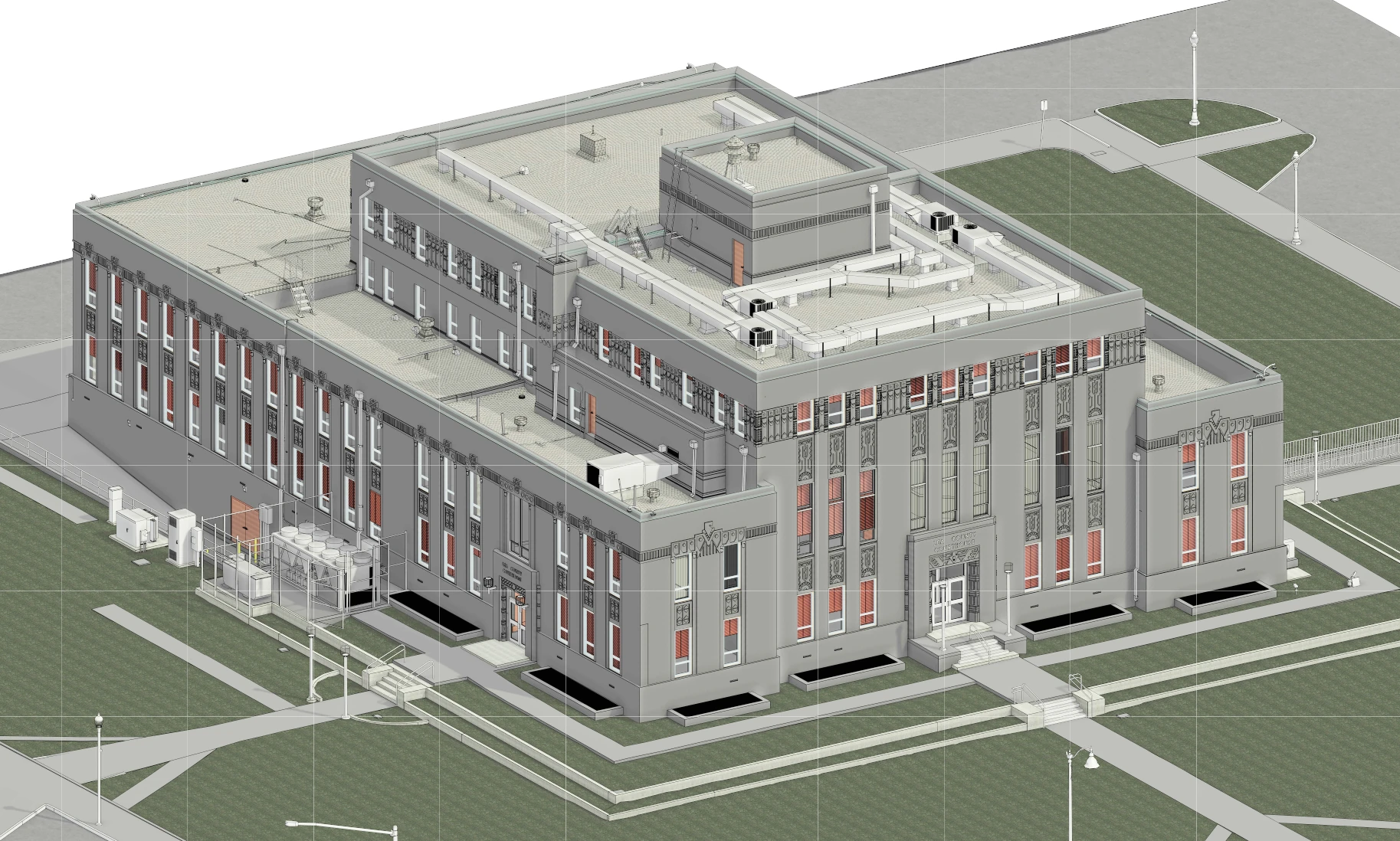
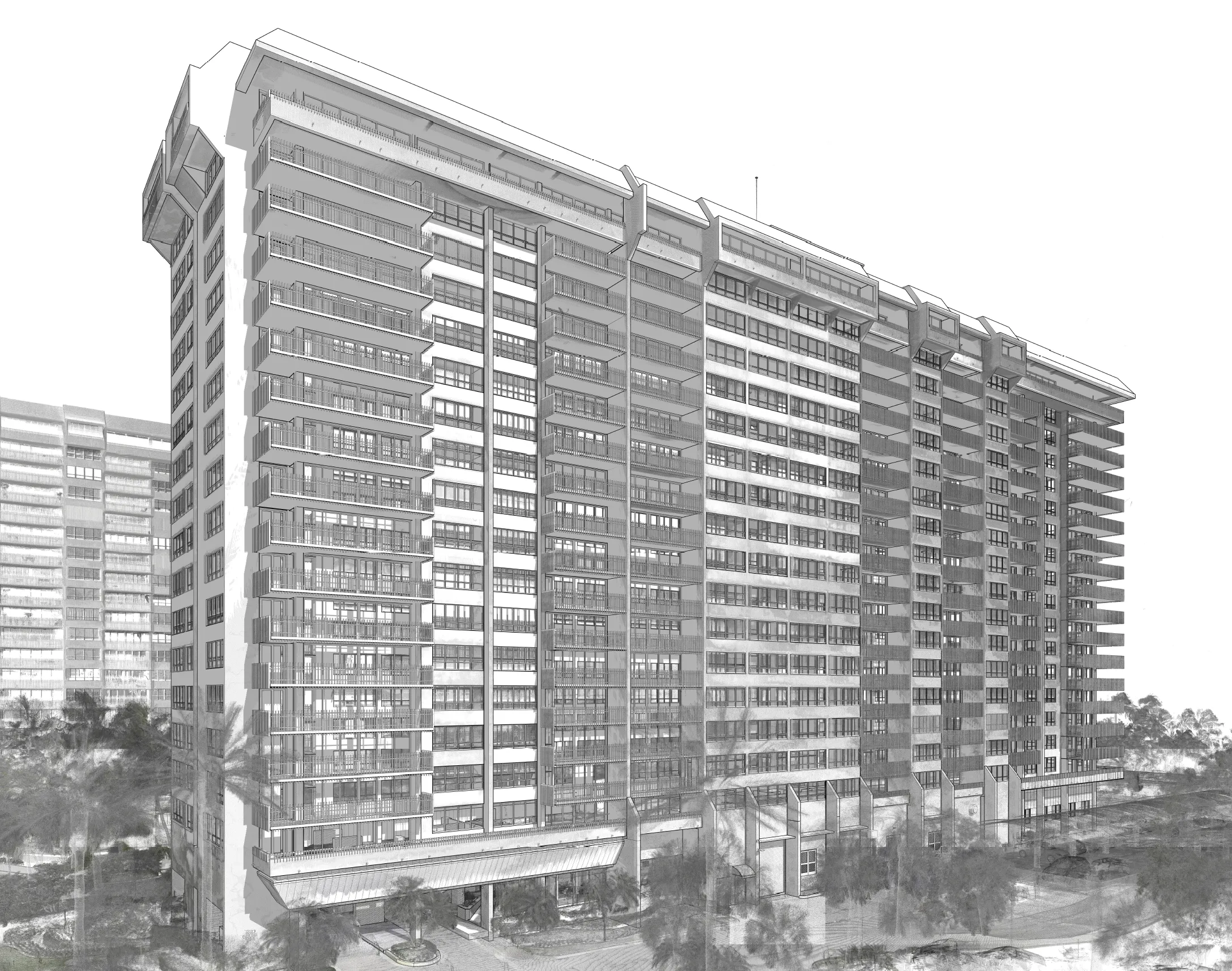
GPRS Intelligently Visualizes The Built World® to give you actual as-builts - often accurate within 2-4mm - delivered in a variety of media.
///CONTROL DATA CONTROL DAMAGE


SITEMAP® PROJECT
- Prevent damages, change orders, and cost overruns to keep your assets & people safe.
- All subcontractors and trades use GPRS services
- All accurate GPRS infrastructure data is automatically uploaded to create a single source of truth
- Secure & accessible for the life of your project

SITEMAP® PRO
- Focuses on one facility
- Allows you to manage all your projects from one secure location
- Aggregated, layered above and below-ground infrastructure documentation for progress capture, record-keeping, and planning
- Customization to your needs
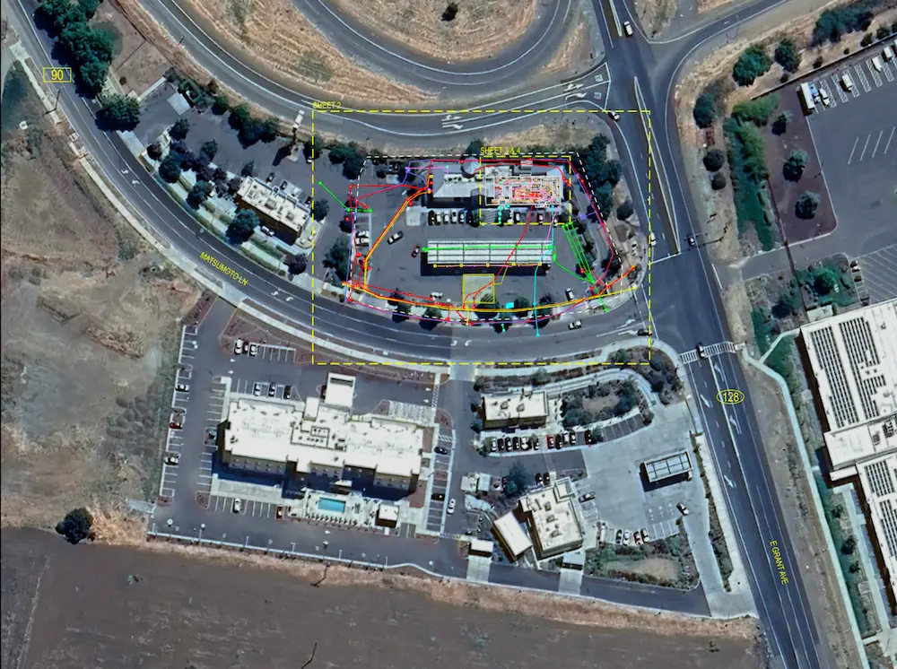
As-Built Case Studies


.avif)


///Case Study


.avif)
.svg)
.svg)
.svg)
///FREQUENTLY ASKED QUESTIONs
They provide precise documentation of existing conditions, enabling accurate maintenance planning, system upgrades, and emergency response coordination.
They verify that construction matches design intent, document deviations, and fulfill turnover requirements for compliance and warranty validation.
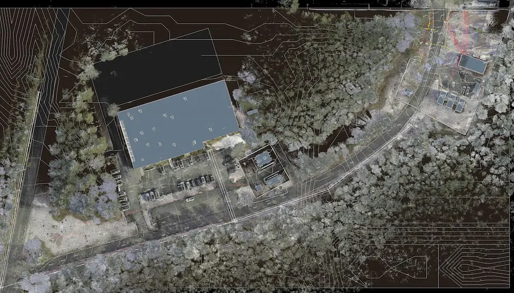
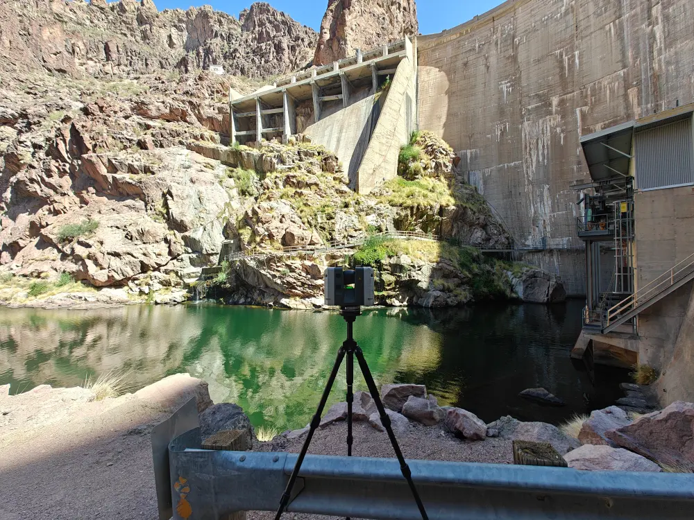
Reality Capture technologies like 3D laser scanning and LiDAR capture both aboveground spatial data and GPRS’ 99.8% accurate subsurface markings with millimeter precision. That data can then be registered and rendered to create accurate as-builts that integrate your structural and subsurface existing conditions to reduce manual measurement errors, update, and fill in the blanks on any outdated records.
As-built accuracy is the difference between a smooth, clash-free project and potential chaos. Because at any time you could need to locate structural elements, utilities, and/or mechanical systems, to know where you can cut, core, drill, or dig without causing expensive damages and delays.
Design drawings show intent, while as-builts, also known as record drawings, reflect your actual field conditions, and should include all changes made and specifications noted during construction.