GPRS used 3D laser scanning and BIM modeling to support Whiting-Turner’s renovation of one of the most critical telecom hubs on the West Coast.
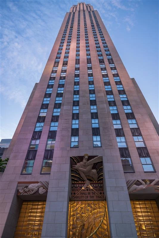
GPRS partnered with Whiting-Turner to 3D laser scan 200,000 square feet of the Pittock Block Internet Exchange in Portland, Oregon, an eight story, 302,262 square foot carrier hotel, data center, and office space. Built in 1914, the historic building was adaptively reused from an electric substation into a modern data center that now hosts one of the highest densities of telecom networks and carriers on the West Coast. Whiting-Turner planned renovations to tenant and common areas on the ground, mezzanine, fourth, and eighth floors, including new entry vestibules, infrastructure upgrades, support rooms, and façade modifications. To support this work, GPRS captured as-built data of the building to generate a point cloud, CAD drawings, and Autodesk Revit Model.
GPRS partnered with Whiting-Turner to 3D laser scan 200,000 square feet of Pittock Block Internet Exchange in Portland, Oregon, an eight‑story, 302,262 s.f. carrier hotel, data center, and office space. Built in 1914, this historic building underwent adaptive reuse, evolving from an electric substation distribution location into a modern data center that now houses the second greatest density of telecom networks and carriers on the West Coast. Whiting-Turner was planning a renovation of tenant and common areas on the ground floor, mezzanine level, fourth floor, and eighth floor, including the construction of new entry vestibules, infrastructure and equipment upgrades, and support rooms as well as modifications to ground-floor facades. To support the renovation, GPRS reality captured as-built data of the building to generate a point cloud, CAD drawings, and an Autodesk Revit Model.
Highlights
THE BOTTOM LINE
GPRS used 3D laser scanning and BIM modeling to support Whiting-Turner’s renovation of one of the most critical telecom hubs on the West Coast. INDUSTRY
Data Center SERVICE
3D Laser Scanning, Mapping & Modeling LOCATION
Portland, Oregon GPRS Insight
"This property spanned an entire city block and featured a central lightwell. My 3D scanning training and experience helped me to accurately tie in data from the lightwell to the rest of the building. The roof also contained an extensive cooling system to ensure that hot air generated by the data center is expelled to prevent damage to the servers." Daniel Jones, GPRS Project Manager Deliverables
Point Cloud, 2D CAD Drawings, Autodesk Revit 3D BIM Model PROJECT APPLICATION
GPRS delivers precise as‑built documentation to support data center construction, retrofits, and facility management. Through 3D laser scanning, CAD, and BIM modeling, we provide accurate data that empowers owners, contractors, and design teams to confidently design, build, operate, and maintain their facilities. Task
GPRS partnered with Whiting-Turner to 3D laser scan 200,000 square feet of the Pittock Block Internet Exchange in Portland, Oregon, an eight story, 302,262 square foot carrier hotel, data center, and office space. Built in 1914, the historic building was adaptively reused from an electric substation into a modern data center that now hosts one of the highest densities of telecom networks and carriers on the West Coast. Whiting-Turner planned renovations to tenant and common areas on the ground, mezzanine, fourth, and eighth floors, including new entry vestibules, infrastructure upgrades, support rooms, and façade modifications. To support this work, GPRS captured as-built data of the building to generate a point cloud, CAD drawings, and Autodesk Revit Model. PROBLEM
Renovations and infrastructure upgrades needed to be completed without disrupting ongoing tenant operations or critical systems.
The facility could not experience downtime, as it housed 16 fiber optic carriers, 179 service providers, and seven subsea cables critical to its role as a global grade Internet Exchange.
Renovations across multiple levels, including the ground, mezzanine, fourth, and eighth floors, had to modernize shared spaces, infrastructure, and systems while maintaining uptime.
Entry vestibules needed to be updated in a way that enhanced security, yet preserved smooth tenant and visitor flow.
Specialized rooms had to be designed and constructed to support IT infrastructure and facility operations while meeting strict technical requirements.
Ground floor facades required modification while preserving the building’s historic character.
Infrastructure and systems essential to data center operations had to be upgraded to ensure reliability, scalability, and compliance with industry standards.
Scheduling challenges had to be addressed when certain areas were unavailable for scanning or construction due to demolition or phased work.
Solution
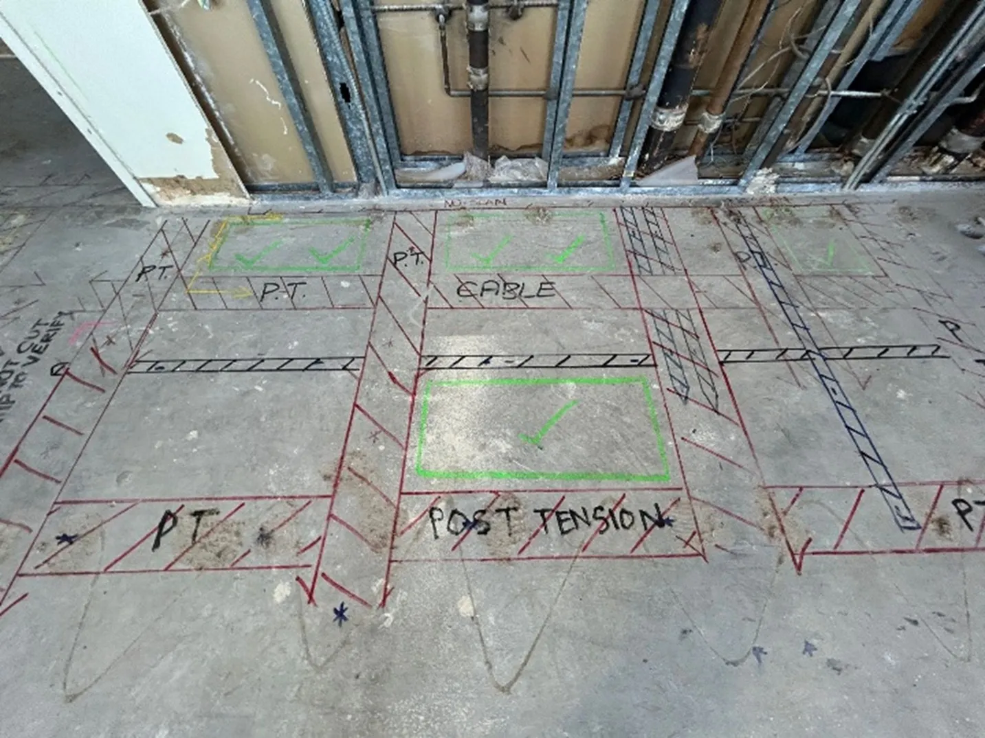
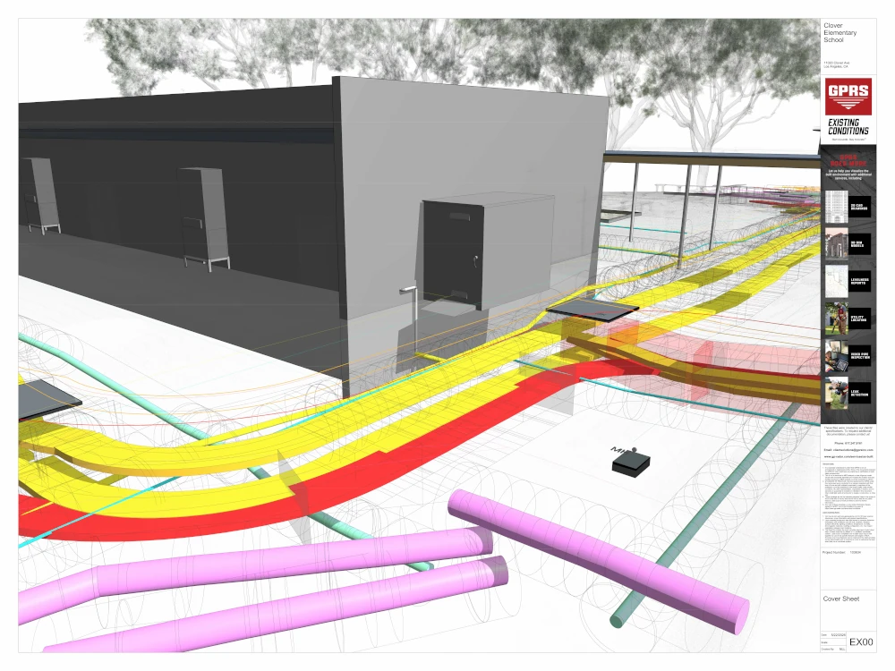
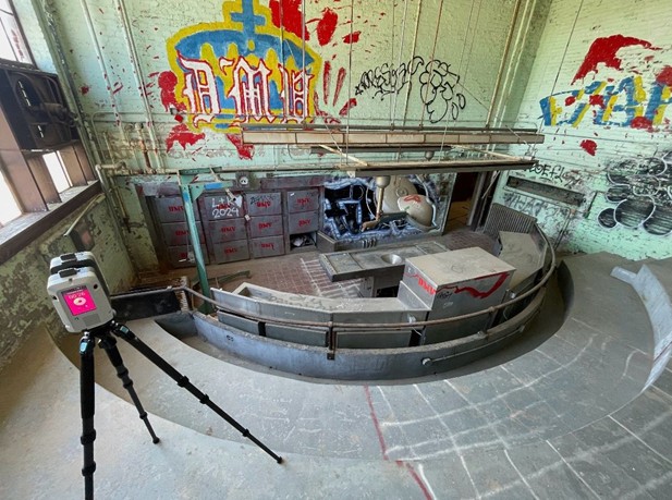
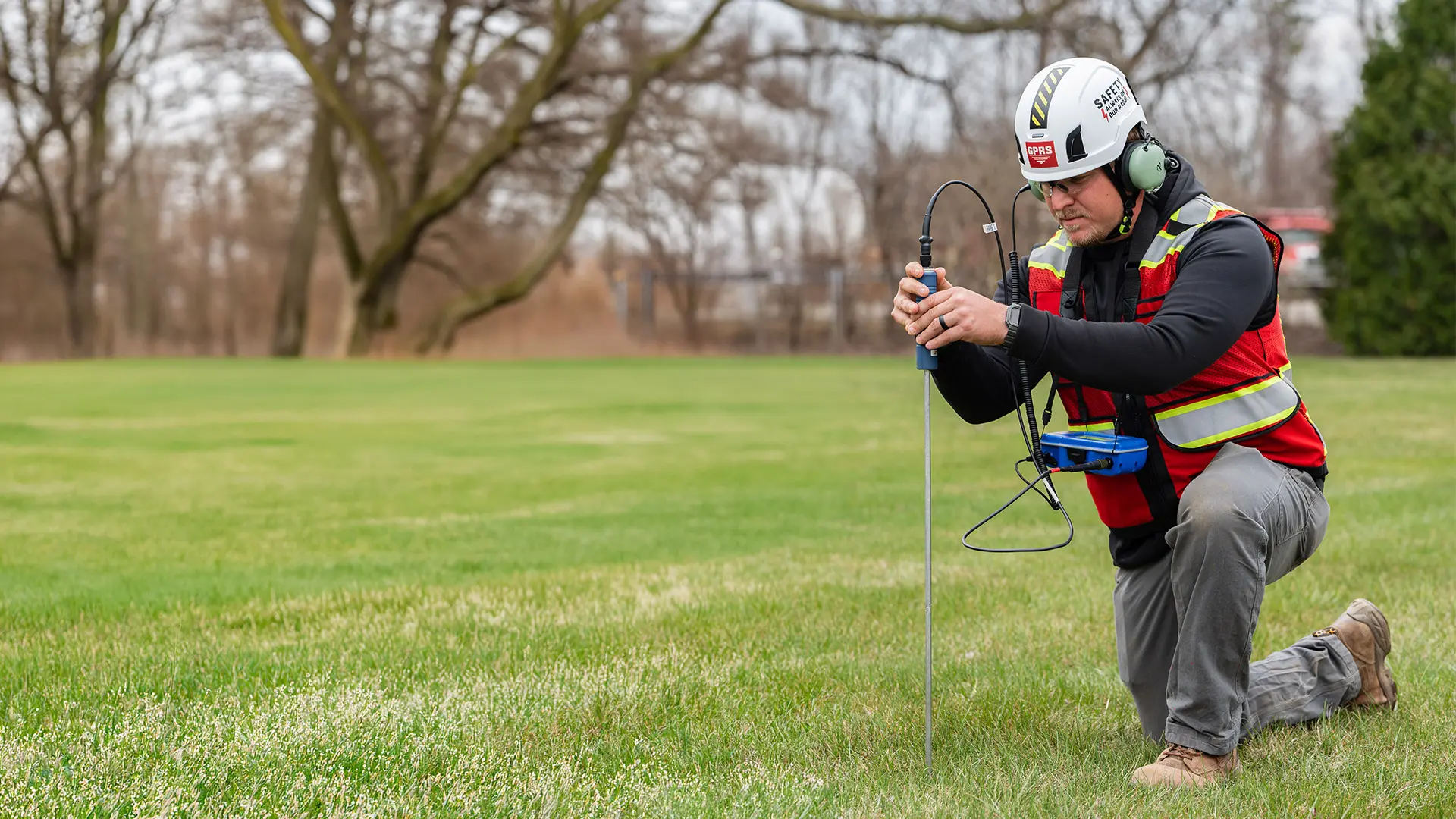
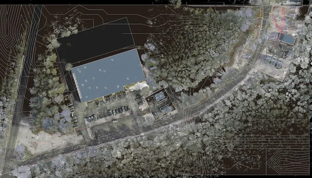
GPRS’ Project Manager captured 200,000 square feet of space with the Leica RTC360 scanner at 2-4mm accuracy, completing 504 individual laser scans.
Two mobilizations were conducted to ensure complete coverage of the basement, levels 1–4, level 8, and the roof.
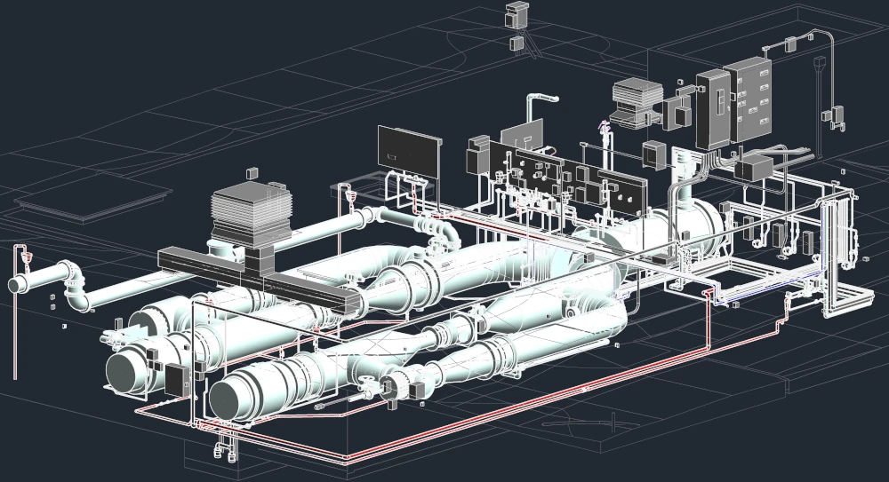
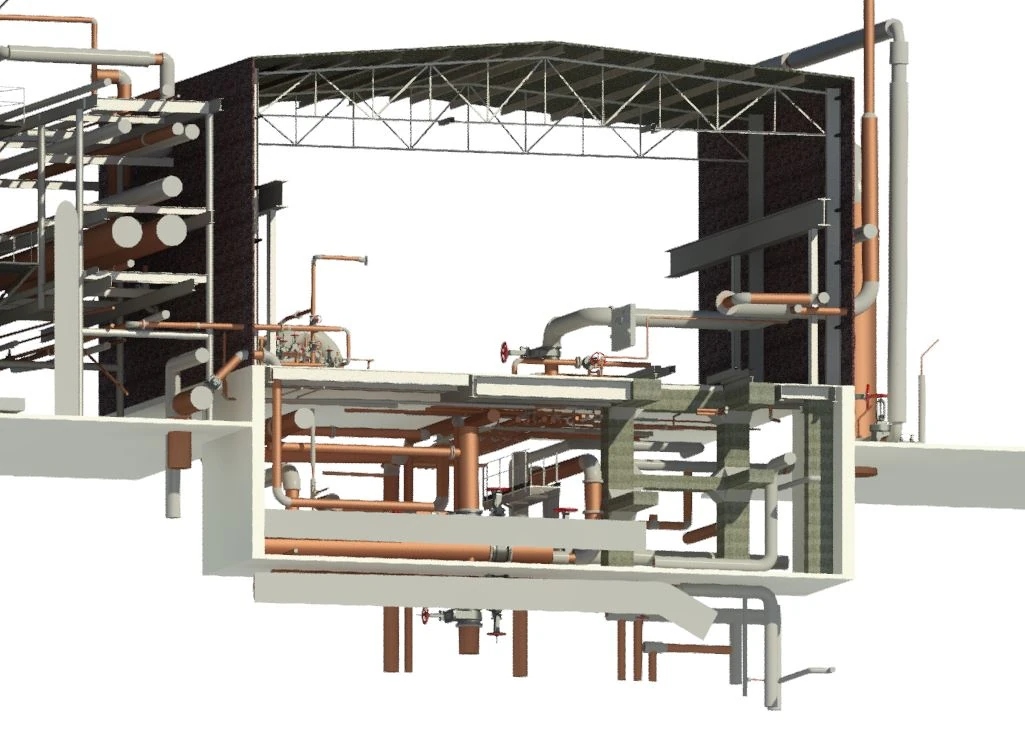
All architectural, structural, and MEP systems, including data closets and cooling systems, were documented in a colorized point cloud, capturing walls, floors, ceilings, doors, windows, roof infrastructure, exposed columns, beams, stairs, piping, conduit, and ducts.
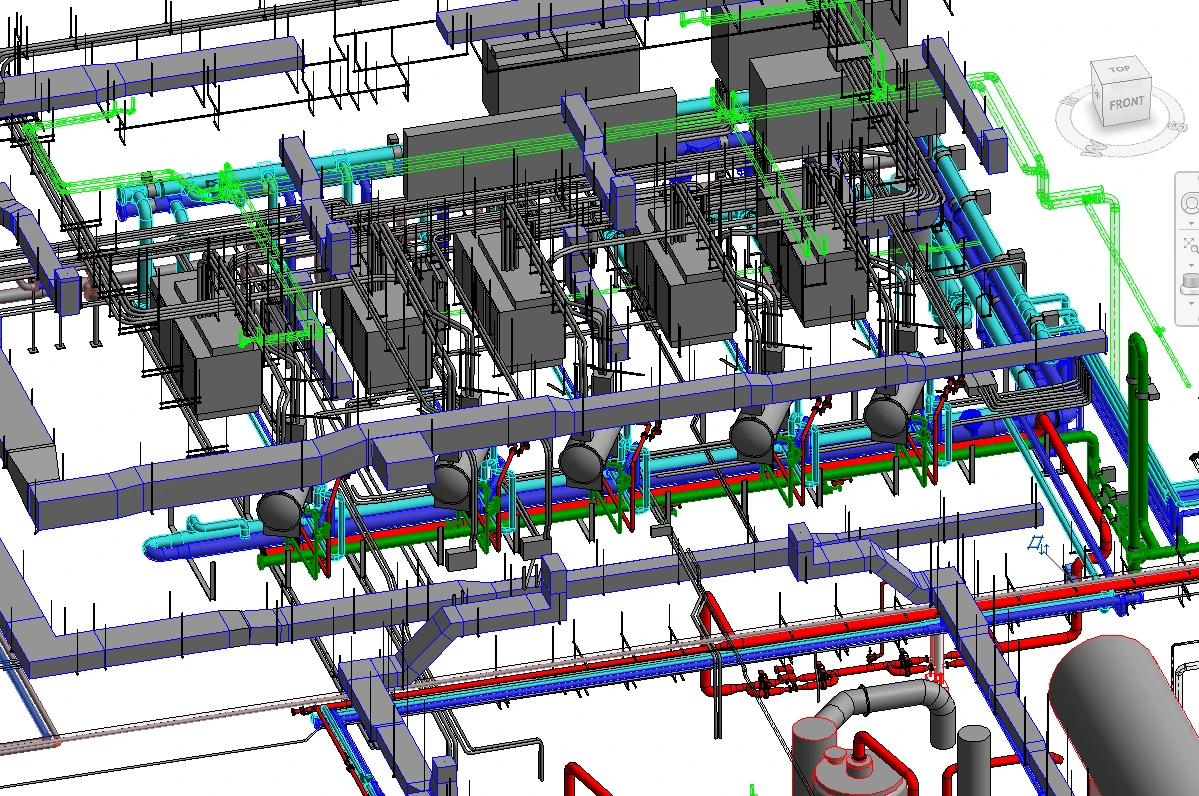
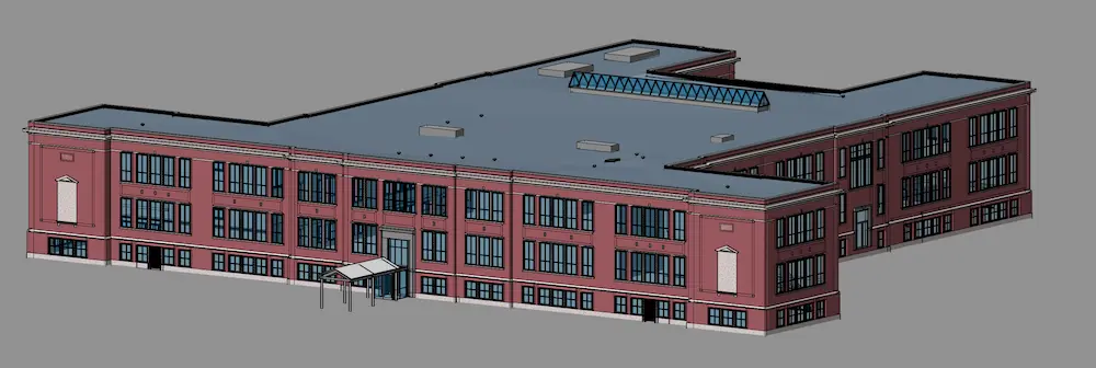
An Autodesk Revit 3D BIM model was generated to provide precise details of the data center’s spatial relationships, geometry, structure, and systems.
From the BIM model, 2D CAD drawings were produced to support pre-construction planning, enabling teams to quickly understand the project scope before advancing into detailed 3D modeling.
Benefits
3D laser scanning delivered a comprehensive, real time digital view of the data center, capturing precise structural and MEP layouts that seamlessly integrated with CAD and BIM for accurate planning, clash detection, and efficient construction sequencing.
Deliverables were shared via SiteMap, GPRS’ secure, cloud based platform and mobile app, which centralized point cloud data, CAD files, and BIM models into an interactive tool for easy access and collaboration.
With accurate facility as-builts, errors, change orders, delays, and costs were reduced during renovation.
Cooling system upgrades were enhanced through precise modeling of roof infrastructure.
Whiting-Turner successfully delivered turnkey data center renovations to meet tenant needs.
All


.svg)


.webp)