

.svg)
GPRS’ 3D laser scanning services and expertise provided unbiased data evidence for a criminal trial in Colorado.

GPRS Project Manager Stanley Jones was tasked with a 3D laser scanning job of a property in Colorado. What may have seemed like a run of the mill 3D laser job quickly turned into something Jones had never worked on before.

The client that hired Jones for the job specializes in 3D renderings and interactive visuals for court cases across the country. Jones’ job was to scan the site lines, the “line” extending from an observer’s eye to a viewed area or object, of those involved in a crime scene in using the RTC360 laser scanner and creating a 3D point cloud of their perspectives. The highly accurate data that is gathered in a 3D point cloud helps paint a picture of the events of that day to those who didn’t experience it themselves.
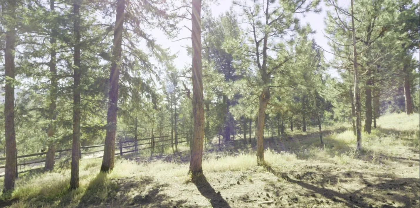
The trial involved a man allegedly firing gunshots towards police at his rural home in Pine, Colorado. The defendant claimed it was in self-defense as he alleged the police didn’t make him aware that they were law enforcement. The complexity of this case meant that Jones’ scans would provide the lawyers, judge, and jury with a visual from the point of view of all parties involved. The data that Jones collected served as an important element of impartial truth of what happened that day.
After three years of executing 3D laser scans in all kinds of conditions, Jones says this is the most unique job he has been on yet. Not only had he never scanned site lines before, but the prosecutor and defense attorney were both on site that day.
“So, they had us get very specific areas scanned in to so that they could generate the actual site lines of both parties involved,” the Project Manager explained. “So yeah, [it was] super unique.”
All angles listed by the police and the defendant needed to be captured. Some angles captured included the police’s point of view as they walked up the driveway of the property and the alleged shooter’s point of view overlooking an upstairs balcony. The area was also heavily obstructed by tress, which presented an issue to investigators and was another reason these scans were so important and valuable.
“They had us go through the police report,” Jones continued. “So, then, we ended up taking scans… extra scans like from the exact points where the parties were supposedly standing.”
Despite it being an unusual job compared to Jones’ usual field work, he said that the process was still relatively the same as a standard 3D laser job.
“It's fairly standard for the most part,” Jones explained. “You know, it's basically just capture the whole area. So that was pretty run-of-the-mill… just set up the camera in enough areas to get a full 3D recreation of just the area in general.”
Once the scans had been completed, they were sent to the GPRS Mapping & Modeling team to render the 3D models. The models were completed and sent over prior to the trial. Along with being delivered in a timely manner, Jones had stated that he was told that the deliverables exceeded the client’s expectations.
The two-week trial began and ended in February of 2024 and resulted in the accused being acquitted of all charges.
The inherently unbiased nature of 3D LiDAR data can also help you with your next project by showing you what you need to see.
What is a point cloud and why is it important?
Point cloud data is transforming the way architecture, engineering, and construction projects are planned and managed. Once the highly accurate digital measurements of the site or assets are recorded using 3D laser scanners, a 3D point cloud is produced and can be processed into other deliverables. A point cloud is where all GPRS Project Managers begin in the world of reality capture, as-builts and scan-to-BIM. The 2-4 millimeter accurate dataset gathered during the scan can be processed by the GPRS Mapping & Modeling team and transformed 3D BIM models, 3D meshes, 2D CAD drawings, and WalkThru 3D virtual tours.
The information that a point cloud delivers is invaluable. Whether it’s a scan of a skyscraper or a crime scene, the collection of coordinates visualizes everything a client would need to see so they can pull every ounce of information from the scan as possible.

From the courthouse to a field house, to a warehouse, GPRS Intelligently Visualizes The Built World® and delivers data that wouldn’t fail a polygraph test. Can you handle the truth? If so, what can we help you visualize?