industry insights
Featured Articles
Why Do You Need Updated As-Builts on Your Next Project?
Is Utility Mapping Worth the Cost?
industry insights
How Quickly Is Ultra-Fast EV Charging Infrastructure Expanding In The U.S.?
The news on EVs and charging infrastructure can seem like it’s all over the place. The New York Times decried the “slow rollout” of a national charging network that was funded in 2022 with $5 billion from the federal government, and a Business Insider article in June of 2024 decried the “bleak” state of EV charging, worrying that drivers may “ditch their EVs” in increasing frustration. Yet, in March of 2024, the “fastest EV chargers in the U.S.” opened in New York City, and Price Waterhouse Cooper predicted that the U.S. EV charging network could “grow nearly tenfold” by 2030.

Instead of chasing headlines down rabbit holes, GPRS cut through the noise and went straight to the source because providing subsurface utility locating, utility mapping, and concrete scanning support to EV charging networks is important to their safe, efficient installation, operation and maintenance. So we asked, who is investing in EV charging infrastructure near you and how much are they putting into it? When you evaluate the market information through that perspective, it paints a picture of a market and industry that has barely started its growth, and the numbers back it up.
Big Oil Goes Big Into EVs
If there’s one word to sum up where oil & gas companies see the future, it is diversification. For instance, BP’s future-casting is centered on a portfolio of five “transition growth engines,” as it moves to position itself as an integrated energy company. The five areas of growth they have identified are electric vehicle charging, bioenergy, convenience, renewables and power, and hydrogen.
Yahoo! Finance reports that several key oil and gas companies are expanding their EV charging station investments to meet demand. U.S. O&G companies like Shell, Chevron, and Phillips 66 join multinationals TotalEnergies, Eni, Repsol, Pkn Orlen, and Petronas in the EV charging station race. However, even the most invested oil company in the U.S., Shell, is still spending “a fraction of their capex on clean energy investments.” And it’s worth noting that some petroleum giants – Exxon Mobile, Valero, and Conoco Phillips, specifically – have decided to stay in their lane and focus on oil & gas, even though fossil fuel energy use is expected to stagnate by 2030.
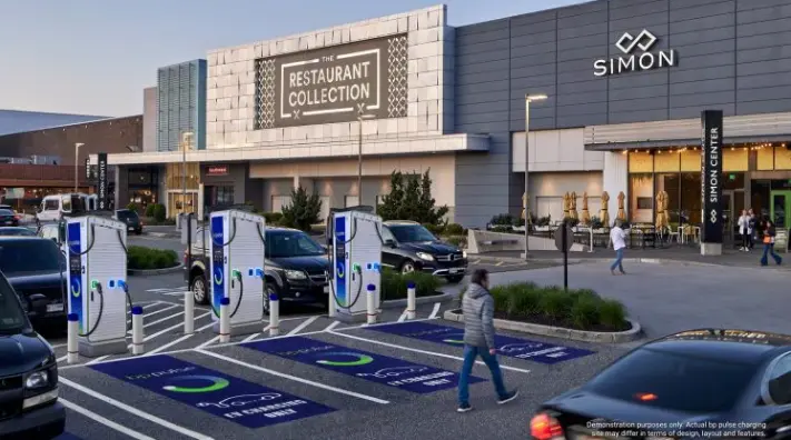
As part of their diversification and transition strategy, BP inked a new deal in July 2024 to roll out ultra-fast Gigahubs, large fast-charging EV hubs located in high-demand areas, to 75 Simon® locations. The deal is expected to add 900+ new charging bays near shopping, dining and entertainment, and mixed-use areas held by the Simon Property Group. The first of these Gigahubs should go online in early 2026. This investment is part of BP’s commitment to investing $1 billion in EV charging hubs. Currently, the company has 29,000 EV charge points worldwide. Their goal is 100,000 sites by 2030.
EV Arms Race Fueled by Shell & BP
BP’s Gigahub investment seems to be positioning the company in an attempt to overtake Shell in the U.S., but they’ve got some catching up to do. Shell currently has approximately 55,000 public charge points worldwide, with stated expansion goals of 70,000 by 2025 and 200,000 by 2030.
Chevron, meanwhile, has sunk cash into ChargePoint and put additional investment capital into Electric Era Technologies’ PowerNode™ EV charging stations through its VC arm, Chevron Technology Ventures.
Other key retail gas station players in the EV charging arms race include Kum & Go (Maverik), Buc-ee’s, Pilot, and Sheetz, all installing EV chargers at a rapid pace.
The Verge’s Umar Shakir likens the surge in EV charging stations in the U.S. to the “smartphone charging wars” of the early 2000s, with pricier hardware. Because just like the frustration of realizing there’s no USB-C port available when you need it and the need for standardization for device charging, the race between leading EV charging hardware components, CCS and NACS is heating up. Ford, GM, Toyota, Rivian, Volvo, Polestar, Nissan, Mercedes-Benz, Jaguar Land Rover, Fisker, Hyundai, Stellantis, Volkswagen, and BMW have all signed on to use the new NACS port for their new EV models in the U.S. NACS refers to North American Charging Standard, the rebranded name of Tesla’s EV charging connector, which the company opened up for standardized use. However, the first of the new NACS-equipped vehicles won’t roll off assembly lines until the 2026 model year.
The allure of the ChargePoint technology for Chevron is that it “automatically delivers the right connection for your car,” eliminating the need for an adapter.
Underlying the importance of emerging EV charging technologies and infrastructure expansion is the portfolio planning, pre-construction site prep, and safe excavation for hubs required by every EV charging installation company. That’s where GPRS comes in.
Our 99.8%+ accurate utility locating and mapping, guaranteed accurate concrete scanning, and 3D above and below-ground existing conditions capture allows us to capture the precision data EV charging installers need to safely complete their projects. GPRS’ national Rapid Response team of SIM-certified Project Managers means we can usually be on site within 48 hours of your call, if not sooner. And, our industry-leading site and facility data management software, SiteMap® (patent pending), can put you in complete control of your data, allowing you to securely access and share vital information with contractors, subs, trades, and stakeholders, from anywhere, 24/7.
So, whether you need a basic locate before excavation, or require fully integrated above and below-ground 3D conceptual site models for multiple sites nationwide, GPRS and SiteMap® can help you Intelligently Visualize The Built World® to bring your projects in on time, on budget, and safe.
What can we help you visualize?
Frequently Asked Questions
Who installs EV charging stations?
Anyone who has met the U.S. Department of Energy’s requirements procurement process requirements knows that there are many contractors who claim they install EV chargers, but as with any infrastructure project, hiring a certified electrical contractor, general contractor, and a private and public utility locating & mapping contractor with proven track records with EV charging installation is important.
How much does it cost to install an EV charging station? (public and private)
The base cost of a commercial EV charging station is between $1,000 and $2,500 according to information from the EV Charging Summit. However, that is merely the cost of the unit itself, and those costs change dramatically when looking at home installations.
A Level 1 private (home) EV charger will cost between $300 and $1,000, not including cost to install. A Level 2 home charger, on the other hand, will cost from $700 - $1,800, again not including installation, and commercial public units can cost $12,000 or more for commercial installation.
To help keep costs low, doing your due diligence with complete subsurface facility mapping prior to any excavation is crucial. Accurate utility locating and concrete scanning can mitigate the risk of damages caused by utility strikes and prevent accidents.
Explaining XCEL Energy’s Wildfire Mitigation Plan
According to the National Park Service, humans are responsible for about 85 percent of all wildfires each year in the United States.
Additionally, the Annual 2022 Wildfires Report from the National Centers for Environmental Information revealed that over 7.5 million acres of wildland were consumed by fire that year. However, wildfires can also be sparked by other factors, such as unusually long bolts of hot lightning. Wildfires have increasingly become a major concern, particularly in regions prone to dry conditions and high winds. In response to these growing threats, XCEL Energy has unveiled a new wildfire mitigation plan, committing $1.9 billion to initiatives that prominently feature undergrounding technology. This strategy, supported by advanced utility mapping services like those provided by SiteMap® (patent pending), powered by GPRS, marks a significant advancement in protecting both infrastructure and communities.
What does this $1.9 billion plan entail? How does technology like GPR aid in undergrounding efforts? And how are initiatives like this reshaping our infrastructure across the nation?

XCEL Energy’s $1.9 Billion Wildfire Mitigation Plan
XCEL Energy, a leading utility provider, has recognized the critical need to adapt and upgrade its infrastructure to reduce wildfire risks. Their updated wildfire mitigation plan includes groundbreaking investments in undergrounding power lines, a strategy that significantly lowers the risk of wildfires caused by downed or damaged electrical equipment and helps protect utility lines during active wildfires. This strategic initiative responds to the devastating wildfires that have ravaged various regions, particularly in the Western United States, Texas, and Alaska.
According to the National Interagency Fire Center, Texas leads the country in the number of wildfires, while Alaska has the most acres burned. California, however, frequently experiences the largest, most destructive, and deadliest wildfires.
XCEL’s plan centers on relocating power lines underground in high-risk areas. This approach minimizes the chances of electrical faults igniting fires and enhances the reliability and resilience of the power grid. Undergrounding is a proactive measure that not only reduces the likelihood of wildfires but also helps preserve utilities during other natural disasters, such as storms, floods, hurricanes, and tornadoes.
Key elements of the XCEL plan include:
- Public Safety Power Shutoff (PSPS) Program: This program involves de-energizing parts of the transmission and distribution systems to prevent wildfire ignitions. XCEL Energy is also planning to offer energy support rebates for income-qualified and medically vulnerable residents.
- Enhanced Powerline Safety Settings (EPSS) Program: This initiative uses sectionalized protective devices to operate the system more conservatively under heightened wildfire risk conditions.
- Expanded Situational Awareness: XCEL Energy is increasing its expertise and adding new weather stations in high-risk areas, along with implementing AI-driven cameras.
The plan also includes system resiliency upgrades and the introduction of a new process for regular inspections.
The Role of Undergrounding in Wildfire Mitigation
Undergrounding power lines involves burying electrical infrastructure below ground, protecting it from environmental hazards like wind, lightning, and falling trees. In California, many neighborhoods built after 1950 already have underground power lines, making them largely immune to various adverse conditions.
Undergrounding offers several key benefits:
- Fire Prevention: By placing power lines underground, the risk of fires caused by electrical sparks is significantly reduced, especially in areas with dense vegetation and dry conditions.
- Increased Reliability: Underground power lines are far less vulnerable to weather-related disruptions, making them nearly immune to many conditions except for excess moisture from flooding. This results in fewer power outages and a more stable electricity supply, which is crucial during emergencies.
- Aesthetic and Environmental Benefits: Removing overhead lines enhances the visual appeal of landscapes and reduces the need for tree trimming and maintenance. Ever noticed how much cleaner a place looks without power lines?
- Long-Term Cost Efficiency: While the initial investment in undergrounding is substantial, it can prove more cost-effective over time due to lower maintenance and repair costs. According to the California Public Utilities Commission, the initial costs for undergrounding can range from $350 to $1,150 per foot, or $1.85 million to $6.072 million per mile. Although repairs can be more expensive, underground utilities are more durable and require less frequent maintenance, reducing long-term costs.
The benefits of underground utilities are so significant that the U.S. Department of Energy (DOE) has announced a $34 million investment in 12 projects across 11 states. These funds aim to strengthen and modernize America’s aging power grid through the development of undergrounding technologies.
SiteMap® and GPRS: Leading Utility Mapping Services
To successfully implement undergrounding projects, accurate and comprehensive utility mapping is crucial. This is where advanced utility locating services like those provided by GPRS come into play. Companies like ours, along with platforms such as SiteMap®, deliver the technology and expertise needed to create detailed maps of existing underground utilities, ensuring safe and efficient project execution—all with the same trusted 99.8% accuracy that our clients depend on.
SiteMap®
SiteMap® excels in providing high-resolution mapping solutions that capture the precise locations of underground utilities. Their services include:
- Data Integration: SiteMap® integrates utility data into comprehensive, layered maps, allowing project managers and engineers to easily access and analyze the information.
- Interactive Maps: SiteMap® offers interactive underground utility maps that enable stakeholders to visualize and plan projects with greater accuracy.
SiteMap® also provides a variety of features:
- Secure cloud-based storage
- Ability to upload and store as-built drawings and site records
- Capability to import existing infrastructure data
- Options to attach videos, photos, GPR data, and other documents
- Access to GPRS data
GPRS
GPRS is a leader in utility locating and subsurface discovery services, offering a range of solutions to support undergrounding projects:
- Subsurface Scanning: GPRS uses GPR technology to locate and map underground utilities, ensuring that construction activities do not inadvertently damage existing infrastructure. GPRS also offers advanced services such as 3D Laser Scanning, Video Pipe Inspection, Leak Detection, Drone Imagery, and more.
- Utility Mapping: Our Mapping & Modeling Team can provide anything from simple GPS-enabled locating maps to highly detailed 2D CAD drawings and 3D BIM models, depending on your specific needs.
- Safety and Compliance: GPRS ensures that projects adhere to safety regulations and helps avoid costly utility strikes.
Is Utility Mapping Worth It?
The question, "Is utility mapping worth it?" is essential for any organization involved in underground construction. The answer is unequivocally yes. Accurate utility mapping is critical for several key reasons:
- Safety: Preventing accidents and damage to existing utilities is crucial for protecting both workers and the public.
- Cost Savings: Avoiding unexpected utility strikes minimizes costly repairs and prevents project delays.
- Efficiency: Detailed maps enable more precise planning and execution, which helps streamline project timelines.
- Regulatory Compliance: Accurate mapping ensures that projects comply with safety and environmental regulations.
Broader Impact of Undergrounding Technology
While XCEL Energy's wildfire mitigation plan is a significant step forward, the benefits of undergrounding technology and advanced utility mapping go well beyond wildfire prevention.
These technologies are transforming industries worldwide, including:
Telecommunications
- Enhanced Connectivity: Underground fiber optic cables provide more reliable internet and communication services, crucial for both urban and rural areas.
- Reduced Interference: Underground cables are less prone to interference, ensuring better signal quality and fewer outages.
- Reduced Tampering: While not excessively common everywhere, some metropolitan areas may find tampering to be a problem with certain utility lines. When underground, the lines become resistant to human interference, as well as animals, and nature.
Water and Sewer Systems
- Leak Detection: Advanced mapping helps identify leaks and weaknesses in underground pipes, facilitating timely repairs and reducing water loss. New undergrounding systems make it easier for utility locates to manage and inspect pipes for leaks, stopping them from becoming serious issues.
- Infrastructure Upgrades: Accurate maps support the planning and execution of upgrades to aging water and sewer systems.
Transportation
- Road and Rail Safety: Mapping underground utilities is essential for the construction and maintenance of roads and railways, preventing damage and ensuring safety.
- Smart Infrastructure: Integrating utility data with transportation systems supports the development of smart cities, enhancing traffic management and public services.
XCEL Energy's $1.9 billion wildfire mitigation plan, centered on undergrounding power lines, represents a forward-thinking, and revolutionary approach to addressing the increasing threat of wildfires, as well as other threats to our infrastructure system. XCEL Energy is not only enhancing the safety and reliability of its power grid but also setting a precedent for other utility providers.
Undergrounding requires utility mapping services, such as those provided by SiteMap® and GPRS. GPRS can provide the precise, comprehensive maps needed to execute undergrounding projects safely and efficiently. Looking beyond wildfire prevention, undergrounding technology, which is made possible by advanced utility mapping, is driving progress across multiple industries, from telecommunications to transportation. Go underground, it’s the cool thing to do.
Contact GPRS to learn more about our services, and how they can best serve your project, whether below or above ground.
GPRS JobSite Plus Revolutionizes Construction with Early Subsurface Scanning
Have you ever tried to unravel a tangled mess of cords or wires? No matter how carefully you trace the knot, it's hard to determine where it starts and ends. This challenge mirrors the complexities faced in construction and project management. Keeping track of all your subcontractors and trades can be overwhelming, especially when tasks require a strict sequence — for example, ensuring MEP work is completed before HVAC installation and roofing.
By partnering with GPRS through the JobSite Plus program, you bring in a single trusted company to handle all on-site needs: utility locating, concrete scanning, pipe inspection, 3D laser scanning, and the creation of cutting-edge CAD drawings, maps, and models tailored to your project. GPRS' JobSite Plus Program is designed to meet your specific requirements by leveraging advanced technology to scan and map underground utilities before construction begins, greatly improving the project's success. So, what are the benefits of early site scanning? What role does SiteMap® (patent pending), powered by GPRS, play? And how do these components enhance the efficiency of the JobSite Plus Program?

The Importance of Early Subsurface Scanning
Early subsurface scanning has become an essential step in modern construction practices. This process uses cutting-edge technology to detect and map underground utilities before breaking ground. The proactive nature of early scanning offers numerous significant advantages. Chief among these is enhanced safety. Construction sites often conceal hidden dangers like gas lines, electrical cables, and water pipes. Accidentally striking any of these can lead to serious injuries, project delays, or even fatalities. By pinpointing the exact locations of these underground utilities before any excavation begins, early scanning dramatically reduces the risk of accidents, creating a safer work environment for everyone involved.
In addition to improving safety, early scanning helps to structure the project lifecycle in a way that boosts efficiency. Having detailed knowledge of the subsurface conditions allows for more accurate and effective project planning. Engineers and project managers can design construction strategies that avoid conflicts with underground utilities, thereby streamlining the entire construction process. This level of foresight helps to prevent unforeseen delays and issues, ultimately saving both time and resources.
Since the JobSite Plus Program requires clients to utilize GPRS for data capture services, all information is organized and streamlined to maximize efficiency and workflow management. Early scanning, facilitated by JobSite Plus and GPRS, can enhance project flow, budget management, and timelines, making the entire process smoother and more manageable.
Explaining JobSite Plus
The GPRS Job Site Plus Program is crafted to deliver a full suite of services, ensuring that construction projects begin with a robust foundation. By leveraging GPRS's expertise and state-of-the-art technology, this program provides precise and dependable subsurface data.
The JobSite Plus Program includes a variety of services, such as:
- Subsurface Utility Locating: This service involves identifying and mapping site utilities using advanced techniques and technologies. GPRS's mission is to Intelligently Visualize The Built World®. We offer comprehensive mapping of both aboveground and underground facilities and infrastructure, serving industries like construction, facility management, engineering, architecture, and manufacturing. Our offerings include accurate 3D BIM models, utility locating and concrete imaging with over 99.8% accuracy using GPR, NASSCO-certified Video Pipe Inspection (CCTV) reports, 2D CAD drawings and floor plans through FLRPLN, Conceptual Site Models (CSM), 3D construction progress reporting via ProCap, and 3D virtual tours with WalkThru 3D.
- Concrete Scanning: This service detects embedded objects within concrete structures, such as rebar, post-tension cables, conduits, and potential voids. Concrete scanning is essential for projects involving modifications to existing structures, ensuring that new work doesn't compromise the building's integrity.
- 3D Laser Scanning: Utilizing this advanced technology, GPRS captures detailed 3D images of structural elements with 2-4mm precision. It can be combined with GPR and electromagnetic imaging to map the subsurface environment, offering a comprehensive view of the site's underground utilities. 3D laser scanning is especially valuable for complex projects requiring highly accurate data for planning and execution.
SiteMap®: A Powerful Tool Backed by GPRS
A noteworthy addition to GPRS and the JobSite Plus Program is SiteMap®, an advanced visualization service that plays a pivotal role in early site scanning. Powered by GPRS's expertise, SiteMap® offers a suite of features that enhance the effectiveness of GPRS's data capture and mapping services. It provides users with an intuitive way to interact with facility and location data. Furthermore, SiteMap® serves as a digital storage platform for all your existing conditions documentation, including blueprints, as-built drawings, maintenance records, and permits. Whether managing a single building or multiple facilities across the U.S., SiteMap® offers a unified view of all your information, delivering numerous benefits such as:
Interactive Underground Utility Maps
SiteMap® features a layered, interactive underground utility map that provides detailed, accessible data about the subsurface environment. This tool allows construction teams to precisely plan their activities by accessing information on the location and depth of utilities. The user-friendly map lets you toggle lines on or off, drill down into specifics like tie-ins and manholes, and is easily accessible to project managers, engineers, and field teams, ensuring everyone is aligned. Every GPRS utility locating customer receives a complimentary SiteMap® Personal subscription, granting 24/7 access to their data from anywhere, often within minutes of finalizing the field locate.
Accurate Visualizations
The precision of SiteMap® is vital for the success of any construction project. It intelligently visualizes and delivers your GPRS data with the trusted 99.8%+ accuracy rate that GPRS clients depend on. This level of accuracy helps prevent utility strikes and ensures that construction activities are conducted safely and efficiently. By offering a clear and accurate underground utilities map of your site, SiteMap® significantly enhances the overall quality of the project.
Seamless Integration
SiteMap®’s GIS platform integrates seamlessly with GPRS and the JobSite Plus Program, offering exceptional data portability with any existing GIS platform you may use, while also supporting user-uploaded data, photos, as-builts, and more. This provides a comprehensive solution for subsurface scanning and utility mapping. The integration and portability ensure that every aspect of the project is covered, from initial planning to final execution. By combining SiteMap®’s capabilities with GPRS’s expertise, the JobSite Plus Program delivers outstanding service and results.
Easy Updates
Given the dynamic nature of construction projects, adjustments based on new information are often necessary. SiteMap® offers secure, easy-to-access progress updates, depending on the products you choose, ensuring that your team and stakeholders have the latest data, whether on-site or across the country. This feature is particularly valuable in fast-paced construction environments where timely information is crucial for informed decision-making. Regular construction progress updates within SiteMap® help maintain momentum and prevent delays. Additionally, SiteMap® is user-friendly and accessible from your favorite device, anywhere, anytime.
Benefits of the JobSite Plus Program and Early Scanning
GPRS and their JobSite Plus Program, with its emphasis on early subsurface scanning, offer numerous benefits that contribute to the success of construction projects.
Enhanced Safety
Safety is paramount in construction, and it’s a core focus for GPRS. Our JobSite Plus Program is designed with this priority in mind. Through this program, we enable early scanning by having greater control over the sequence of services. By identifying and mapping underground utilities before construction begins, we can significantly reduce the risk of accidents and injuries. This proactive strategy ensures that construction sites are safer for workers and minimizes the potential for costly and dangerous utility strikes.
GPRS's commitment to safety begins with our elite training programs. Our Project Managers are not only trained in Subsurface Investigation Methodology (SIM), the industry’s most stringent educational standard, but they also undergo comprehensive safety training, which includes:
- OSHA 10
- OSHA 30
- HAZWOPER 40 HOUR
- Monthly hazard recognition and safety training
- Toolbox talks
- Near miss/incident reporting and investigations
- Site-specific safety training and planning
- Pre-task and job reviews for every project
- New hire safety training and orientation
- Regular safety manual reviews and updates
Improved Efficiency
Efficiency is another major advantage of the Job Site Plus Program. When GPRS manages your critical services, we can customize our data capture to align with your workflow needs while also taking steps to enhance efficiency, which often involves early scanning. Early scanning and precise utility mapping allow construction teams to plan their activities more effectively. With a clear understanding of the subsurface environment, project managers can develop construction plans that avoid conflicts with underground utilities. This foresight streamlines the construction process and helps prevent delays.
Cost Savings
JobSite Plus provides complete transparency in your costs, eliminating unexpected price increases, delays, or inaccuracies that often arise when working with multiple subcontractors. Unexpected encounters with underground utilities can cause substantial financial setbacks. GPRS helps mitigate these risks by delivering precise and dependable data, which can be utilized for SiteMap® utility mapping. By avoiding utility strikes and preventing costly repairs, the program ensures that your projects remain on budget and are completed on schedule.
Environmental Responsibility & EST
In 2019, approximately 11% of global primary energy was generated from renewable technologies. While this progress is encouraging, the intensifying climate challenges indicate that more action is needed. Protecting the environment is a crucial aspect of modern construction and various other industries. Early scanning and accurate mapping play a significant role in reducing the ecological impact of construction activities. By avoiding unnecessary excavation and preserving natural habitats, JobSite Plus supports sustainable and environmentally responsible construction practices.
The GPRS Job Site Plus Program, enhanced by SiteMap®, helps streamline and optimize your construction processes. By prioritizing early subsurface scanning and delivering accurate utility mapping services, the program provides you with control that boosts safety, efficiency, cost-effectiveness, and environmental responsibility in construction projects. SiteMap® ensures that construction teams have access to top-tier digital deliverables, tools, and data, empowering them to plan and execute projects with confidence and precision.
JobSite Plus and GPRS eliminate the uncertainty in an already complex field. By leveraging advanced technology and expertise, GPRS, SiteMap®, and the JobSite Plus Program enhance efficiency, safety, and overall success. Early scanning is key, allowing the order of operations to flow more efficiently and systematically for greater project success.
Contact GPRS today to learn how JobSite Plus and early scanning can make a significant difference in your next project.
Explaining the Second Avenue Subway Project
According to a 2022 MTA report, New York City's subway system serves approximately 3.2 million riders daily, while the bus system accommodates around 1.4 million. That's an enormous number of people depending on this essential resource. However, over time, these transit lines have become degraded, overcrowded, and inefficient. To address these issues, a plan was proposed to expand and modernize the system.
The Second Avenue Subway project in New York City is a monumental and complex endeavor that has garnered significant attention from urban planners, engineers, and the public. With a budget of $3.4 billion, this project marks a major advancement in the city's transportation infrastructure. However, executing such an ambitious project is only possible with the support of cutting-edge technologies like those provided by GPRS and SiteMap® (patent pending), powered by GPRS. So, what exactly is the Second Avenue Subway project? What is the vital role of utility mapping and site mapping software in this context? And how are these technologies enabling large-scale infrastructure projects? Read on to discover the answers and more!

The Second Avenue Subway Project: A Brief Overview
The Second Avenue Subway project, often known as the "T Line," is an expansion of New York City's subway system designed to ease congestion on the Lexington Avenue Line, one of the busiest subway lines globally. The project's first phase, which opened in 2017, extended the Q line from 63rd Street to 96th Street. Now, with a $3.4 billion federal investment, the current phase will extend the line further north from 96th Street to 125th Street, adding three new stations at 106th Street, 116th Street, and 125th Street. These new stations will also feature ADA-accessible stops at 106th, 116th, and 125th Streets, serving approximately 300,000 daily riders across both Phase 1 and Phase 2.
This phase is vital for improving transit access to East Harlem, an area historically underserved by public transportation. The new stations will not only enhance connectivity but are also expected to stimulate economic development and job creation in the neighborhood.
This expansion marks the continuation of a project that has been in the works for nearly a century. Planning for the Second Avenue Subway began in the 1920s when the cost of constructing the city's transit system was significantly lower. Although Phase 1 opened in 2017, it was the result of almost 100 years of planning.
Originally, the Second Avenue Subway was intended to include 16 stations, but to date, only three—at 72nd, 86th, and 96th Streets—have been completed. This 1.5-mile segment, often dubbed a “stubway,” cost $4.6 billion, a figure that has ballooned from an original mid-20th century budget of $335 million for the entire project, making it the most expensive train line in world history. Even after adjusting for inflation, the cost per station was 25 times higher than when the system was first built in 1904.
Although the project technically started in the 1970s, it has undergone numerous changes and budget revisions over the years. Phase 1, which extended the Q line from 63rd Street to 96th Street, represented the most significant expansion of the subway system in 50 years. Service began on January 1, 2017, with additional stations at 72nd Street and 86th Street. Since then, the Second Avenue Subway has carried over 130 million passengers, with more than 200,000 passengers using it on a typical pre-pandemic day. A tunnel segment for Phase 2, built in the 1970s, runs from 110th Street to 120th Street along Second Avenue.
The Role of Federal Funding
Securing $3.4 billion in federal funding was a pivotal milestone for the Second Avenue Subway project. This significant investment highlights the federal government’s commitment to enhancing urban infrastructure and improving public transportation. The funds are allocated to cover various elements of the project, including construction, engineering, and the integration of essential technologies.
Senator Chuck Schumer and Representative Adriano Espaillat played key roles in securing this funding, underscoring the project’s significance for the future of New York City.
“The advancement of the Second Avenue Subway Phase II project into engineering is fantastic news for the residents of East Harlem and all of New York City,” Schumer said. “Long envisioned – but unfortunately too long delayed – the project is now moving full-speed ahead. I was proud to secure the historic $23 billion in grant funding for mass transit capital projects through the Bipartisan Infrastructure & Jobs law, and I will continue to fight to ensure this critical project receives its fair share.”
The Importance of Utility Mapping and Site Mapping Software
Large-scale infrastructure projects like the Second Avenue Subway are intricate endeavors that demand careful planning and precise execution. A significant challenge is maneuvering through the dense web of existing underground utilities in New York City. This is where technologies from companies like GPRS and SiteMap® prove to be essential.
GPRS and SiteMap® The Secret Tool
GPRS specializes in utility locating services that are essential for preventing costly and hazardous utility strikes during construction. With a proven 99.8% accuracy in utility locating and concrete scanning, our SIM-certified Project Managers offer rapid and reliable services you can trust.
Our offerings include:
- Utility Locating: Utilizing a suite of advanced technologies, GPRS accurately detects and maps underground utilities such as water lines, gas pipes, electrical conduits, and communication cables.
- Concrete Scanning: Using GPR, we scan concrete to reveal rebar, post-tension cables, electrical conduits, voids, and more. This method is also effective for structural reviews, including concrete slab measurement and rebar spacing.
- 3D Laser Scanning: Accurate measurements are crucial for avoiding costly errors, reworks, and change orders. GPRS’s 3D Laser Scanning services deliver 2-4mm precision by capturing 2 million data points per second, supporting efficient planning, design, and construction.
And much more! Our wide range of services includes NASSCO-certified video pipe inspection, pinpoint leak detection, reality capture, and 3D photogrammetry. These services provide up-to-date and accurate construction as-builts, existing condition drawings, 2D CAD drawings, 3D BIM models, 3D mesh models, digital twins, point clouds, updated floor plans (FLRPLN), and more, all tailored for construction design, prefabrication, clash detection, facility modifications, and asset management.
SiteMap® offers more than just high-resolution mapping solutions; it is an essential tool for any major project.
Data Integration: SiteMap® seamlessly integrates utility data into comprehensive, interactive maps, making it easier for engineers and project managers to visualize and plan construction activities. It also ensures exceptional data portability between SiteMap’s GIS interface and any existing GIS platforms you may already use.
Interactive Maps: GPRS uses SiteMap® to deliver GPS-located, layered, interactive maps of underground utilities, which are invaluable for coordinating complex construction projects.
Easily Shared: SiteMap® provides the simplest way to access and securely share your data. Those with access can view their information from anywhere in the world, 24/7, on their preferred device.
SiteMap®’s greatest strength is its flexibility. Nearly any location data and documentation can be uploaded and organized. Users can view and store information such as:
- Utility layouts
- As-built drawings
- 3D models
- Floor plans
- Structural drawings
- Subsurface void information
- Drone imagery
- Sewer and manhole video inspection data
- Underground storage tank information
- Aboveground storage tank information
As new information becomes available, the system can grow with the user. Additionally, SiteMap® allows for data export to other systems, giving clients the flexibility to use their information on the platform of their choice. GPRS’s elite Mapping & Modeling team can provide these services, along with many other valuable deliverables, such as digital twins and virtual tours.
Utility Mapping: An Investment in Safety & Efficiency
A common question that arises during large infrastructure projects is, "What is the cost of utility mapping?" While the initial expense of utility mapping may seem substantial, it is an essential investment that yields significant long-term benefits. Accurate utility mapping is crucial for preventing utility strikes, which can result in costly repairs, project delays, and serious safety hazards. By investing in utility mapping services from GPRS, and leveraging the capabilities of SiteMap®, project managers can ensure that construction progresses smoothly and safely.
The cost of utility mapping is a fraction of what an OSHA violation, a utility strike repair, or, even worse, a wrongful death lawsuit could entail. In the USA, the average cost of utility strikes is $61 billion. Avoid these incidents and their associated costs by making a smart investment from the start with SiteMap®, backed by GPRS’s 99.8% accuracy.
Map of Underground Utilities: Essential for Planning & Execution
A detailed map of underground utilities is an essential asset for any construction project. In the case of the Second Avenue Subway project, these maps empower engineers to:
- Identify Potential Obstacles: Understanding the location of existing utilities allows engineers to identify potential challenges and plan construction activities to avoid them.
- Coordinate with Utility Companies: Accurate utility maps make it easier to collaborate with utility companies for the relocation or protection of utilities during construction.
- Enhance Safety: By preventing utility strikes and other hazards, these maps help construction teams operate more safely, minimizing the risk of accidents and injuries.
SiteMap®: Revolutionizing Infrastructure Projects
SiteMap® is transforming how infrastructure projects are planned and executed. This advanced platform enables the creation of interactive maps that integrate multiple data sources, offering a comprehensive view of the project area.
The benefits of site mapping software, including SiteMap®, are numerous:
- Enhanced Visualization: Interactive maps provide a clear, detailed view of the project site, making it easier to spot and address potential issues early on.
- Improved Collaboration: Site mapping software fosters better collaboration among project stakeholders by ensuring that everyone has access to the same accurate, up-to-date information.
- Streamlined Planning: By integrating various data sources, site mapping software simplifies the planning process, allowing for more efficient and effective project management.
The Broader Impact of the Second Avenue Subway Project
The Second Avenue Subway project is more than just an upgrade to public transportation; it embodies a broader commitment to modernizing urban infrastructure and enhancing the quality of life for New Yorkers. This new subway line will:
- Reduce Congestion: By offering an alternative to the overcrowded Lexington Avenue Line, the new subway line will alleviate congestion and improve the overall efficiency of the transit system.
- Boost Economic Development: Enhanced transit access to East Harlem is expected to drive economic growth in the area, attracting businesses and creating job opportunities.
- Enhance Connectivity: The new line will improve connectivity throughout the city, making it easier for residents to commute to work, school, and other destinations.
- Improve ADA Conditions: With the addition of three new stops, individuals with disabilities will find it much easier to navigate the city.
Utility locating and mapping services are crucial for managing the intricate network of underground and aboveground utilities and anomalies in urban areas. The integration of these technologies in infrastructure projects will continue to drive progress and enhance the quality of life globally. The Second Avenue Subway project stands as a prime example of how technology, funding, and vision can unite to create lasting positive change.
In this context, the innovative technologies offered by GPRS and SiteMap® are paving the way for safer, smarter, and more efficient infrastructure projects, ensuring that cities like New York continue to thrive and grow.
Visualize your future with SiteMap® — contact us today to learn how we can help you plan, design, manage, dig, and build better!
DOE Awards $371 Million in Funding to 20 Transmission Projects
The U.S. Department of Energy (DOE) recently announced that 20 high-voltage, interstate transmission and community infrastructure projects across 16 states will receive up to $371 million in grant funding.
According to the department’s website, the funding is part of the Transmission Siting and Economic Development (TSED) Grant Program and intended to “accelerate the permitting” of these transmission projects, which will occur “along major new and upgraded transmission lines.”
The TSED Grant Program is a $760 million total investment through the Inflation Reduction Act. It includes grants for siting and permitting activities, and grants for economic development activities. Four of the 20 selected projects are siting and permitting projects, which received more than $17 million in funding combined, while the other 16 were economic development projects which received a combined investment of over $353 million.

One of the projects selected, which will see a microgrid powered by renewable energy constructed at a school complex in Barnstable, Massachusetts, was highlighted in a recent article in Engineering News-Record. This project received $42 million in TSED funding.
Barnstable, a Cape Cod town of less than 50,000 people, and the Massachusetts Department of Energy Resources plan to build the microgrid at the Barnstable High School and Intermediate School complex. Options being considered reportedly include a mix of solar canopies, rooftop solar, HVAC electrification, fleet charging and battery storage infrastructure.
“We’re investing in clean energy for the sake of our children, and it is exciting that workforce development and training opportunities be offered for Barnstable High students,” Massachusetts Governor Maura Healey said in a statement.
The DOE expects to release the second TSED funding opportunity in Fall 2024.
America’s Transmission Problems
The American Society of Civil Engineers (ASCE) gave America’s energy infrastructure a C- in its 2021 Report Card for America’s Infrastructure.
Specifically, the ASCE pointed to the 638 transmission outage events reported from 2014 to 2018, which were mainly blamed on severe weather.
“Additionally, distribution infrastructure struggles with reliability, with 92% of all outages occurring along these segments,” the ASCE wrote. “In the coming years, additional transmission and distribution infrastructure, smart planning, and improved reliability are needed to accommodate the changing energy landscape, as delivery becomes distributed, and renewables grow.”
According to the ASCE, annual spending on high voltage transmission lines grew from $15.6 billion in 2012 to $21.9 billion in 2017. Spending has only increased as federal funding has stepped up to address reliability issues.
GPRS Services Support Transmission Projects
You don’t want subsurface damage to derail your transmission project – especially when that project is supported by federal funding.
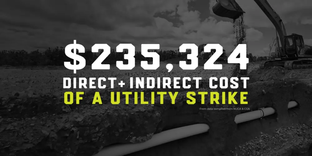
The average total cost (including direct and indirect cost) of a single utility strike is $234,324, according to data compiled from the National Utility Contractors Association (NUCA) and Common Ground Alliance.
Since 2001, GPRS has partnered with major companies like Duke Energy, American Electric Power, Ameren, and Exelon to complete Transmission ROW scanning and substation projects.
When clients seek out a utility locating company, they aim to work with the best. At GPRS, we take pride in our extensive experience and expertise. Our highly trained project managers deliver prompt and precise reports on subsurface utilities, enabling you to complete your projects safely and effectively. We have experience across various T&D settings, including overhead transmission rebuilds, underground transmission planning, substation as-built updates, foundation mapping, and more. With our wide range of reporting options, we offer clients current records of underground utilities for future reference.
At GPRS, we Intelligently Visualize The Built World® to keep your projects on time, on budget, and safe.
What can we help you visualize?
Frequently Asked Questions
What type of informational output is provided when GPRS conducts a utility locate?
Our Project Managers flag and paint our findings directly on the surface. This method of communication is the most accurate form of marking when excavation is expected to commence within a few days of service.
GPRS also uses a global positioning system (GPS) to collect data points of findings. We use this data to generate a plan, KMZ file, satellite overlay, or CAD file to permanently preserve results for future use. GPRS does not provide land surveying services. If you need land surveying services, please contact a professional land surveyor. Please contact us to discuss the pricing and marking options your project may require.
Can you find PVC piping and other non-conductive utilities?
GPR scanning is exceptionally effective at locating all types of subsurface materials. There are times when PVC pipes do not provide an adequate signal to ground penetrating radar equipment and can’t be properly located by traditional methods. However, GPRS Project Managers are expertly trained at multiple methods of utility locating.
What to Expect When OSHA Inspects Your Job Site: A Comprehensive Guide
The thought of an Occupational Safety and Health Administration (OSHA) inspection can send shivers down the spine of many employers.
The fear of heavy fines, potential citations, and the unknown aspects of the inspection process can make even the most diligent business owner uneasy. However, understanding what to expect during an OSHA inspection and how to prepare for one can greatly reduce the anxiety surrounding it and help ensure a clean inspection.
OSHA's primary mission is to “assure safe and healthful working conditions for working men and women by setting and enforcing standards and by providing training, outreach, education, and assistance.” While this mission is undoubtedly positive, many employers fear the day OSHA shows up at their door unannounced. This fear often stems from uncertainty or a lack of preparation. Here, we'll break down what you can expect during an OSHA inspection and how you can prepare to ensure a smooth process.

OSHA’s Inspection Priorities: Why They Might Show Up
OSHA doesn’t have enough inspectors to visit every workplace in the United States, so they prioritize inspections based on a “worst first” approach. This means they focus on industries and companies with higher risks, such as those with hazardous occupations or a history of violations. The typical reasons OSHA may choose to inspect your job site include:
- Imminent Danger: Situations that could cause death or serious physical harm
- Fatality or Catastrophic Incident: Following up on serious incidents that have occurred
- Complaints and Referrals: Often the result of employee complaints or referrals from onsite contractors
- Targeted Inspections: Industries or companies targeted due to known hazards
- Follow-Up Inspections: Verifying that previously cited violations have been corrected
In industries with high-risk activities like confined-space entry or trenching, OSHA inspections are more common due to the inherent dangers involved.
The Unannounced Arrival: Be Prepared
One of the most unsettling aspects of an OSHA inspection is that it’s typically unannounced. While you do have the legal right to refuse entry, this often results in the inspector returning with a search warrant. Cooperation from the start is usually the best course of action, as it sets a positive tone for the inspection and can influence the outcome favorably.
If an inspector shows up, the first step they will take is to hold an opening conference. During this meeting, they will explain the purpose of the inspection and outline the areas they wish to examine. It’s crucial to have a member of management present at this conference, and you should always check the inspector’s identification, which will include a USDOL ID card with a photo and serial number.
Documentation Is Key: Keep Records Updated
During the opening conference, the inspector will likely request to see various records, including injury/illness logs, safety policies, training records, equipment inspection records, and other documents relevant to the inspection. Keeping accurate and up-to-date records is essential, as these documents provide evidence of your commitment to safety and compliance with OSHA standards.
Stick to the Scope: Avoid Volunteering Extra Information
Once the inspection begins, it’s important to adhere strictly to the areas specified by the inspector. Offering a plant tour or volunteering additional information, even if you believe your site is fully compliant, is not advisable. The inspector is required to cite any violations they observe in “plain view,” so expanding the scope of the inspection could lead to additional citations.
Employee Cooperation: Honesty Is Crucial
During the inspection, the OSHA officer may interview employees, take photographs, conduct instrument readings, and take notes. It’s important that your employees understand the importance of honesty during these interviews. Any attempt to mislead or withhold information from the compliance officer could result in stiffer penalties and potentially even civil penalties against the company.
Be Present During the Inspection: Follow the Inspector
As an employer or manager, you have the right to accompany the inspector throughout the job site. This is an opportunity to demonstrate your cooperation and to document any findings or violations that the inspector points out. If the inspector identifies any violations, ask for clarification on how to correct them, and if possible, correct the issue immediately. This proactive approach shows good faith and can positively influence the inspector’s final report.
The Closing Conference: Understanding the Next Steps
Once the inspection is complete, the officer will hold a closing conference. During this meeting, they will discuss any issues they observed and give you the opportunity to ask questions. They will also inform you of any citations they are recommending and the timeframes within which you must correct the noted problems. It’s important to remember that the actual citations and any associated fines will be determined by the area director, not the inspector.
The factors that influence the amount of the fines include:
- Nature of the Violation: How severe the violation is
- History of Violations: Previous citations may lead to higher fines
- Good-Faith Efforts: Demonstrating a commitment to safety and correcting violations promptly
- Size of Your Operation: Smaller businesses may receive reduced fines
If you wish to contest any fines or citations, you must do so within 15 business days of receiving the official paperwork.
Turning an Inspection Into a Positive Experience
While an OSHA inspection can be daunting, it doesn’t have to be a negative experience. In fact, it can serve as an opportunity to identify and correct potential hazards before they result in serious injury or even death. By approaching the inspection with a cooperative attitude, maintaining accurate records, and demonstrating a commitment to safety, you can greatly increase the chances of a clean inspection.
OSHA inspectors are there to ensure that workplaces are safe for employees. If you show good faith in correcting any violations they find, they are likely to work with you to resolve the issues. In the long run, a positive relationship with OSHA and a proactive approach to workplace safety can protect your employees and your business from the consequences of non-compliance.
By preparing ahead of time, staying calm during the inspection, and addressing any issues promptly, you can ensure that your next OSHA inspection is as smooth and stress-free as possible.
GPRS is committed to helping make your job site as safe as it can be, both through our suite of subsurface damage prevention, existing conditions documentation and construction & facilities project management services, as well as through the variety of safety initiatives we sponsor and host. At GPRS, we Intelligently Visualize The Built World® to keep you and your projects on time, on budget, and safe.
What can we help you visualize?
Frequently Asked Questions
Does GPRS Perform S.U.E. Work?
Subsurface Utility Engineering (SUE) reduces the risk and improves the accuracy of subsurface utility readings. It is broken down into four levels of quality, governed by ASCE Standard 38-02. GPRS does not provide engineering services. If you need professional engineering services, please contact a professional engineer. GPRS does not perform SUE work, but our utility locating and mapping services support SUE at QL-B.
How quickly can GPRS respond to an emergency need?
Because we have a nationwide team of SIM and NASSCO-certified Project Managers, GPRS can respond within 24-48 hours of contact, in most circumstances, to an emergency need. Click here for an online quote form.
Washington State Department of Ecology Announces $309 Million in Clean Water Project Funding
The Washington State Department of Ecology recently announced a round of grants and loans to support new clean water projects and ongoing infrastructure investments.
The $309 million in funding will support 136 projects, including stream restoration on the Touchet River near Prescott and engineered wetlands providing stormwater treatment in Ferndale, according to a press release on the department’s website.
“Our top priority is to support communities,” said Water Quality Program Manager, Vince McGowan. “Across Washington, we are using innovative ideas to help put money to work faster and with greater benefits. We are excited to support clean water pilot projects that are already proving successful and to continue trying new approaches.”

Washington’s clean water funding includes both state and federal funds – $40 million of which come from the 2021 Bipartisan Infrastructure Law – dedicated to improving and protecting water quality.
According to the department’s press release, this year’s project list includes new approaches to its clean water funding work: a pilot process where communities can apply for wastewater funding outside of the annual funding cycle.
“Through off-cycle planning, Ecology will work with communities or utilities that have an urgent need for funding wastewater planning projects,” the release states. “This could include post-emergency recovery efforts from natural disaster or projects that have received funding from other sources but still need to meet some of Ecology’s prerequisites.”
The first project funded under this pilot program will see Ecology provide $60,000 to help the Town of Metaline Falls update their general sewer plan, with a focus on identifying and replacing aging infrastructure to prevent future emergencies.
“This investment will help the community make necessary progress on wastewater and stormwater infrastructure improvements and better protect the Pend Oreille River,” the press release states.
Additionally, this year’s clean water funding list incorporates an Environmental Justice Assessment for grant or loan projects over $12 million, as required under Washington’s HEAL Act.
These assessments provide the department an opportunity to evaluate a wide range of environmental justice impacts that an action may have in the early developmental stages of the process, with the goal of helping the department and its partners make informed decisions to reduce environmental harms and address environmental and health disparities in overburdened communities.
Six wastewater-related projects selected as part of this round of funding require environmental justice assessments, which the department says it will finish in the coming months and prior to finalizing each project’s funding agreement.
The bulk of the funding ($255 million) is earmarked for wastewater projects, and 28 of them will occur in communities eligible for financial hardship consideration.
“Given the critical service that wastewater treatment facilities provide, Ecology prioritizes supporting the planning, design, and construction of these facilities, particularly in areas where these investments would create a financial burden for residents,” the release states.
A full list of all 136 projects is available both as an interactive map and in the final offer list publication.
Washington’s Department of Ecology accepts clean water project applications every August through October. More information about the application process can be found on the department’s clean water funding webpage.
Protecting Your Water Project from Subsurface Damage
Protecting your existing water and wastewater infrastructure from damage during excavation is vital to protecting the communities these systems serve.
GPRS helps prevent utility strikes by mapping subsurface utilities for you prior to you breaking ground – so you know where you can and can’t safely dig.
Using state-of-the-art technology such as ground penetrating radar (GPR), electromagnetic (EM) locating, and remote-controlled sewer pipe inspection rovers, our SIM and NASSCO-certified Project Managers Intelligently Visualize The Built World® to keep you on time, on budget, and safe.
To ensure seamless sharing of the vital infrastructure visualization services we provide, GPRS created SiteMap® (patent pending): our project & facility management application that provides accurate existing condition documentation to protect your assets and people.
Compatible with your existing GIS platform and accessible 24/7 from any computer, tablet, or smartphone, SiteMap® provides you with the peace of mind that comes with knowing you, your team, and your subcontractors are all working off the same accurate data. With SiteMap®, you can plan, design, manage, dig, and build better.
Every GPRS client receives a complimentary SiteMap® Personal subscription with every utility locate we conduct.
GPRS SiteMap® team members are currently scheduling live, personal SiteMap® demonstrations. Click below to schedule your demo today!
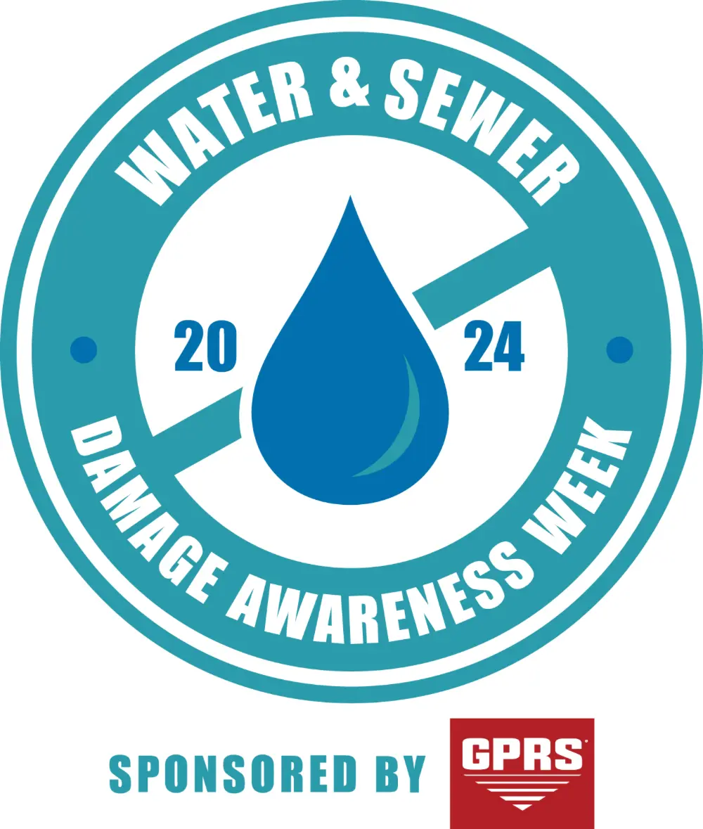
Water & Sewer Damage Awareness Week Returns
GPRS is committed to assisting municipalities, facility managers, and similar entities in enhancing the maintenance and protection of their water and wastewater infrastructure. With that goal in mind, we are thrilled to announce that the second annual Water & Sewer Damage Awareness Week will take place from October 21-25, 2024.
By participating in a complimentary WSDAW presentation, your team will gain insights into:
- The increased vulnerability of infrastructure to damage in today’s environment
- The risks posed to your systems’ equipment due to improper or infrequent maintenance
- The importance of regular water loss surveys and proactive maintenance plans for water, sewer, and stormwater systems to prevent service interruptions and safeguard your entity’s reputation
- Strategies to minimize non-revenue water (NRW) loss, protecting both your community and financial resources
- Methods to mitigate the risks associated with cross bores
- And much more!
Don’t miss this opportunity – Sign up for your free WSDAW presentation today!
Frequently Asked Questions
What type of informational output is provided when GPRS conducts a utility locate?
Our Project Managers flag and paint our findings directly on the surface. This method of communication is the most accurate form of marking when excavation is expected to commence within a few days of service.
GPRS also uses a global positioning system (GPS) to collect data points of findings. We use this data to generate a plan, KMZ file, satellite overlay, or CAD file to permanently preserve results for future use. GPRS does not provide land surveying services. If you need land surveying services, please contact a professional land surveyor. Please contact us to discuss the pricing and marking options your project may require.
Can GPRS find PVC piping and other non-conductive utilities?
GPR scanning is exceptionally effective at locating all types of subsurface materials. There are times when PVC pipes do not provide an adequate signal to ground penetrating radar equipment and can’t be properly located by traditional methods. However, GPRS Project Managers are expertly trained at multiple methods of utility locating.
Can GPRS locate a pipe in addition to evaluating its integrity?
Yes! Our SIM and NASSCO-certified Project Managers use VPI technology equipped with sondes, which are instrument probes that allow them to ascertain the location of underground utilities from an inaccessible location. This allows them to use electromagnetic (EM) locating to map sewer systems while evaluating them for defects.
Can Solar Power Solve America's Power Supply Shortfalls?
As the United States continues to grapple with power supply shortfalls, particularly during periods of extreme demand and adverse weather conditions, the potential of solar power as a solution has come under increased scrutiny.
The North American Electric Reliability Corporation (NERC) has highlighted significant risks of electricity shortages across much of North America during the summer months, largely driven by the increased electrification of the economy, the retirement of conventional power plants, and the challenges posed by widespread heat events. Given these risks, it's crucial to explore whether solar power can be a reliable and sufficient solution to America's power supply issues.

The Current Landscape: Growing Risks and Solar's Role
According to NERC’s 2024 Summer Reliability Assessment, many regions in the U.S. are at an elevated risk of power shortfalls during peak summer conditions. This risk is exacerbated by a combination of factors, including extreme weather, growing electricity demand due to factors like increased adoption of electric vehicles, and the retirement of traditional power generation assets. Solar power has played a significant role in mitigating some of these risks, with a record 25 gigawatts (GW) of solar capacity added in the past year alone. However, the assessment also points out that solar power’s effectiveness is often limited during critical periods, such as late afternoon and evening hours when solar generation diminishes but demand remains high.
Solar power contributes significantly to the grid, especially during sunny days when demand is high. However, its variability—particularly its decline in output as the sun sets—poses a challenge during periods of peak electricity demand. This limitation is a significant concern for grid operators, especially in regions like Texas and California, where solar power constitutes a large portion of the energy mix. Without sufficient backup from other energy sources, these areas remain vulnerable to supply shortfalls during periods of low solar output.
The Potential of Solar Power to Meet Demand
Solar power's potential to solve America’s energy shortfalls lies in its scalability and the rapidly decreasing costs of solar photovoltaic (PV) installations. Solar energy has the advantage of being a renewable and increasingly cost-effective source of electricity, with the U.S. Department of Energy projecting that solar could power up to 40% of the nation’s electricity needs by 2035. This ambitious goal would require a massive scale-up of solar infrastructure, including the integration of advanced energy storage systems to address solar’s intermittent nature.
Energy storage, particularly in the form of batteries, is crucial to making solar power a more reliable source of energy. By storing excess energy generated during peak sunlight hours, batteries can provide power during periods when solar generation is low, such as during the night or on cloudy days. The combination of solar power and storage solutions could potentially address some of the grid reliability concerns highlighted by NERC, particularly in areas prone to extreme weather.
Challenges and Considerations
Despite the promise of solar power, several challenges must be addressed to fully realize its potential in solving power supply shortfalls. One of the primary concerns is the need for substantial investment in grid infrastructure to accommodate the integration of large-scale solar power. This includes upgrading transmission networks to handle the increased load and ensuring that solar installations are resilient to grid disturbances.
Moreover, the variability of solar power means that it cannot be relied upon as the sole solution for meeting peak electricity demand. NERC’s assessment emphasizes the importance of maintaining a diverse energy mix, including natural gas and other dispatchable energy sources, to ensure grid reliability during periods when solar output is insufficient. The assessment also points to the need for enhanced coordination between gas and electric systems to manage supply shortfalls effectively.
Another critical factor is the speed at which solar power can be deployed. While solar installations are growing rapidly, the pace of deployment must accelerate to meet the increasing demand for electricity and replace retiring conventional power plants. Policymakers and industry leaders must work together to streamline permitting processes, incentivize solar adoption, and invest in research and development to improve solar technologies and storage solutions.
A Partial Solution with Great Potential
Solar power holds significant potential to contribute to America's energy needs, particularly as part of a broader strategy to diversify the energy mix and enhance grid resilience. However, it is not a silver bullet for the nation’s power supply challenges. To effectively address the risks identified by NERC, a combination of strategies is required, including continued investment in solar power, the expansion of energy storage capacity, and the retention of reliable, dispatchable power sources.
In the face of growing electricity demand and the increasing frequency of extreme weather events, solar power can play a crucial role in mitigating some of the risks to the power grid. However, to ensure a stable and reliable energy supply, solar power must be integrated into a well-planned and diversified energy system that includes other renewable sources, storage technologies, and conventional generation. By doing so, America can move closer to a sustainable and resilient energy future while minimizing the risks of power supply shortfalls.
GPRS has served the power and renewable energy industries throughout our 23-year history. We provide subsurface damage prevention, existing conditions documentation, and construction & facilities project management services to keep you and your projects on time, on budget, and safe.
What can we help you visualize?
Frequently Asked Questions
Can GPR differentiate between different objects embedded within concrete?
Ground penetrating radar (GPR) can usually differentiate between rebar, electrical conduit, post tension cables, rebar, and other objects that may be embedded within your concrete slab.
In addition to GPR, GPRS’ SIM-certified Project Managers can use electromagnetic (EM) locators to determine the location of conduits in the concrete. If we can transmit a signal onto the metal conduit, we can locate it with pinpoint accuracy. We can also find the conduit passively if a live electrical current runs through it.
What type of informational output is provided when GPRS conducts a utility locate?
Our Project Managers flag and paint our findings directly on the surface. This method of communication is the most accurate form of marking when excavation is expected to commence within a few days of service.
GPRS also uses a global positioning system (GPS) to collect data points of findings. We use this data to generate a plan, KMZ file, satellite overlay, or CAD file to permanently preserve results for future use. GPRS does not provide land surveying services. If you need land surveying services, please contact a professional land surveyor. Please contact us to discuss the pricing and marking options your project may require.
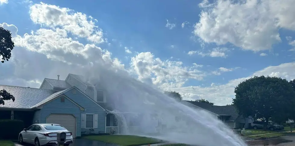
Homeowners Displaced, Residence Damaged After Contractor Strikes Water Main
Officials are still trying to determine the identity of the contractor who struck a 30-inch water main while doing work in an Edison, New Jersey neighborhood August 13.
According to an article on the local NBC affiliate’s website, the break sent a geyser of water shooting up onto the roof of a house consisting of two single-family homes. The water damaged the roof on the right side of the residence, leading to the evacuation of the entire building. In a Facebook post, Edison Mayor Sam Joshi said that no one was injured in the incident and nearby residents were not expected to have water flow disrupted due to the damaged line being separate from the residential distribution system.
Joshi added that his office is working to determine the identity of the contractor who caused the damage, and which company they were working for.
“The home obviously cannot be occupied,” Joshi said. “I’ve spoken to the resident, she said she was gonna find another place to [stay]. Again, no one was injured, but it took a couple of hours for the water main break to slow down because there were a lot of valves that had to be shut off.”
Middlesex Water Company, which owns and operates the main that was damaged, told the local ABC affiliate that the contractor who hit the water main was not working for them during the time of the incident. The company said it is reviewing the matter.
“Repairs are still continuing, and the road remains closed,” the water company said in a statement. “We anticipate having the road re-opened tomorrow mid-day and that the main will be returned to service by Friday mid-day.”
Elizabethtown Gas, which owns the gas lines in the area, said in a statement that the contractor who caused the damage was not working for them either.
“The Fire Department alerted Elizabethtown Gas about the incident last night and asked Elizabethtown Gas to shut off the gas to two houses for safety reasons,” the company said in a statement. “Elizabethtown Gas and our contractors did not have any crews working in Edison [on August 13], when the incident occurred. Our priority is always the safety of the customers and the communities we serve.”
Srujana Panda, a nearby resident, said the incident left them and their neighbors terrified.
“It was coming at a certain angle,” Panda told the ABC affiliate. “If it came at another angle, it could’ve hit any of these other houses.”
Frank Adinolfe, whose home is attached to the damaged house, said he raced outside when he heard the water gushing.
“I was afraid if I opened the door, we would see a lot of water,” Adinolfe said. “But no water at all, so we really lucked out. But my neighbor really got it next door to us.”
GPRS Services Help Prevent Utility Strikes
Whether it’s a 30-inch water main or a gas line, striking an underground utility while digging can endanger you, your team, and the surrounding community.
GPRS helps prevent utility strikes by mapping subsurface utilities for you prior to you breaking ground – so you know where you can and can’t safely dig.
Using state-of-the-art technology such as ground penetrating radar (GPR), electromagnetic (EM) locating, and remote-controlled sewer pipe inspection rovers, our SIM and NASSCO-certified Project Managers Intelligently Visualize The Built World® to keep you on time, on budget, and safe.
But even our 99.8%+ accurate utility locating services can’t help you if you aren’t able to easily share that data with everyone working on site. That’s why GPRS created SiteMap® (patent pending), our project & facility management application that provides accurate existing condition documentation to protect your assets and people.
Compatible with your existing GIS platform and accessible 24/7 from any computer, tablet, or smartphone, SiteMap® provides you with the peace of mind that comes with knowing you, your team, and your subcontractors are all working off the same accurate data. With SiteMap®, you can plan, design, manage, dig, and build better.
The best part: every GPRS client receives a complimentary SiteMap® Personal subscription with every utility locate we conduct.
GPRS SiteMap® team members are currently scheduling live, personal SiteMap® demonstrations. Click below to schedule your demo today!
Water & Sewer Damage Awareness Week Returns
GPRS aims to help municipalities, facility managers, and more enhance their water & wastewater infrastructure maintenance and protection planning. To that end, we are excited to announce that the second annual Water & Sewer Damage Awareness Week will run October 21-25, 2024.
During your free WSDAW presentation, your team will learn:
- Why your infrastructure is more vulnerable to damage than ever before
- The risks to your systems’ equipment posed by improper/infrequent maintenance
- How routine water loss surveys, and proactive water, sewer, and stormwater system maintenance plans eliminate service interruptions and maintain your entity’s reputation
- How to keep non-revenue water (NRW) loss from hurting your community and your bottom line
- How to mitigate the risks of cross bores
- And more!
Click here to sign up for your free WSDAW presentation today!
Frequently Asked Questions
What type of informational output is provided when GPRS conducts a utility locate?
Our Project Managers flag and paint our findings directly on the surface. This method of communication is the most accurate form of marking when excavation is expected to commence within a few days of service.
GPRS also uses a global positioning system (GPS) to collect data points of findings. We use this data to generate a plan, KMZ file, satellite overlay, or CAD file to permanently preserve results for future use. GPRS does not provide land surveying services. If you need land surveying services, please contact a professional land surveyor. Please contact us to discuss the pricing and marking options your project may require.
Can GPRS find PVC piping and other non-conductive utilities?
GPR scanning is exceptionally effective at locating all types of subsurface materials. There are times when PVC pipes do not provide an adequate signal to ground penetrating radar equipment and can’t be properly located by traditional methods. However, GPRS Project Managers are expertly trained at multiple methods of utility locating.
Can GPRS locate a pipe in addition to evaluating its integrity?
Yes! Our SIM- and NASSCO-certified Project Managers use VPI technology equipped with sondes, which are instrument probes that allow them to ascertain the location of underground utilities from an inaccessible location. This allows them to use electromagnetic (EM) locating to map sewer systems while evaluating them for defects.
Third Annual Architecture & Interiors Awards Announced by Architect Magazine
Whether reimagining what mixed-use developments or adaptive reuse can look like, utilizing outdoor spaces to enhance indoor experiences, or creating something new that honors the flavor of the neighborhood it inhabits, the 2024 Architecture & Interiors Award winners prove that beauty and function are never mutually exclusive.
A jury of three notable voices in design: Ben Crawford of Omniplan, Dallas, John Frane of HGA, Los Angeles, and Brooke Horan of HDR, New York, were moderated by Paul Makovsky as they selected an eclectic slate of honorees to represent “a diverse range of commercial architecture and interior design projects showcasing innovation and ingenuity in all its forms” for Architect Magazine.
There were 34 awards in all: 11 projects won Honors awards and another 23 received Merit awards. The projects spanned the globe from the Honor award for the Kempegowda International Airport in Bengaluru, India to the mixed use project Die Macherie in Munich, Germany, from striking interior staircase Special Entry, FIXTURE Award honoree in New York City to the Theatre de Verdure in Montreal, and the astonishing use of indoor space by Honor award winner, the Neil Campbell Rowing Center, also in Canada (Ontario), the breadth and depth of talented architects, designers, engineers, and the developers and general contractors who executed their designs is apparent.
Below, you’ll find a quick overview of some of the winners and why they stood out among the thousands of new projects developed each year.
Kempegowda International Airport Terminal 2: Biophilic Design
The fantastical sense of whimsy captured in Skidmore, Owings & Merrill’s design for Terminal 2 at the airport in Bengaluru evokes “a calming oasis for travelers… as well as a nod to Bengaluru’s reputation as the ‘garden city,’” with its use of biophilic design, developed with landscape architect Grant Associates, that includes “massive living walls and meandering paths to gardens of hanging planters” and even indoor waterfalls that serve to cool temperatures while providing meditative focal points.
The central design element of cross-laid, engineered bamboo adorns ceilings, covers structural elements, and is even used to clad the two-story pavilions on the site, evoking traditional Indian cane.
The execution of the award-winning design was Rs 5,000 crore ($595.986 million USD) sustainable project, completed in 2023, with general contractor Larson & Toubro bringing it to reality. The terminal also won the Indian Green Building Council Platinum Certification and is the largest terminal in the world to receive pre-certification as LEED Platinum by the USGBC.
What Is Biophilic Design?
Biophilic design provides the opportunity for people and nature to comingle in commercial spaces – bringing nature indoors, if you will – to promote looking beyond the human experience to focus on people’s place in the natural scheme of things.
Arts & Letters Creative Co.: Honoring the Past While Creating a Modern Space with Adaptive Reuse

When you are adapting a historic building, especially converting a manufacturing site into an open-plan, collaborative space, striking the perfect balance between old and new while providing the modern infrastructure, MEP features, and functional elements required for a modern business can be a very heavy lift. However, ARCHITECTUREFIRM, partnering with AFK Group, Engineering Solutions, and GC DPR Construction made the very difficult project look easy.
The design makes the most of the natural light by preserving the industrial window design and adding skylights, and the exterior honors the building’s past – as a Lucky Strike Tobacco power plant, dating to the 1930s. By incorporating exposed beams and ceiling fans, white walls, and light wood details, the designers made the most of the industrial brick walls and steel structural elements to create an inviting space that allows creative juices to flow.
The 20,400 s.f. adaptive reuse project was completed in 2021 with a final cost of $3,822800 and houses the creative firm, Arts & Letters Creative Co.’s 160-person team.
Die Macherie: A Mixed-Use Neighborhood Full of Surprises

Multiple architectural firms collaborated to create Europe’s first LEED-GOLD neighborhood that includes a 10-story hotel, coworking spaces, retail shops, restaurants & entertainment, and offices that completely transformed a barren industrial tract into a “vibrant, emotionally engaging community.”
The design brainchild of HWKN Architecture, OSA, m3 Architekten, and Holger Meyer Architektur broke ground in 2019 with Dibauco as the general contractor, hired to bring to life 18,580.6 square meters of mixed-use space. The cost is confidential, but with so much unique development over some 200,000 s.f., its completion in 2022 had to have cost hundreds of millions of dollars.
The buildings share some common themes, like the brickwork exteriors that pay tribute to Munich’s brick-making past. Each structure has its own unique personality; none more so than the Scandic Munchen Macherie hotel that towers above the neighborhood layout that includes three “pedestrian canyons” clad in orange brick. The hotel’s façade feels like the building itself is in mid-motion, like a Rubic’s Cube that’s about to click into place at any second.
What is LEED Certification?
LEED stands for Leadership in Energy and Environmental Design. The certification levels provide the most globally recognized rating system for green construction with over 197,000 projects throughout 186 countries and territories, and more than 29 billion square feet of buildings.
A LEED certification is a “globally recognized symbol of sustainability achievement and leadership.”
There are four LEED certification levels: from Certified (green), through Silver, Gold, and Platinum. These levels are earned by adhering to strict sustainable construction standards that factor in carbon footprint, energy, water use, waste, and transportation, among others. A project can be LEED certified in almost any sector:
- Building Design and Construction (BD+C)
- Interior Design and Construction (ID+C)
- Building Operations and Maintenance (O+M)
- Neighborhood Development (ND)
- Homes
- Cities
Each of the 34 winners has a unique perspective on architecture and design, with many integrating structural design, interior design, and landscape design and engineering to create a seamless, holistic space.
You can view the full slate of winners, here.
The massive collaborative effort required to develop and realize such complex builds is testament to the individual talents of the architects, engineers, designers, and contractors involved, and also to the obvious emphasis put on pre-planning. Because without an intricate and precise pre-construction plan, that includes clash detection, exacting existing conditions documentation, and construction progress capture, any of these award-winning projects could have failed.
GPRS Intelligently Visualizes The Built World® for customers throughout the U.S. What can we help you visualize?
Risk Management in Infrastructure Construction: Building for Extreme Heat
$10 million per mile. That’s how much it now costs to build a two-lane road in the U.S. When you factor the effects of extreme heat into the equation, the budget may be higher.
When you’re constructing a road, bridge, or railway, the ideas of risk mitigation and management usually come in the form of reducing accidents, clashes, and reworks during your build. However, the infrastructure construction industry increasingly looks at risk in terms of “resilience.” i.e., how the structures they build will stand up to changing climate conditions while providing safe passage for the millions of cars, trucks, and trains that utilize them daily.
Buckling & Melting Roads
“Climate change is impacting roads in surprising ways, and contractors and engineers need to be prepared for extreme weather, sea level rise and hotter temperatures, said a panelist at the National Building Institute of Building Sciences’ Building Innovation Conference in Washington, D.C., on May 23,” according to Construction Dive.
There were 28 individual climate & weather-related events with a price tag in excess of $1 billion each in 2023 alone. 2023 set a new record for such events, continuing an upward trend, cautions the National Oceanic and Atmospheric Administration (NOAA).
As a result, the Federal Highway Administration’s Amir Golalipour, a highway research engineer in the Office of Infrastructure Research and Development, cautions that general contractors and infrastructure planners need to scuttle any climate models that rely on stationary weather patterns and plan roads, bridges, and rails that can better withstand fire, floods, and flash-freezing events. Recently, Golalipour shared the following information with Construction Dive regarding the fact that flood immersion can weaken a roadway by as much as 50%.
“Just to put that in perspective, in the city of Paradise, [California], that was part of the Camp Fire, when they removed debris, the load that they put on the pavement in two weeks was equal to 20 years of traffic.” The Camp Fire (2018) is still considered the most destructive in California history.
10 years ago, the FHWA issued Order 5520, which provides guidance to the agency, departments of transportation, state and municipal planners, and contractors on climate risk mitigation. It also requires states to consider the potential risk of future climate conditions when creating asset management plans.
To help with climate risk mitigation planning, the FHWA has created a suite of tools and resources, which you can find here.
Rails & Bridges Feel the Heat, Too
In July of 2024, Kristina Dahl, the Principal Climate Scientist at the Union of Concerned Scientists told NPR that “Heat affects all of these different types of infrastructure in different ways. For our cars and trucks that are running on asphalt roads, asphalt can deform or buckle when it’s extremely hot, so that can make road transportation difficult.”
“In terms of railroads, we know that rails can actually deform and buckle as well when it’s hot. Or if there are electric lines that the trains are connecting to overhead, those lines can sag. And that can cause problems for the trains and operators who have to sloe the trains down. When it comes to airplanes, there are a few different effects that can happen. The tarmac at our airports can deform when it’s hot, which causes problems as planes are trying to take off and land. But hot air also expands and becomes less dense. And, that makes it harder for airplanes to get to the level of thrust they need to be able to take off. So, when it’s really hot, all of these forms of transportation can be affected.”
Dahl went on to discuss how Amtrak has to slow its Northeast Corridor line to deal with the heat. Another infrastructure climate scientist, Dr. Suyun Paul Ham at The University of Texas at Arlington, recently wrote in a comprehensive piece on the subject of infrastructure and climate for The Conversation that Amtrak routinely slows its cars in the Northeast from its usual speeds to just 35 miles per hour once track temps reach or exceed 135 degrees Fahrenheit. At those temperatures, even the sturdiest steel can buckle, causing what are called “sun kinks,” which can quickly derail a train.
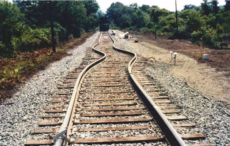
Just like steel rail lines can warp and kink, so too, can steel bridges. On July 8, 2024, the Third Avenue Bridge, a through-truss steel swing bridge, and the oldest in the region in its original form, became stuck in open position due to heat damage that kept the bridge from securely locking into place at the roadway. Firefighters brought tugboats into the river to spray the bridge down in an attempt to cool the expanded metal so it could close. While one could argue that the problem was due to the bridge’s age, the Third Street Bridge was partially rebuilt with new materials in 2004.

What Are Infrastructure Professionals Doing to Combat Extreme Heat Damage?
When it comes to concrete, it has long been a practice to cut the pavement slabs into sections to allow space for the slab to expand and contract with temperatures in an attempt to avoid buckling. However, with heat in excess of 100 degrees Fahrenheit for days or weeks at a time, states from Texas to Minnesota have issued additional guidance for travelers and maintenance crews. Adding extra sealant-filled, single-cut joints may provide flexibility while remaining water resistant. And, taking care not to pour concrete during low temperature periods, with more resilient and durable concrete, may also help.
The problem is that water and steel reinforced concrete simply do not mix. The structure meant to strengthen the concrete roads and bridges can cause extensive interior damage to the slab before it is evident in a visual inspection, rendering any aging concrete structure at risk to concrete cancer.
In the railway space, replacing traditionally smelted steel with martensite or hypereuctectoid rail steel, and adjusting the design of tracks could help avoid buckling.
Meanwhile, several universities, like The Smart Infrastructure and Testing Laboratory at UTA, and governmental agencies like the Federal Department of Transportation and the FHWA are all sinking significant funds into finding new ways to combat extreme heat and create climate-durable infrastructure.
Whether you’re building roads, bridges, high-rises, or any concrete structure, GPRS can provide the concrete imaging services you need to help keep your project on time, on budget and safe. We Intelligently Visualize The Built World® for customers across the nation.
What can we help you visualize?
Frequently Asked Questions
How does GPRS provide accurate concrete imaging?
Ground Penetrating Radar Systems (GPRS) provides accurate concrete imaging by using ground penetrating radar waves to detect embedded objects, voids, and changes in material properties within concrete structures. The radar emits high-frequency radio waves into the concrete, and these waves bounce back upon hitting different materials such as rebar, conduits, or voids. By analyzing the time it takes for the signals to return and their strength, GPRS can create detailed images of the subsurface. This non-destructive method allows for precise identification of structural elements and potential hazards without damaging the concrete.
What is "concrete cancer," and how can it be repaired or stopped?
"Concrete cancer" refers to the deterioration of concrete due to the corrosion of the steel reinforcement within it. This occurs when water and oxygen penetrate the concrete, causing the steel to rust, expand, and crack the surrounding concrete. To repair or stop concrete cancer, the damaged concrete must be removed, and the corroded steel should be treated or replaced. Afterward, the area is patched with new concrete, and protective coatings can be applied to prevent further water ingress. Regular maintenance and inspections are crucial to mitigating the risk of concrete cancer.
The Importance of Protecting Vital Infrastructure from Natural Disasters and Strategies for Resilience
A Texas energy company’s ongoing response to Hurricane Beryl highlights the importance of strengthening our infrastructure against the threat of natural disasters.
According to an Underground Infrastructure article, Texas Governor Greg Abbott recently held a press conference in which he demanded CenterPoint Energy take immediate action to improve their hurricane preparation and response efforts following the power failures in the Greater Houston area related to Beryl.
Abbott also sent a letter to the Public Utility Commission (PUC) of Texas, instructing them to initiate an investigation into the utility company’s failure to restore power after Hurricane Beryl made landfall.
“First and foremost, Texas’ No. 1 goal is to protect life,” the Governor said. “An issue that we see in the ongoing response to Hurricane Beryl are life-based issues, not because of the hurricane itself, but because of the lack of power supply. The failure of power companies to provide power to their customers is unacceptable.”
Per Abbott’s direction, CenterPoint had until July 31 to provide his office with an action plan detailing how they will address current power issues and reduce the possibility that power is lost in the future.
CenterPoint must:
- Provide in detail how it plans to remove all vegetation that threatens any power line
- Specify how it will prepare in advance of any tropical storm that enters the Gulf Coast
- Specify action it will take to pre-stage enough linemen and other personnel to be able to immediately respond to any power outages that may occur for any tropical storm that hits their service region
“CenterPoint has repeatedly failed to deliver power to its customers,” Abbott continued. “To help Texans in the Greater Houston area and to avoid a repeat of unacceptable power outages, I will give CenterPoint until the end of the month to provide my office with specific actions to address power outages and reduce the possibility that power will be lost during a severe weather event. If CenterPoint fails to comply, I will issue an Executive Order to impose actions on the company that are geared to keep the power on.”
Natural disasters like hurricanes, floods, earthquakes, and wildfires pose significant threats to infrastructure worldwide. As climate change intensifies, the frequency and severity of these disasters are expected to increase, making it crucial for governments, businesses, and communities to prioritize the protection of vital infrastructure. This article explores the importance of safeguarding infrastructure and outlines effective strategies to enhance resilience against natural disasters.
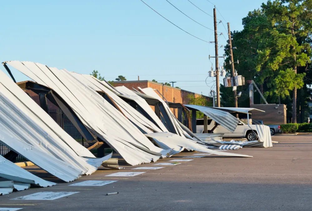
The Critical Role of Infrastructure
Infrastructure serves as the backbone of modern society, encompassing essential services such as transportation networks, energy grids, water and sewage systems, communication networks, and healthcare facilities. These systems are fundamental to economic stability, public safety, and quality of life. When infrastructure is compromised by natural disasters, the impacts can be devastating, leading to loss of life, economic downturns, and prolonged recovery periods.
For instance, Hurricane Katrina in 2005 caused widespread devastation across the Gulf Coast of the United States, with significant damage to New Orleans’ levee system, transportation networks, and power grid. The hurricane’s aftermath revealed vulnerabilities in infrastructure planning and underscored the critical need for resilient infrastructure to withstand such events. Similarly, Hurricane Maria in 2017 left Puerto Rico’s power grid in shambles, resulting in months of outages that hindered recovery efforts and exacerbated the humanitarian crisis.
Given the increasing risks posed by natural disasters, protecting infrastructure is not just a matter of public safety—it is an economic imperative. The cost of rebuilding damaged infrastructure can be astronomical, often far exceeding the investment required to fortify it against potential disasters. Moreover, resilient infrastructure helps to minimize disruptions, enabling quicker recovery and reducing the overall economic impact of a disaster.
Understanding Vulnerabilities in Infrastructure
To effectively protect infrastructure from natural disasters, it is essential to understand the vulnerabilities that exist within these systems. Infrastructure is often interconnected, meaning that damage to one component can have cascading effects on others. For example, a damaged power grid can disrupt communication networks, water supply systems, and healthcare facilities, compounding the challenges of disaster response and recovery.
Vulnerabilities can stem from various factors, including:
- Aging Infrastructure: Many countries face the challenge of aging infrastructure that was not designed to withstand the increased frequency and intensity of modern natural disasters.
- Geographic Location: Infrastructure located in areas prone to hurricanes, floods, or earthquakes is inherently more vulnerable. Coastal cities, for example, are at higher risk from storm surges and rising sea levels.
- Lack of Redundancy: Infrastructure systems that lack redundancy—alternative options to maintain services when primary systems fail—are more susceptible to prolonged disruptions.
- Insufficient Maintenance: Regular maintenance is crucial to ensuring that infrastructure can withstand the stresses of a natural disaster. Neglected infrastructure is more likely to fail under pressure.
Strategies for Protecting Infrastructure
To mitigate the risks posed by natural disasters, it is essential to implement strategies that enhance the resilience of infrastructure. These strategies can be categorized into several key areas: risk assessment, design and construction, maintenance, and emergency preparedness.
1. Conducting Comprehensive Risk Assessments
Effective protection begins with understanding the specific risks that infrastructure faces. Conducting comprehensive risk assessments allows planners to identify vulnerabilities and prioritize areas that require fortification. These assessments should consider the likelihood and potential impact of various natural disasters based on historical data, climate projections, and geographic factors.
For example, in hurricane-prone regions, risk assessments might focus on the potential for storm surges, high winds, and flooding. In earthquake-prone areas, assessments would consider the risks of ground shaking and soil liquefaction. By understanding these risks, infrastructure managers can make informed decisions about where to allocate resources and how to design systems that can withstand these threats.
2. Implementing Resilient Design and Construction Practices
One of the most effective ways to protect infrastructure is to incorporate resilient design and construction practices from the outset. This involves using materials and techniques that can withstand the forces of natural disasters. For example:
- Elevating Structures: In flood-prone areas, elevating buildings and infrastructure above expected flood levels can prevent water damage. This approach is commonly used in coastal cities to protect against storm surges.
- Strengthening Foundations: In earthquake-prone regions, reinforcing the foundations of buildings and bridges can help them withstand ground shaking. Seismic retrofitting is a common practice for older structures that were not originally designed with earthquakes in mind.
- Designing Redundant Systems: Creating redundancy in critical systems, such as power grids and communication networks, ensures that if one component fails, others can continue to operate. This is particularly important for maintaining essential services during and after a disaster.
- Using Durable Materials: Selecting materials that are resistant to the specific hazards of a region can extend the lifespan of infrastructure and reduce the need for costly repairs. For instance, using corrosion-resistant materials in coastal areas can help protect against saltwater damage.
3. Regular Maintenance and Upgrades
Even the most resilient infrastructure can become vulnerable over time if it is not properly maintained. Regular inspections, maintenance, and upgrades are essential to ensure that systems remain in good condition and are capable of withstanding natural disasters. This includes:
- Routine Inspections: Conducting regular inspections of infrastructure systems, such as bridges, roads, and power lines, helps identify potential issues before they become critical.
- Proactive Repairs: Addressing wear and tear or minor damage early on can prevent more significant problems from developing. Proactive repairs are often more cost-effective than emergency repairs following a disaster.
- Upgrading Older Systems: Retrofitting and upgrading older infrastructure to meet modern standards can significantly enhance resilience. This is particularly important for infrastructure that was built before the risks of climate change were fully understood.
4. Enhancing Emergency Preparedness
No matter how resilient infrastructure is, natural disasters can still cause disruptions. Therefore, emergency preparedness is a critical component of infrastructure protection. This involves:
- Developing Emergency Plans: Creating detailed emergency response plans that outline procedures for maintaining and restoring critical infrastructure during and after a disaster.
- Training Personnel: Ensuring that personnel are trained to respond effectively to emergencies, including coordinating with local authorities and other stakeholders.
- Implementing Early Warning Systems: Utilizing early warning systems to provide advance notice of impending natural disasters, allowing for timely evacuation and protective measures.
- Establishing Communication Protocols: Maintaining clear lines of communication between all stakeholders, including government agencies, utility providers, and the public, is essential for coordinating disaster response efforts.

GPRS Services Aid Natural Disaster Recovery & Preparedness
Protecting vital infrastructure from natural disasters is a complex but essential task that requires proactive planning, investment, and collaboration.
As the frequency and intensity of natural disasters continue to rise, the importance of resilient infrastructure cannot be overstated. By conducting thorough risk assessments, implementing resilient design practices, maintaining infrastructure systems, and enhancing emergency preparedness, you can reduce the impact of natural disasters and ensure that our communities remain safe, functional, and resilient in the face of adversity.
In the aftermath of a natural disaster, conducting a rapid, detailed, and accurate infrastructure assessment is essential to obtain a clear and comprehensive understanding of the damage.
GPRS can help you prepare and protect your infrastructure from the dangers of a natural disaster, and swiftly collect data and assess your building or site following one of these events using the following scanning and mapping services:
3D Laser Scanning: The physical damage to buildings and infrastructure (such as residential and commercial buildings, as well as roads) can be accurately documented with 3D laser scanning. And this technology can be used to fully assess your infrastructure and analyze what steps you need to take to protect it from an event. 3D laser scanning captures every point of the structure or site, mapping it onto an XYZ coordinate system for precise visualization, removing the guesswork from decision-making. Critical data on existing conditions enables contractors and engineers to accelerate construction planning by using real-world building information as the foundation.
Utility Locating: Utility locating is essential for any construction project involving subsurface excavation both before and after a natural disaster. GPRS utilizes cutting-edge technology to provide the most precise and thorough information and mapping for water lines, gas lines, sanitary sewer lines, storm sewers, electrical lines, telecommunications, irrigation lines, abandoned lines, and underground storage tanks. Additionally, GPRS offers a complimentary .KMZ file and PDF with every outdoor utility location service we perform.
Video Pipe Inspection: Video pipe inspection (VPI) is a sewer inspection service that uses advanced video cameras to identify issues by examining underground water, sewer lines, and lateral pipelines. GPRS’ NASSCO-certified Project Managers can detect clogs, investigate cross bores, identify structural faults and damage, and conduct lateral sewer line inspections.
Concrete Scanning: Considering the risks involved in concrete drilling, GPRS Project Managers employ a range of technologies to ensure safe zones for core drilling and anchoring. Our scanning and imaging services can be conducted on any surface, including concrete slabs, walls, columns, and beams. Upon completing the scan, you’ll receive a clear layout of critical obstacles such as post-tension cables, rebar, beams, and conduits.
Identify Subsurface Voids: Identifying hidden subsurface voids is critical to preventing major failures following a natural disaster. Voids beneath roadways and concrete present significant hazards, making it essential to detect their presence, location, and size. GPR technology has advanced to the point where the subsurface conditions of roadways and concrete can be accurately diagnosed. Early detection of voids using GPR can prevent safety risks such as structural collapse of concrete, roadway failures, and misaligned storm pipes.
GPRS can be your first step in protecting you and your infrastructure from, and/or rebuilding after a natural disaster. We offer rapid response to job sites, often within 24 hours. With over 500 highly trained Project Managers strategically located across every major market in the U.S., we are prepared to commit to any project at any location. Our approach ensures quality data that is virtual, cataloged, and secure.
What can we help you visualize?
Frequently Asked Questions
Can GPR differentiate between different objects embedded within concrete?
Ground penetrating radar (GPR) can usually differentiate between rebar, electrical conduit, post tension cables, rebar, and other objects that may be embedded within your concrete slab.
In addition to GPR, GPRS’ SIM-certified Project Managers can use electromagnetic (EM) locators to determine the location of conduits in the concrete. If we can transmit a signal onto the metal conduit, we can locate it with pinpoint accuracy. We can also find the conduit passively if a live electrical current runs through it.
What type of informational output is provided when GPRS conducts a utility locate?
Our Project Managers flag and paint our findings directly on the surface. This method of communication is the most accurate form of marking when excavation is expected to commence within a few days of service.
GPRS also uses a global positioning system (GPS) to collect data points of findings. We use this data to generate a plan, KMZ file, satellite overlay, or CAD file to permanently preserve results for future use. GPRS does not provide land surveying services. If you need land surveying services, please contact a professional land surveyor. Please contact us to discuss the pricing and marking options your project may require.
FAA Awards $427.8 Million in Airport Improvement Grants
The Federal Aviation Administration recently awarded $427.8 million in grants for airport upgrades nationwide.
According to an FAA press release, the funding will support 245 airport-related infrastructure projects across 39 states intended to modernize and improve the country’s airports. The funding comes from the Bipartisan Infrastructure Law Airport Infrastructure Grants (AIG) program, part of the $25 billion total included in the law for airport improvements such as terminal expansions and baggage system upgrades, runway safety enhancements, and air traffic infrastructure improvements.
“Americans are flying in record numbers this summer,” said U.S. Transportation Secretary Pete Buttigieg. “The funding we’re announcing, made possible by the Bipartisan Infrastructure Law, will help airports across the country make needed improvements to ensure safety and efficiency now and for years to come.”

Airports receiving funding as part of this grant package include:
- $29.4 million to John Glenn Columbus International Airport in Ohio: This grant supports the construction of a new terminal tarmac and taxiway, along with the extension of an existing taxiway to enhance safety.
- $10.6 million to El Paso International Airport in Texas: This grant funds the construction of a new general aviation (GA) apron and the rehabilitation of the existing GA apron pavement to enhance efficiency.
- $18.1 million to Norman Y. Mineta San Jose International Airport in California: This grant supports the construction of a new taxiway and funds the building of a new terminal to accommodate more passengers.
- $24.9 million to Southwest Florida International Airport in Florida: This grant supports the construction of a new taxiway and the expansion of a concourse apron to handle more passengers. Additionally, it funds the expansion of the existing terminal access road by adding an off-ramp and three traffic lanes to exclusively accommodate increased vehicular traffic serving the airport.
- $8.5 million to Minneapolis-St. Paul International Airport in Minnesota: This grant supports the expansion of the terminal access road and the rehabilitation of a tarmac and taxiway to improve safety.
- $11.2 million to Hector International Airport in North Dakota: This grant supports the expansion of an existing terminal by adding four gates to better accommodate more passengers and baggage.
- $4.2 million to Dallas Love Field Airport in Texas: This grant supports improvements to the existing airfield drainage system and the Runway 13/31 safety area to mitigate runway excursions and enhance safety.
- $13.6 million to Cincinnati/Northern Kentucky International Airport in Kentucky: This grant supports the replacement of passenger boarding bridges to enhance the efficiency of passenger movement throughout the airport.
- $6 million to Glacier Park International in Montana: This grant supports the expansion of the existing terminal to include additional gates, ticketing and kiosk areas, security checkpoints, and passenger holdrooms to better accommodate more passengers.
- $13 million to Norfolk International Airport in Virginia: This grant supports the final phase of construction to rehabilitate Runway 5/23, enhancing safety. It also funds a portion of the terminal building expansion to increase capacity.
A full list of announced AIG grants is available here.
The Airport Infrastructure Grant program is one of three aviation grant programs stemming from the Bipartisan Infrastructure Law. To date, nearly $9 billion of AIG funding has been made available to airports across the country.
Completed projects that have benefited from the AIG program include:
- $4.4 million to Mesa Phoenix-Mesa Gateway in Arizona: This grant funded the reconstruction of the pavement on Runway 12/30 to improve safety.
- $3.8 million to Mobile International in Alabama: This grant upgraded 870 feet of drainage system controls in the future terminal area to meet FAA standards.
- $3.1 million to Valley International in Harlingen, Texas: This grant extended Runway 35L by an additional 1,100 feet to accommodate a higher volume of aircraft and reduce delays in existing traffic.
America’s airports have for years needed some TLC.
The American Society of Civil Engineers (ASCE) gave the United States’ aviation infrastructure a D+ in its 2021 Report Card for America’s Infrastructure.
“Over a two-year period, passenger travel steadily increased from 964.7 million to 1.2 billion per year, yet flight service only increased from 9.7 to 10.2 million flights per year — contributing in part to a total of nearly 96 million delay minutes for airline passengers in 2019,” the ASCE wrote. “Terminal, gate, and ramp availability was not meeting the needs of a growing passenger base.”
Whether you're managing an airport expansion or improvement, or installing fiber optic cable in a suburban neighborhood, the most effective way to keep your projects on track is by mitigating the risk of subsurface damage during excavation and ensuring seamless communication among all stakeholders from start to finish.
GPRS offers a suite of subsurface damage prevention, existing conditions documentation, and construction & facilities project management services designed to protect your assets and people. From precision concrete scanning and utility locating to 3D laser scanning, video pipe inspections and virtual tours, we strive to keep your projects on time, on budget, and safe.
To put this field-verified data at your fingertips 24/7, GPRS created SiteMap® (patent pending), our cloud-based project & facility management application that provides accurate existing condition documentation to help you plan, design, manage, dig, and ultimately build better.
GPRS’ SiteMap® team members are currently scheduling live, personal demonstrations. Click below to schedule your free SiteMap® demo today!
Frequently Asked Questions
What type of informational output is provided when GPRS conducts a utility locate?
Our Project Managers flag and paint our findings directly on the surface. This method of communication is the most accurate form of marking when excavation is expected to commence within a few days of service.
GPRS also uses a global positioning system (GPS) to collect data points of findings. We use this data to generate a plan, KMZ file, satellite overlay, or CAD file to permanently preserve results for future use. GPRS does not provide land surveying services. If you need land surveying services, please contact a professional land surveyor. Please contact us to discuss the pricing and marking options your project may require.
What types of concrete scanning are there?
GPRS provides two specific but different scanning services: elevated concrete slab scanning and concrete slab-on-grade locating. Elevated concrete slab scanning involves detecting embedded electrical conduits, rebar, post-tension cables, and more before core drilling a hole through the slab. Performing a concrete slab-on-grade locating service typically involves scanning a trench line for conduits before conducting saw cutting and trenching to install a sanitary pipe, water line, or something similar.
Maximizing Flow: How to Eliminate Most NRW Loss & Create Lead Service Line Inventories with Leak Detection and Utility Mapping Services
When it comes to managing water distribution infrastructure, conducting a comprehensive assessment of your pressurized lines before excavating for pipe repairs/replacement can save time, money, and resources, allowing you to target your efforts only where they are needed. That way, you keep more of your water in your lines, and more of its revenue on your balance sheet.
And now, more than ever, knowing exactly where your water service lines are, the condition of those lines, and what they’re made of, matters.
Because the U.S. Environmental Protection Agency (EPA) has issued regulations that include a hard deadline of October 16, 2024 for municipalities of over 50,000 people to create and file an LSL (lead service line) inventory with the agency as part of the federal “Get The Lead Out” program.
By undertaking routine water loss surveys along with utility locating and mapping, municipal water managers can potentially reduce the need for complete replacement of leaking non-lead pipes, in favor of refurbishment or relining where appropriate.
Water systems and their consulting engineers can leverage regular water loss surveys and leak detection to maximize cost-effectiveness, especially for smaller water utilities with limited capital budgets.
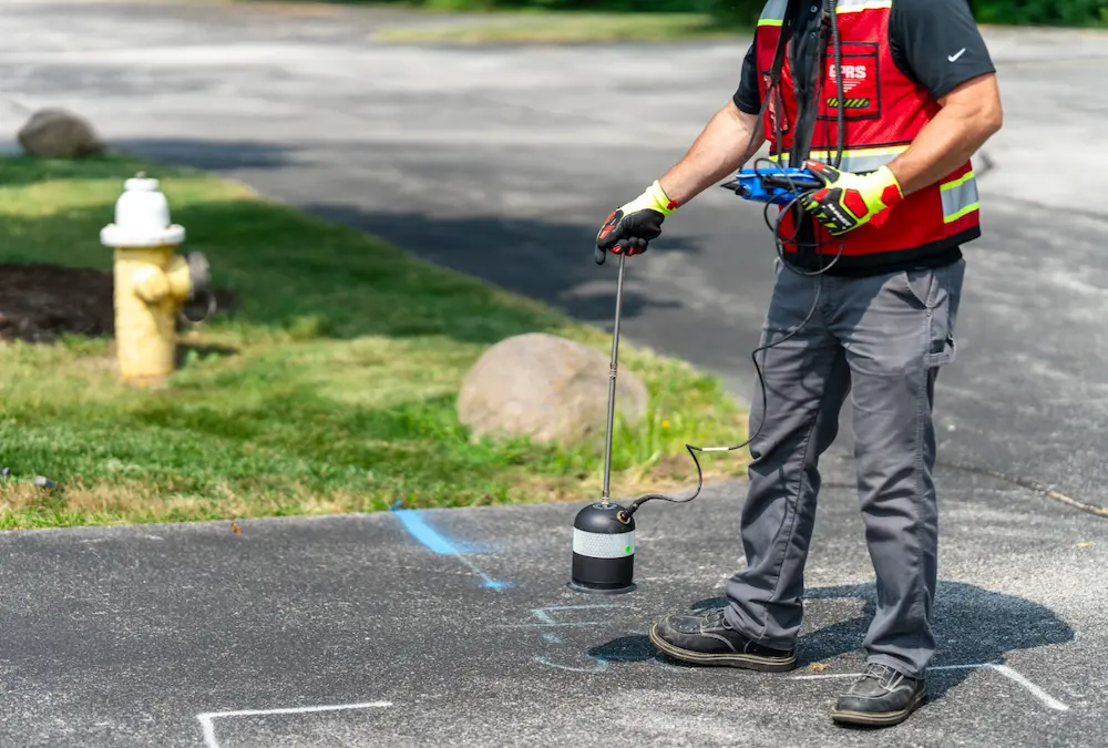
What Are Your NRW and LSL Options?
The decision to replace or repair piping infrastructure involves numerous variables, such as pipe material, age, soil conditions, and repair history. And, of course, whether or not there is an active leak causing Non-Revenue Water (NRW) loss. Given the high cost of excavating miles of piping—approximately $1.5 million in cost per mile—it’s crucial to identify which pipe segments need replacement and which can still provide years of reliable service. By reassessing some traditional "rules of thumb," utilities can benefit from water loss surveys to precisely focus capital expenditures where they are most needed:
1. Go Beyond Transmission Lines
While it’s logical to prioritize the high-profile backbone of a water network (typically transmission pipes over 16 inches in diameter), these usually only make up about 10% of water distribution networks. Utilizing non-invasive technologies to map and evaluate the remaining 90% can help identify the most cost-effective priorities for maintenance or replacement. The majority of pressurized line leaks appear in the 90% of non-transmission lines. So, if you focus only on transmission, you are missing most of your opportunities to eliminate NRW loss. It’s important to note, too, that the EPA’s regulations may require that pipes downstream of LSLs be replaced, even if they are not made of lead themselves.
2. Coordinate Aboveground Infrastructure & Water System Work
Coordinating the excavation, repair, and replacement of water lines with road repairs is much more efficient than ripping up a freshly paved road or sidewalk. Water loss surveys can easily reveal if your existing infrastructure is safe to remain in service until the next time the road needs resurfacing, leading to substantial savings compared to additional excavations and wholesale replacement.
3. Enhance Risk Models with Current Condition Data
While risk models based on past experiences are valuable, supplementing these with up-to-date existing subsurface utility and water line data can improve their accuracy. For instance, one utility detailed in a recent Water Online article deferred 60% of its planned replacement budget after assessing just 20% of its system.
Finding the Best LSL Inventory, Replacement, Repair, and NRW Solutions
Leak detection and utility locating technologies for distribution lines fall into several categories: external non-invasive, internal invasive, and spot inspection. Each offers varying capabilities based on cost, pipe material, and installation environment. You can find a great deal of practical and technical assistance with regard to line repair and replacement from The AWWA M77 Condition Assessment of Water Mains manual, which may also help you best utilize your water system budget.
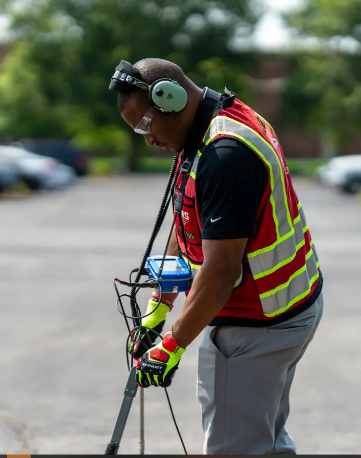
You Have to Use the Right Tools
There are cases where water system applications like pipelines feeding nuclear plants, might require high-resolution electromagnetic scans. However, non-invasive acoustic leak detection, confirmed with leak correlation technology is often the most cost-effective for urban environments with numerous fittings and connections and plastic (PVC) pipes. Marrying water loss surveys conducted by a professional leak detection company with 99.8%+ accurate utility locating and mapping can provide a complete, layered, and easy to use map and service line inventory. When you hire GPRS to do the job, you get everything in a secure, accessible digital platform, SiteMap® (patent pending), that also provides excellent data portability for reporting and GIS purposes.
Is The ROI Worth It?
Non-invasive technologies typically require less prep work and can provide valuable data without disrupting water flows, digging chambers, or inserting tools into water lines, thus posing zero risk to pipelines or water quality. And, because pinpoint leak detection can give you the exact location of a leak and utility locating can map the entire water system, you can create a comprehensive inventory, and maintenance, repair, and replacement plans for leaking and lead service lines.
A Dose of Reality
The truth is that at present, only 1% of all U.S. infrastructure is replaced annually. So, it’s crucial to focus expenditures on the highest-risk areas. A small percentage of any pipe usually represents the biggest portion of structural failure risk, making targeted water loss surveys highly cost-effective from a material, labor, and water loss standpoint.
Routine Water Loss Surveys + Utility Mapping = A Healthier Water System
Your water loss survey report can inform more than just replacement decisions. It can make it obvious whether cleaning and lining large segments of pipe is the best option, instead of replacing them, provide insights on changing hydraulics & pressure, and assist in planning based on your system’s customer base and budget cycle.
Learning More About Routine Water Loss Surveys
Municipal and large facility water managers can greatly benefit from incorporating routine water loss surveys into their maintenance strategies. These surveys, such as those provided by GPRS Leak Detection Services, offer a comprehensive approach to identifying leaks and assessing pipeline conditions, ensuring efficient use of capital and maintenance resources. To learn more about how routine water loss surveys can optimize your water management practices and how GPRS Intelligently Visualizes The Built World® for customers nationwide, click here.
NUCA Acquires Dozer Day®
The National Utility Contractors Association (NUCA) has purchased the trademark and naming rights to Dozer Day®, a nationwide event that gives kids an opportunity to learn about the utility construction industry.
NUCA, the leading trade association representing the utility construction and excavation industry in the United States, acquired Dozer Day® as part of a partnership with the event’s previous owners, the Nutter Family Foundation, according to a recent article in Dig Different.
Under the new agreement, NUCA assumes the responsibility for the several existing Dozer Day events planned by NUCA chapters and associated charitable entities. Over the next several years, NUCA intends to work with its chapter network and other organizations and businesses to grow the events in communities and regions which have previously not hosted events.
“This new Dozer Day partnership between NUCA and the Nutter Foundation will enrich thousands of young men and women, and give them a strong future,” NUCA CEO Doug Carlson told Dig Different. “Dozer Day provides an unforgettable experience for children, sparking their interest in engineering, construction and teamwork. We are fortunate that our partnership will continue the special Dozer Day experience for more children and young adults in more American towns.”
Dozer Day® began as a one-day educational event and charity fundraiser held annually in Vancouver, Washington, by the Nutter Family Foundation, a 501© (3) dedicated to improving the lives of children. Industry partners including NUCA eventually helped the Nutter Foundation bring Dozer Day® to communities throughout the U.S.
Today, there are eight Dozer Day® events held nationwide annually. During these events, kids experience the operation of heavy construction equipment and machinery, learn about their community and careers in the design/build industry, and participate in fun family-focused events. Under the watchful eye of trained professional operators, they get to control and operate the machinery. Dozer Day® events are fundraisers, with the annual flagship event in Vancouver raising over $100,000 annually, from which grants are made to children’s charities. To date, over $2.2 million has been given back to charities nationwide.
“Passing the shovel to NUCA National is a moment of both reflection and excitement for us at Dozer Day,” Nutter Foundation founder, Renee Nutter, said in an article in Utility Contractor Magazine. “This event has always been about more than just showcasing construction machinery – it’s about community, education, and inspiration. We are confident that NUCA National will carry forward our mission with the same passion and dedication. Their commitment to engaging with and uplifting communities aligns perfectly with the spirit of Dozer Day. We look forward to seeing this cherished event continue to grow and touch even more lives under NUCA’s leadership.”
Carlson said that Renee Nutter “has been the driving force behind these exciting events, and her support of our industry and our employees today and for the future has been inspirational.”
“Our new partnership will lead into our industry’s future,” Carlson added.
GPRS Supports Safe Construction Projects
As programs like Dozer Day® cultivate the next generation of construction professionals, GPRS ensures that the construction professionals of today can do their work safely and efficiently through our comprehensive suite of subsurface damage prevention, existing conditions documentation, and construction & facilities project management services.
Our concrete scanning, utility locating, video pipe inspection and leak detection offerings prevent the costly and potentially dangerous utility strikes that could derail your budget and schedule. 3D laser scanning and photogrammetry captures your site with 2-4mm accuracy to assist in efficient planning. And SiteMap® (patent pending), our GIS-based infrastructure mapping solution, eliminates the mistakes caused by miscommunications.
From skyscrapers to sewer lines, GPRS Intelligently Visualizes The Built World®. What can we help you visualize?
Frequently Asked Questions
What type of informational output is provided when GPRS conducts a utility locate?
Our Project Managers flag and paint our findings directly on the surface. This method of communication is the most accurate form of marking when excavation is expected to commence within a few days of service.
GPRS also uses a global positioning system (GPS) to collect data points of findings. We use this data to generate a plan, KMZ file, satellite overlay, or CAD file to permanently preserve results for future use. GPRS does not provide land surveying services. If you need land surveying services, please contact a professional land surveyor. Please contact us to discuss the pricing and marking options your project may require.
What types of concrete scanning are there?
GPRS provides two specific but different scanning services: elevated concrete slab scanning and concrete slab-on-grade locating. Elevated concrete slab scanning involves detecting embedded electrical conduits, rebar, post-tension cables, and more before core drilling a hole through the slab. Performing a concrete slab-on-grade locating service typically involves scanning a trench line for conduits before conducting saw cutting and trenching to install a sanitary pipe, water line, or something similar.
What deliverables does GPRS offer when conducting a sewer pipe inspection?
GPRS is proud to offer WinCan reporting to our video pipe inspection clients. Maintaining sewers starts with understanding sewer condition, and WinCan allows GPRS Project Managers to collect detailed, NASSCO-compliant inspection data. GPRS Project Managers not only inspect the interior condition of sewer pipes, laterals, and manholes – they can also provide a map of their location. The GPRS Mapping & Modeling Department can provide detailed GPS overlays and CAD files. Our detailed WinCan/NASSCO reports contain screenshots of the interior condition of the pipe segments that we inspect, as well as a video file for further evaluation, documentation, and/or reference.
A Complete Guide to Evaluating Mobile Point Cloud Quality
A Complete Guide to Evaluating Mobile Point Cloud Quality
In this article, we’ll explain the metrics that laser-scanning experts use to determine the quality of a mobile point cloud, and then show you the simple process that they use to audit a data set – all without the need for complex analysis tools.
What Metrics Do Pros Use to Judge a Mobile Point Cloud?
First, let's explore the qualities that you should look for in a mobile point cloud and explain why these qualities are important.
1. Coloring/Texture
What is it? How realistic the coloring and texturing of the point cloud looks. Put another way: how much the point cloud looks like a photo from a high-quality digital camera.
Why is it important? Good coloring and texture help you identify small details in the data set, for instance trees, doors, and even the text on signs. This has tremendous value during the modeling process, when the ability to interpret the scan and discern objects is crucial.
By making the point cloud look like the real-world environment you captured, good coloring and texture also make it easier for experts and non-experts to understand what they are looking at, and navigate the data set.
2. Noise
What is it? The “fuzziness” of the point cloud. Noisy points show up in every raw data set, regardless of the scanner, because the physical behavior of the laser sensor creates random imperfections in the data. Every manufacturer has their own approach for removing this noise—some of which are more successful than others.
Why is it important? Too much noise can cause problems in modeling applications. For instance, if you are modeling a floor, a “line” that is 3 cm thick due to noise can make it difficult to discern where to start a line. The same problem comes up when you try to model fine details. Excess noise also makes a point cloud larger than it needs to be to represent the geometry accurately, which causes bigger files and longer transfers.
3. Resolution of Fine Details
What is it? How crisp small details are, for instance 90° edges, or the shape of a door frame.
Why is it important? A lot of modeling applications require you to work at high levels of detail. If you are modeling a floorplan with a scale of 1:50, or doing visual inspection, then it’s likely you’ll need to see a lot of fine details to produce a good quality deliverable.
4. Absolute and Relative Accuracy
What is it? Though this is a very complex topic, we can give you a relatively simple working answer. Accuracy numbers represent how close a measurement is to the correct value.
In mobile scanning, we measure two kinds of accuracy. Absolute accuracy refers to the accuracy of your data on a global scale. This metric applies to a measurement taken across multiple scan locations, for instance from one corner of a building to another.
Relative accuracy, refers to the accuracy of the data set on a local scale. This metric applies to measurements between points in a single scan location, like a room.
Why is it important? These metrics are important in determining the reliability of a scanner, because they can show how accurate the dimensions of a building are, and how accuracy the dimensions of room are – both of which are important considerations for applications like scan-to-BIM or generating floor plans.
4 Steps for Auditing Point Cloud Quality
You’re probably aware that many experienced laser scanning professionals judge the quality of a point cloud using a benchmark data set and complex software. What you might not know is that many of them also use a simple step-by-step process to audit a point cloud by eye.
By looking for specific indicators, they can quickly judge how well any point cloud scores on the metrics we covered in the previous section. Here’s how Stefan Romberg, NavVis’ head of mapping and perception, does it.
Step 1: Note your first visual impressions
Download the sample data and open it in your point cloud software. Explore the data and note your first impressions.
- How colorful is it? Does it look like a high-quality photograph, or is it dim?
- Does it seem crisp, or fuzzy?
A quick visual check sounds almost too subjective to be useful, but Romberg says it is a very important step. “Most of the time,” he explains, “the more beautiful a point cloud is, the better it is. Subjective beauty is not a proof of quality – but it is an indicator of hard, objective qualities that can be measured.”
This is because a beautiful point cloud requires realistic coloring and texture and noise reduction, and a point cloud must hit a baseline accuracy to prevent problems like warping and distortion.
Step 2: View the point cloud in an ortho view, and take a horizontal slice
Looking at the point cloud from the top enables you to check for two more important indicators: straight lines and consistency.
- Are the walls straight where they’re supposed to be straight?
- Are the walls or beams the same thickness from one end to the other?
- Do you see warping in long hallways?
This will give you a better idea for the accuracy of the mobile mapping device. As Romberg explains, if the walls are warped rather than straight, if they get thicker or thinner from one end to the other, or if they split off into a false double, then your data is wrong. This might have happened because the SLAM could not cope with the environment.
Step 3: Zoom in to check fine details
Pull up a small section of the point cloud, for instance the area around a door. This will allow you to look for familiar details and see how well the point cloud resolves them.
- How accurately does the data represent corners, or other 90° angles?
- Are the walls actually curving (not straight) when you look at them closer?
- How crisp are details like door edges, which have a contour that can be difficult to capture?
This will help you double-check for accuracy. It also helps to determine how well the point cloud scores on resolution of fine details.
Step 4: Check the white papers
This is a big one. The steps we just described will give you a very good sense for accuracy – and they’ll only take you a few minutes. But they aren’t a guarantee of accuracy. For that, you’ll need hard numbers, which means the simplest option is to put aside some time to review the mobile mapping scanner manufacturer’s white papers.
You might say, why do this if I’ve already looked at the spec sheet? A spec sheet for a mobile mapper has limited use. It indicates the accuracy of the mobile scanner in ideal, controlled circumstances. But the real world is not ideal. The accuracy of a mobile scanner depends on a number of factors, like how well its on-board processing handles its environment, and how effective its correction functions are.
That’s why you should review the manufacturer’s accuracy white papers, which demonstrate the accuracy of the scanner in a variety of applications. These papers will show you how the scanner performs in the kinds of environments that matter to you.
Wrapping Up
Anyone can verify the quality of a point cloud, with or without complex analysis tools. By performing a careful visual audit, you can get a very good idea for how it scores on a variety of important metrics. Finish up by reading the accuracy white papers and comparing to TLS data – and you should know whether the scanner’s data is right for you.
For more information on the NavVis VLX mobile mapping laser scanner, click here.
Written by: Sean Higgins
Source: A complete guide to evaluating mobile point cloud quality (navvis.com)
5 Reasons Why It’s Time to Invest in Mobile Mapping
A mobile mapping system equipped with LiDAR scanning technology delivers comprehensive, highly detailed reality capture data to laser scanning professionals for complex sites, both indoor and outdoor. In this article, we’ll talk about why it’s time to invest in one of these cutting-edge mobile mapping tools, and how they can transform your day-to-day work.
Whether you’re an independent contractor, part of a firm that provides laser scanning services, or you hold an in-house scanning role for a construction firm, here are five ways that mobile mappers will transform your business.
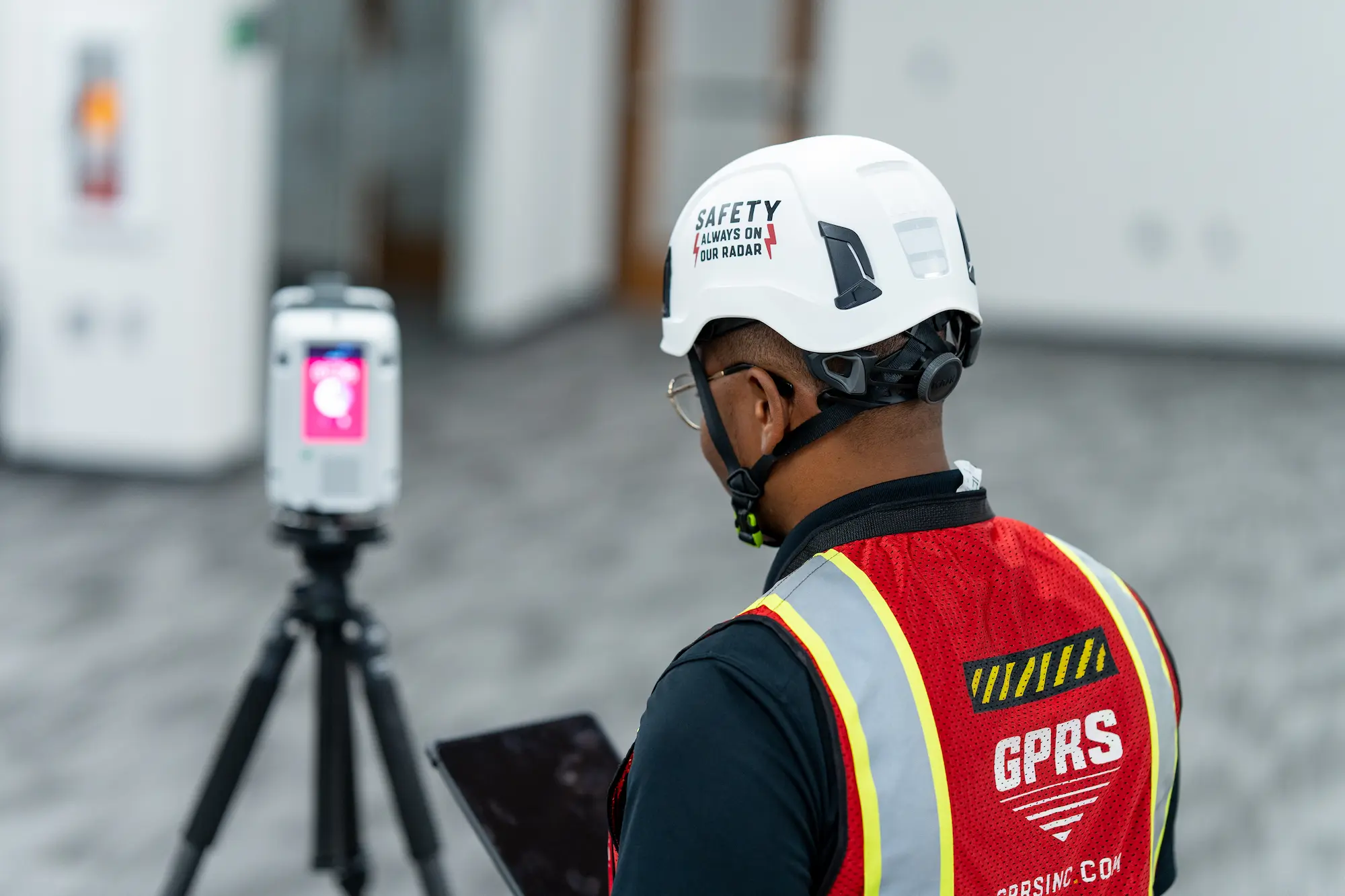
1. Mobile mappers will increase your scanning efficiency
Let’s say you’re set to perform a medium-to-large sized as-built documentation project – for example, a 5,000 sqm office building that includes a variety of spaces like staircases, small rooms, cubicles, long corridors, and mechanical, electrical, and plumbing (MEP) rooms.
In this scenario, investing in a mobile mapping system can speed up your project significantly. As we discussed previously, these devices are capable of capturing buildings at up to 10x faster than a terrestrial laser scanner.
The NavVis VLX for example, can capture 1,000 sqm of complex office space per hour, meaning the project mentioned above would take about five hours of scan time to complete.
Additionally, where a terrestrial laser scanning workflow can require two operators, a mobile workflow can be completed with only one operator. This enables you to free up valuable staffing resources to take on more projects.
Business benefit: Mobile mapping systems improve your scanning efficiency so you can finish big projects faster, and take on more projects, with your existing workforce.
2. Mobile mappers will reduce client disruption
Capturing an asset that is in active use, like a factory, hospital, office, construction site, or parking garage, can be especially complex.
These facilities present all the usual challenges for your as-built capture workflow, and one more: They offer very short windows of downtime for you to scan.
When you use a mobile scanner to capture an active site, the efficiency of the tool enables you to get in and get out much faster, and reduce disruption to your client’s work.
This can help you win new work in industries where the downtime necessary for scanning has prevented clients from performing as-built documentation in the past.
Business benefit: Mobile mapping empowers your business to win more projects by bidding in industries where disruption is an issue, for instance healthcare, factories, and so on.
3. Mobile mappers will expand your services and offerings
Mobile mapping technology won’t just help you to gain new clients. It can also help you to offer new services and deliverables to your existing client base.
Right now, it’s likely that your usual deliverable for as-built documentation project is a CAD or BIM model.
If you add an indoor mobile mapping system like NavVis VLX or NavVis M6 to your workflow, you can use the NavVis Indoor Viewer to automatically produce deliverables like fully immersive 360° walkthroughs for the site.
Deliverables like 360° walkthroughs can offer a great deal of value to your client.
The client can use them to help a variety of stakeholders explore and understand the building; to offer an easy interface for searching, adding, and viewing building information; or even to provide single source of truth for better collaboration in a wide variety of applications in manufacturing, construction, surveying, facilities management, and more.
Business benefit: Mobile mapping can improve your customer retention by enabling you to offer a more compelling set of deliverables than your competitors.
4. Mobile mappers will make your business more flexible
Adding a mobile mapper to your tool set means you can be more flexible about price when negotiating with clients.
Imagine you’re talking with a construction customer that wants to capture reliable as-is conditions for a potential refurbishment project in a relatively simple space.
Since construction firms often want to limit the expense for this kind of project, they won’t want to use a terrestrial laser scanner (in fact, they will often send a student out with a disto to gather measurements by hand).
When you use a mobile mapping workflow, you can offer this customer the best of both worlds. You can supply a 3D deliverable that is much higher quality than they could get with a disto, and much more cost effective than using a terrestrial laser scanner.
On top of that, you can configure your device to provide a different combination of speed and data quality. You could generate data at high accuracy for price A per sqm, and medium accuracy for price B per sqm.
You could let the customer pick the accuracy level that fits their needs, or mix and match accuracy levels for individual spaces throughout the asset.
Business benefit: Mobile mapping systems offer multiple levels of scanning efficiency, and multiple levels of data accuracy. This enables you to adapt your pricing and deliverables to the job requirements – and win more cost-sensitive clients.
5. Mobile mappers will sharpen your competitive edge
As we’ve covered already, mobile mapping technology empowers your business to scan more efficiently, reduce potential disruption for your clients, expand the range of deliverables you can produce, and offer more flexible pricing structures.
This brings an added benefit: It helps your business stand out from your competitors.
If you use mobile scanners, you will differentiate your business during the project acquisition stage.
When the customer compares your business to a competitor that has a more conventional offering, your offer will look more compelling and you’ll be more likely to land the deal.
Business benefit: Using a cutting-edge (but tested) tool like a mobile mapping system will help you stand out from the competition, and win more customers, so your business can continue to grow.
Article Courtesy of NavVis
Written By, Sean Higgins
Sean Higgins is an independent technology writer, former trade publication editor, and outdoors enthusiast. He believes that clear, buzzword-free writing about 3D technologies is a public service.
Topics: Laser Scanning, Reality Capture, Scanning Device, Indoor Mapping, Mobile Mapping
Source: https://www.navvis.com/blog/5-reasons-why-its-time-to-invest-in-mobile-mapping
Frequently Asked Questions
What is 3D laser scanning?
3D laser scanning uses LiDAR technology to capture as-built documentation of existing buildings or sites. Once data is acquired, a point cloud is generated and used to develop 2D CAD drawings or 3D BIM models, expediting the design, planning, and development of projects.
What scanners are used for data collection?
GPRS utilizes a terrestrial 3D laser scanner for data collection, as they are able to document vertical structures, such as buildings and facilities. These scanners sit on a tripod and can take 1-3 minutes to complete each scan, depending on the project requirements. Terrestrial laser scanners are known to produce the most accurate point clouds due to the fact that they are stationary. A laser scanner can only capture what is in its line of sight. Scanners are positioned around a site and take individual scans from varying viewpoints to capture complete site data. The captured points record everything from surface detail and texture, to color, creating a direct representation of the scanned project site.
How SiteMap® is Revolutionizing Infrastructure Projects
The Susquehanna River, stretching about 444 miles along the Eastern Seaboard, has historically provided essential resources for local coal mines and, more recently, hydroelectric power. Travelers cross various sections of the river via numerous bridges and passes throughout Pennsylvania and its surrounding areas. Currently, a major project is underway to connect areas along the river with a new highway bypass, U.S. Route 15. This ambitious endeavor has been decades in the making, involving over 50 years of planning and a significant infusion of new technology.
One such technology likely to be utilized is a centralized GIS platform for project data, such as SiteMap® (patent pending), powered by GPRS. Cloud-based GIS platforms are crucial for the successful completion of large-scale projects like the Central Susquehanna Valley Transportation (CSVT) project. But how do SiteMap® and similar technologies contribute to the efficient and safe progression of such extensive projects?
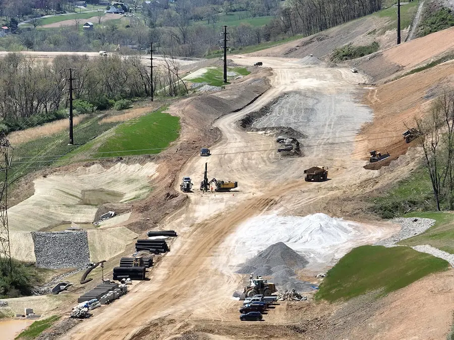
Central Susquehanna Valley Transportation Project: An Overview
The Central Susquehanna Valley Transportation Project is a long-anticipated effort aimed at improving traffic flow and safety in the region. Spanning several decades, this project is designed to create a bypass around the congested areas of Northumberland and Lewisburg, ultimately linking key transportation routes and boosting regional mobility. "It's a four-lane limited-access roadway connecting Route 147 in Northumberland County to Routes 11 and 15 in Snyder County," explained PennDOT's Eric High.
This thirteen-mile project has been in development for years, but construction only began in 2015 due to funding challenges. The work is being carried out in two phases: the northern section connects Route 147 in Northumberland County to Route 15 in Union County, while the southern section links Route 15 to Selinsgrove. The northern section is now open, but the southern section is expected to be completed by 2027.
The importance of this project is significant, especially given its over fifty-year history, underscoring the challenges faced in bringing it to completion. The construction of this crucial link required meticulous planning, extensive coordination, and the use of advanced technologies to navigate the many obstacles encountered along the way.
The Role of Technology in Modern Infrastructure Projects
Historically, infrastructure projects were plagued by delays, cost overruns, and unexpected issues. However, the rise of digital and advanced technologies has transformed how these projects are managed. A prime example of this innovation is SiteMap®, a cutting-edge underground utility mapping software powered by GPRS’s renowned accuracy, elite training, and 99.8% proven precision. SiteMap® provides an interactive underground utility map with precise, easily accessible data, essential for the effective execution of large-scale construction projects.
The groundbreaking technologies of the Fourth Industrial Revolution are redefining possibilities in the built environment. Advances in data proliferation, connectivity, automation, and sustainability are disrupting existing markets and forging new ones. As we adapt our approach to managing infrastructure projects — from energy to data collection — GPRS and SiteMap® exemplify how modern technologies are reshaping and enhancing the industry.
Understanding SiteMap® and its Benefits
Our GIS software platform, SiteMap®, enables you to swiftly access, view, and securely share your infrastructure data with subcontractors, engineers, and your team. All your utility, structural, water & sewer, and facility information is integrated into the SiteMap® Map Viewer and Digital Plan Room. SiteMap® is a digital utility mapping tool that uses advanced technology to offer detailed insights into underground utilities. It’s especially valuable for infrastructure projects, helping to identify and map the intricate network of subsurface utilities. By providing a comprehensive and interactive underground utility map, SiteMap® ensures that project planners and engineers have precise information, minimizing the risk of unexpected utility encounters.
SiteMap® offers a user-friendly way to access facility and location data. It also serves as a digital repository for blueprints, as-built drawings, maintenance records, permits, and more. The platform can visualize georeferenced utility data, site photos and videos, BIM Models, and CAD files all in one place. Recognizing the importance of data portability, SiteMap® integrates seamlessly with other popular GIS platforms, allowing you to leverage GPRS’s 99.8%+ accurate utility maps and concrete scans within your preferred GIS software. A SiteMap® Personal subscription is free for GPRS customers, with additional subscription tiers available to meet various construction and facility needs. SiteMap® presents data in a customizable, intuitive, and cost-effective platform that updates information in minutes.
How Can SiteMap® Improve Project Outcomes
Enhanced Safety: One of the primary concerns in any construction project is safety. Accidentally striking underground utilities can lead to hazardous situations, delays, injuries, fatalities, and increased costs. SiteMap® mitigates this risk by providing detailed maps of underground (or even above ground) utilities, allowing construction teams to plan their activities more effectively and avoid potential hazards. In 2022, the United States construction industry had the highest number of fatal work-related accidents resulting in 1,092 deaths. Platforms like SiteMap®, powered by our elite team of Project Managers, CAD designers, and more at GPRS are helping to reduce this risk through accurate and accessible site data.
Improved Efficiency: With accurate digital utility mapping, construction projects can proceed more efficiently. SiteMap® eliminates the need for time-consuming processes that often result in delays and accidents. By streamlining the process of identifying and mapping underground utilities, SiteMap® helps in reducing project timelines and costs.
Informed Decision-Making: Access to real-time data through SiteMap® empowers project managers and engineers to make well-rounded, informed decisions. They can assess the feasibility of various construction activities, plan alternative routes if necessary, and address potential issues before they escalate. This proactive approach significantly enhances the overall project management process.
Cost Savings: Unforeseen utility encounters can lead to substantial financial setbacks. By utilizing SiteMap®'s underground utility mapping software, construction projects can avoid unnecessary expenses associated with utility damage and project delays. This cost-effective approach ensures that projects stay within budget and are completed on time.
How Technology like SiteMap® Impacts Infrastructure Projects
This Pennsylvania project exemplifies how SiteMap® and similar technologies are revolutionizing infrastructure development. The integration of advanced mapping technologies has been crucial for the smooth execution of this project, allowing developers to accurately plan and map areas near or over the river. As-builts provide essential information and adapt as the project evolves. Advanced mapping and modeling, subsurface mapping, utility locating, and technologies like 3D laser scanning have all contributed to the success of this major highway project.
Technology like SiteMap® supports long-term projects in several key ways:
- Pre-Construction Planning: Comprehensive planning before breaking ground is vital. SiteMap®’s digital utility mapping capabilities offer a detailed view of both underground and above-ground landscapes. Our elite Mapping and Modeling Team can produce BIM models, point clouds, virtual walkthroughs, as-builts, and aggregated maps. This visualized data is crucial for identifying potential challenges and developing strategies to address them. For example, discovering an underground utility line in the proposed construction path allows the team to adjust the design to prevent conflicts, leading to a smoother construction process.
- Easy Data Integration: During construction, seamless and accessible data integration is essential to maintain project momentum. SiteMap®’s interactive underground utility map provides clear visualizations and data on utility locations and other surveyed areas. This allows construction teams to adapt their activities accordingly, minimizing disruptions and keeping the project on schedule.
- Coordination with Stakeholders: Successful infrastructure projects involve multiple stakeholders, including utility companies, government agencies, and local communities. SiteMap® enhances coordination by offering a centralized platform for sharing utility information. This transparency improves collaboration and reduces the risk of misunderstandings or conflicts among stakeholders.
- Minimizing Environmental Impact: Modern infrastructure projects must consider environmental impact. SiteMap®’s precise utility mapping helps avoid unnecessary excavation and minimizes disturbance to the environment. By reducing the project's footprint and protecting natural habitats, SiteMap® supports more sustainable construction practices.
The Future of Infrastructure Development with SiteMap®
As infrastructure projects become increasingly complex and large-scale, the importance of advanced technologies like SiteMap® will grow significantly. In the context of this Pennsylvania project, the transformative impact of digital utility mapping is clear. The advantages of enhanced safety, improved efficiency, informed decision-making, and cost savings make platforms like SiteMap® essential for modern infrastructure development.
The adoption of SiteMap® and similar technologies is expected to become a standard industry practice. Accurately mapping and managing utilities, both subsurface and aboveground, will streamline construction processes and support more sustainable and environmentally responsible practices, which are becoming increasingly important. As these technologies evolve, we can look forward to even more advanced features and capabilities that will further improve infrastructure project outcomes.
This project, with its extensive history and complex challenges, highlights the power of technology in infrastructure development. Without the advent and adoption of modern technologies, such projects might have faced even further delays. SiteMap®’s advanced digital utility mapping has been crucial to the success of such projects, offering valuable insights for future initiatives.
By providing an interactive underground utility map, SiteMap® ensures that construction projects are managed with greater understanding, safety, efficiency, and environmental responsibility. As digital technologies gain traction across industries, the future of infrastructure development looks promising.
To enhance the accuracy and efficiency of your future projects, contact SiteMap® today to learn more.