

.svg)
What is a Point Cloud in Laser Scanning?
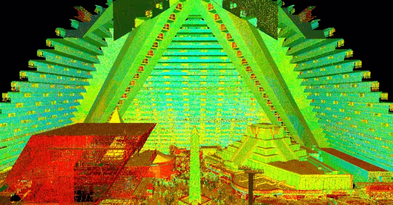
A point cloud represents the initial step in creating an accurate 3D model of the real world. Essentially, it’s a collection of spatial points that serves as the foundation for digital reality, forming a detailed map that can be processed into 3D models of almost any object. On a large scale, this can include buildings, factories, manufacturing plants, civil infrastructure, historical sites, and much more.
3D models derived from point cloud data are increasingly used across various industries for visualization, planning, and customization. This data is revolutionizing the way buildings are designed and maintained, enhancing the accuracy of information available to everyone from architects to operations managers.
To deepen our understanding of this vital technology, let's explore the fundamentals of the point cloud process, including:
- What does point cloud scanning entail
- How it’s generated
- Some ways that point cloud data is used
- How we predict it will be used in the near future
What is a LiDAR Point Cloud?
A point cloud is a collection of an enormous number of measurements: a set of data points or coordinates in three dimensions. The measurements are made by 3D laser scanners and Light Detection and Ranging (LiDAR) technology. A laser measures where light hits surfaces within its line of sight. To give a sense of the huge number of points taken, the Leica RTC360 3D Laser Scanner has a measuring rate of up to two million points per second. It can create an HDR-colored 3D point cloud of its environment in under two minutes. Let’s look at how it creates a point cloud in more detail.
How is a Point Cloud Made?
With a 3D laser scanner, data collection is both portable and precise. Typically, the scanner is mounted on a tripod, positioned within view of the area to be measured, and operated by a technician to initiate the process. For instance, the RTC360 scanner features a high-speed rotating mirror that facilitates rapid measurements. Additionally, its Visual Inertial System (VIS) utilizes advanced algorithms to determine the scanner's relative position and orientation as it moves between different setups.
Various laser scanning systems are used to generate point clouds. Among these, GPRS employs industry-leading Leica professional-grade laser scanners, renowned for capturing top-quality 3D data. Leica Geosystems offers a diverse range of 3D terrestrial laser scanners tailored to different requirements. For example, the Leica ScanStation P-Series is ideal for long-range scanning from a safe distance, while the portable Leica RTC360 excels in mobility and speed. These advanced tools ensure the highest quality data capture for any project.
How Do You Use Point Cloud Scan Data?
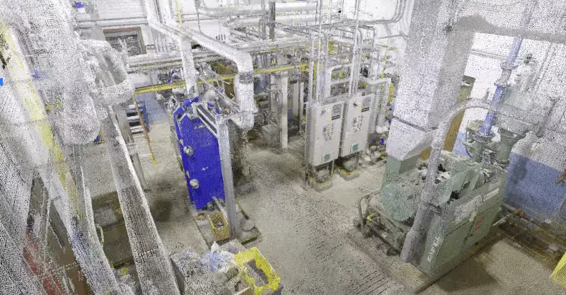
A point cloud needs to be processed to create a complete 3D composite point cloud of the existing conditions. In reality capture technology, you need to register – or stitch together – the final data.
Point cloud registration is where you align overlapping point clouds – if you moved your laser scanner to different positions on site to capture a larger or more complete scene – to cover gaps formed from line of site shadows of the area.
Some of the points collected won’t be needed, and further processing can filter and refine your data. For example, if you scan a shopping center, you will capture a lot of people moving around. Cleaning the data via scanning techniques or other post-processing steps in final registration will remove these undesired ghost objects so that you have a cleaner, smaller, and less noisy dataset.
What is a Point Cloud Used For?
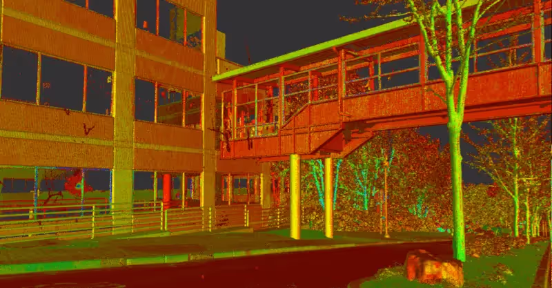
Point cloud data can be utilized in various formats, starting as a raw point cloud file with its associated HDR images. This data can then be transformed into 3D objects, such as surfaces, triangulated meshes, or vector objects like 3D solid models. Additionally, it can be converted into 2D drawings or customized deliverables for diverse analytical needs. For project storage and web-based 3D data visualization and collaboration, the new Cyclone ENTERPRISE serves as a centralized source of truth for project stakeholders.
Once point cloud data is converted into a composite 3D entity, its advantages become apparent, varying by industry and application but primarily hinging on the precision of site data. Here are a few industry-specific examples of point cloud applications:
- Architecture and Engineering: Professionals can leverage Revit software to accurately create a Building Information Model (BIM) of an existing structure or to update original design models with real-world conditions after construction. For retrofit design projects, a virtual site experience allows for conflict checking against existing conditions, helping to prevent critical errors that could delay or halt a project.
- Public Safety: In safety projects, point cloud data facilitates precise modeling. For instance, in flood prevention efforts, laser scanning can be used to assess the impact of proposed safety measures and landscaping experiments.
- Archaeology: Point cloud data offers detailed information on the current state of site structures, aiding in conservation and restoration planning. It also helps researchers develop a clearer understanding of a site’s scale and layout.
Each application highlights the significant impact of accurate point cloud data across different fields.
What Will the Future Look Like for Point Clouds?
The technology to create and process point clouds is getting easier to use. Ten years ago, it would take two or three surveyors a day to create a point cloud on a construction site using a laser scanner the size of a chest freezer. Today, much more portable scanners like the Leica RTC360 can obtain accurate scans within minutes.
Point clouds are becoming more accessible to more industries – and more companies within those industries. In areas like construction, where point clouds are commonly used, the scale of what’s captured will increase. We can create a digital reality from a whole city mixing airborne and earthbound data captures, creating opportunities for the future of urban planning.
Point cloud scanners will be used in more industries via visualization by virtual reality (VR). VR based on point cloud data will be more realistic, more accurate, and more engaging. VR has a wide range of applications, including allowing you to view environments that would otherwise be too expensive or dangerous to access.
Innovation will continue at pace in reality capture technology, and in point cloud processing. It’s common for scanners to be used in UAVs and mobile mapping solutions. In the future, terrestrial laser scanners will become more automated, with users needing to spend less time on site.
Using robotics, scans could be carried out by a specialist surveyor on the other side of the world. Looking even further into the future, a world of ‘big point cloud data’ machine learning and artificial intelligence will eventually automate the interpretation of point clouds. Computers will be programmed to detect certain objects in models as part of an intelligent workflow, saving a huge amount of time and increasing the amount of data that it’s possible to process.
From skyscrapers to sewer lines, GPRS Intelligently Visualizes The Built World® to keep your projects on time, on budget, and safe.
What can we help you visualize?