Precision is essential when scanning buildings and facilities in preparation for restoration, renovation, or expansion projects. This is also true in the world of racing yachts which is why the Offshore Racing Congress (ORC) has turned to 3D laser scanners.
The ORC has been overseeing the measurement of yachts for over 50 years to ensure each vessel can race fairly against their competitors. Each yacht can differ in size and design, so handicaps are necessary to keep the races fair and adjust race times accordingly. The criteria for these handicaps include some the following:
- The vessel’s size and weight
- The configuration of the hull, which is the body or frame of the ship that is mostly underwater when racing
- The shape of the ship’s appendages, which are parts that extend beyond the main hull such as propellers and rudders
- The dimensions of the sails
There is a long list of items that require precise evaluation. Before the implementation of 3D laser scanners, the ORC relied on manual tools and techniques, including hand measuring, that would take a long time to get the yacht’s true dimensions. Due to the possibility of human error, they would often struggle to capture these measurements with precision, and even the slightest inaccuracies can affect the outcome of a race.
The application of 3D laser scanning allows them to capture the information and measurements needed in a fraction of the time the traditional approaches would take.
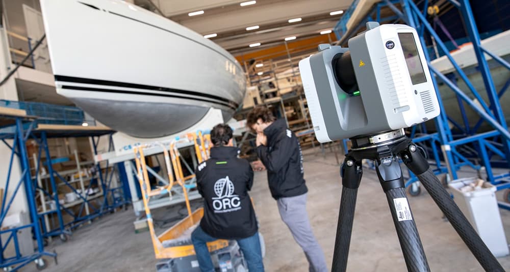
In the summer of 2024, ORC ran a trial run for 3D laser at a shipyard in Finland using the Leica RTC360 terrestrial laser scanner. The results showed that the time needed to precisely document the ship’s shape was around three hours, when it would typically take six.
Similar to GPRS’ 2-4mm accurate scans in the architecture, construction, and engineering industries, ORC stated each scan achieved a resolution of 3mm from a range of 10m. The collected point cloud data, which is a virtual 3D dataset of the scanned area, helped create a detailed 3D model of the yacht. Every essential measurement needed to properly assess the vessel was captured in this model.
Are 3D Scans Used in Other Sports?
3D laser scanning has been making its way into the sports industry to help make sure that athletes, coaches, and trainers keep pace with the constantly evolving world of athletics. The incredible precision of 3D scans allows for a greater level of customization to meet the needs of athletes.
One way 3D laser surveys are revolutionizing sports is in training assessments. By collecting scans of athletes’ bodies, the results provide exceptional insights into their physique and movements. With a precise outlook of the athlete’s biomechanics, coaches and trainers can develop customized training programs to improve their performance and reduce the risk of injury.
Another way 3D laser scanning is used in sports is with equipment design. From custom-fitted shoes to helmets, 3D scans can be used to create sports equipment that enhances both comfort and performance for athletes.
3D laser scanning is not only transforming the world of yacht racing and sports as a whole, but, with professional 3D reality capture companies like GPRS, it is changing the way architectural and construction projects are planned and managed.
How Does GPRS Utilize 3D Laser Scanning?
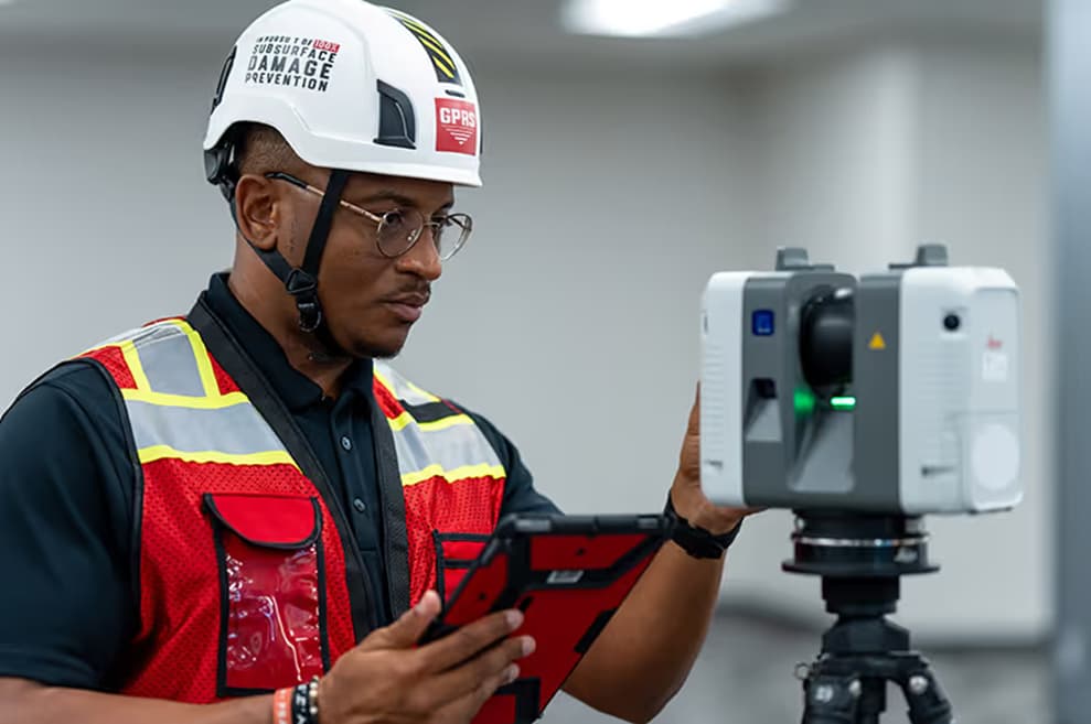
GPRS 3D laser scanning services help clients Intelligently Visualize The Built World® by providing them with highly accurate as-builts and existing conditions documentation. GPRS’ 3D laser scanning services include:
Just like with yacht measurements, hand-measured as-built drawings can be a waste of time and money. Manual measurements are typically inaccurate, which can lead to costly mistakes and project delays. GPRS’ 2-4mm accurate scans and 2-6mm accurate deliverables create detailed and complete as-builts to show clients what they need to see.
Architectural 3D Laser Scanning
The precision and accuracy of 3D laser scanning captures the level of detail necessary for architectural projects. The full documentation of a site or building’s existing conditions helps make sure no inaccuracies or unseen issues arise during the project.
GPRS’ experience in architectural scanning, modeling, and data management helps eliminate site revisits and provides comprehensive as-built documentation that is unmatched by other technologies.
3D Laser Scanning in Construction
For general contractors, securing accurate measurements by hand is often a challenge and can even pose the risk of injury. With the help of 3D laser scanning, general contractors can better design and visualize their plans with highly accurate as-built drawings and measurements captured in a fraction of the time.
Intelligently Visualize The Built World® with GPRS, where we strive to keep your projects afloat even through the roughest waters. What can we help you visualize?
FREQUENTLY ASKED QUESTIONS
What Deliverables Can GPRS Provide?
Our in-house Mapping & Modeling Department can provide 3D modeling in many formats, including:
- Point Cloud Data (Raw Data)
- 2D CAD Drawings
- 3D Non-Intelligent Models
- 3D BIM Models
- JetStream Viewer
Customizable deliverables upon request include:
- Aerial Photogrammetry
- Comparative Analysis
- Deformation Analysis
- Digital Drawings of GPR Markings
- Floor Flatness Analysis/Contour Mapping
- New Construction Accuracy Analysis/Comparative Analysis
- Point Cloud Modeling Training Webinars
- Reconciliation of Clients 2D Design Drawings
- Reconciliation of Clients 3D Design Model
- Structural Steel Shape Probability Analysis
- Template Modeling
- Volume Calculations
- Wall Plumb Analysis
What is LiDAR?
LiDAR is a remote sensing method used to generate precise, three-dimensional information about the shape of an object and its surface characteristics. Much like radar systems that employ radio waves to measure objects, LiDAR uses lasers to calculate the distance of objects with light pulses from 3D laser scanners, gathering 3D information about an object.
What is BIM?
BIM stands for Building Information Modeling and is more than just a 3D model. 3D BIM scanning gives engineers the ability to manage the building data throughout its whole life cycle. It provides accurate spatial relationships and manufacturer details, as well as geographic information and other pertinent aspects of the building.