

.svg)
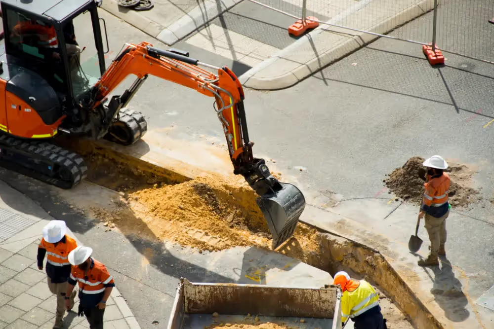
Enhancing data quality and reporting, targeting top damage drivers, and improving locating practices were among the topics that the Common Ground Alliance covered in their most recent recommendations to guide the damage prevention industry.
These recommendations were part of the CGA’s 2023 DIRT Report: the organization’s annual analysis of data submitted to 811 call centers.
The report introduces the CGA’s new tool for measuring the damage prevention industry’s ongoing efforts to enhance excavation safety, and highlights several subsurface damage prevention programs and success stories from the past year.
It also lists recommended actions for facility owners, locators, excavators, and 811 centers to take to achieve the CGA’s 50-in-5 industry challenge, enhance data quality and reporting, target top damage drivers, and improve locating practices.
“As we confront the challenge of significantly reducing damages to underground utilities, addressing the persistent top root causes demands a transformative mindset across the industry,” the report reads. “While the 2022 DIRT Report provides detailed, root cause-specific recommendations that remain relevant, the 2023 Report calls for even more decisive steps towards industry-wide improvement.”

Enhancing Data Quality and Reporting
To enhance data quality and reporting, the CGA recommends the following actions:
Facility Owners, Locators, Excavators
- Participate in the Damage Prevention Institute and submit damage data and metrics monthly to accelerate industry insights and improvements.
811 Centers
- Implement a standardized metric for measuring locate timeliness or “excavation readiness.”
- Establish a consistent process for mapping 811 center ticket data to standard DIRT field options such as work type.
All Stakeholders
- Regularly assess organizational data collection policies and DIRT DQI score, and develop strategies to reduce the percentage of "unknown" entries in critical data fields like root cause and work type.
- Utilize the DIRT root cause flow chart to guide more actionable root cause selection and the Common Work Types tool to map free text to DIRT work types – both are tools developed by CGA Committees.
- Become familiar with your state’s damage reporting requirements by reviewing regulations and 811 center guidelines, ensure all relevant staff are trained on reporting procedures and implement internal processes to meet or exceed state reporting standards.
- Bookmark the DIRT Interactive Dashboard and explore it regularly to guide your damage prevention outreach and programs.
Targeting Top Damage Drivers
To address the top damage drivers, the CGA recommends the following actions:
Facility Owners, Excavators, 811 Centers
- Implement tailored education and outreach programs for water/sewer, telecom and construction/development excavators, which are the leading types of work involved in damages.
- Develop scalable damage prevention strategies to accommodate the expected surge in excavation activities and arrival of out-of-state excavators who may be unfamiliar with local damage prevention regulations.
All Stakeholders
- Develop tiered education approaches based on the urban-rural continuum, recognizing that each geography poses unique challenges.
- Strengthen media and outreach materials for use following extreme weather to reduce damages in the wake of increased precipitation, natural disasters and other extreme events.
- Establish coordination mechanisms between government agencies/regulators, facility owners, excavators, locators and other industry stakeholders to manage the impact of increased infrastructure investments and reduce the incidence of utility-on-utility damage.
Improving Locating Practices
To improve locating practices, the CGA recommends the following actions:
All Stakeholders
- Develop enforcement mechanisms for timely locating, considering both monetary (e.g., New Mexico) and collaborative (e.g., Massachusetts) approaches.
Facility Owners
- Improve contracts with third-party locators to ensure there are not financial, temporal or other barriers to on-time and accurate delivery of locates. Consider implementing best value contracts, which prioritize quality and overall value over the lowest price, as one potential approach to achieve this goal. Regularly meet with third-party locators to facilitate collaboration and information-sharing, regardless of the contract type in place.
- Invest in GPS-enabled locating devices and develop a protocol for locators to update facility maps in the field, ensuring that new or revised asset information is more immediately available to excavators and locators who need it. Implement a quality control process to verify and approve map updates before they are finalized.
Facility Owners, Locators, 811 Centers
- Conduct thorough analysis of 811 ticket screening effects on damage rates and Locating Practice root causes.
How GPRS Supports Subsurface Damage Prevention Efforts
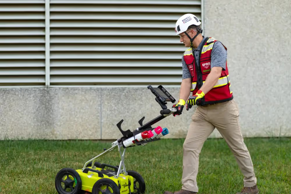
GPRS supports CGA’s mission of subsurface damage reduction through our comprehensive suite of subsurface damage prevention and utility mapping services.
We offer 99.8% accurate utility locating services that utilize ground penetrating radar (GPR) and electromagnetic (EM) locators to fully visualize the built world beneath your feet. And when it’s time to share and collaborate with this accurate, field-verified data, SiteMap® (patent pending), GPRS’ project & facility management application, is there to help you plan, design, manage, dig, and ultimately build better.
From skyscrapers to sewer lines, GPRS Intelligently Visualizes The Built World® to keep your projects on time, on budget, and safe.
What can we help you visualize?
Frequently Asked Questions
How does GPRS communicate the results of their utility locates?
Our Project Managers flag and paint our findings directly on the surface. This method of communication is the most accurate form of marking when excavation is expected to commence within a few days of service.
GPRS also uses a global positioning system (GPS) to collect data points of findings. We use this data to generate a plan, KMZ file, satellite overlay, or CAD file to permanently preserve results for future use. GPRS does not provide land surveying services. If you need land surveying services, please contact a professional land surveyor.
Please contact us to discuss the pricing and marking options your project may require.
Can GPRS locate PVC piping and other non-conductive utilities?
GPR scanning is exceptionally effective at locating all types of subsurface materials. There are times when PVC pipes do not provide an adequate signal to ground penetrating radar equipment and can’t be properly located by traditional methods. However, GPRS Project Managers are expertly trained at multiple methods of utility locating.
Can ground penetrating radar be used to verify known measurements?
We can use GPR to cross-check the measured depth and location of a located utility with existing as-built plans to verify the accuracy of plans.
What are the Benefits of Underground Utility Mapping?
Having an updated and accurate map of your subsurface infrastructure reduces accidents, budget overruns, change orders, and project downtime caused by dangerous and costly subsurface damage.
How does SiteMap® assist with Utility Mapping?
SiteMap®, powered by GPRS, is the industry-leading infrastructure management program. It is a single source of truth, housing the 99.8%+ accurate utility locating, concrete scanning, video pipe inspection, leak detection, and 3D laser scanning data our Project Managers collect on your job site. And the best part is you get a complimentary SiteMap® Personal Subscription when GPRS performs a utility locate for you.
Does SiteMap® Work with my Existing GIS Platform?
SiteMap® allows for exporting of data to SHP, GeoJSON, GeoPackage, and DXF directly from any user’s account that either owns or has a job shared to their account. All these file formats can be imported and utilized by other GIS packages if manually imported by the user.