Building Information Modeling (BIM), sometimes also known as Building Information Management Modeling has become an indispensable tool in the construction industry.
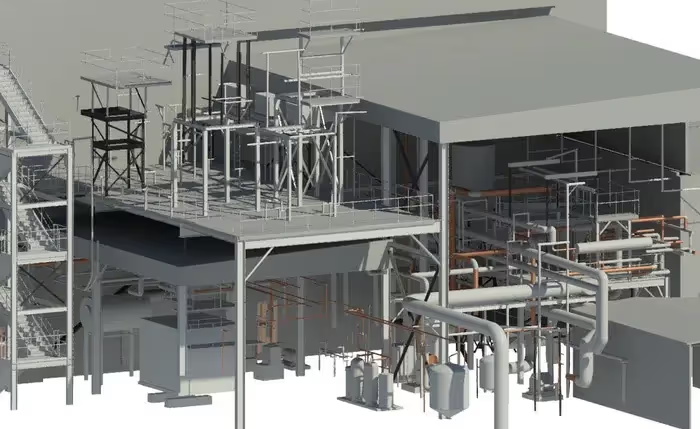
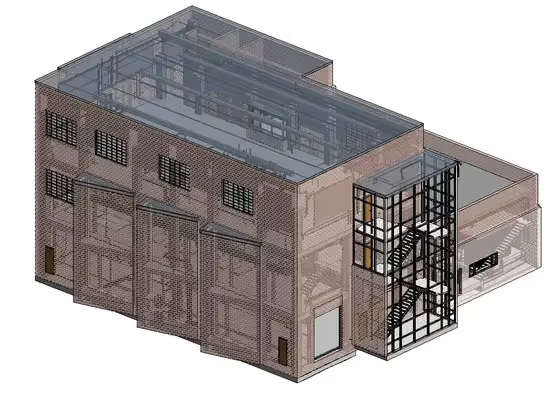
BIM goes beyond traditional 2D drafting, providing a 3D digital representation of the physical and functional characteristics of a facility. This model serves as a shared knowledge resource for information about a facility, forming a reliable basis for decisions during its life cycle, from earliest conception to demolition. But how does one go about obtaining a BIM for their site or facility?

Step 1: Define Your Requirements
Before diving into the process of obtaining a BIM, it’s crucial to define what you need from the model. BIM models vary significantly based on their usage — from architectural design and structural engineering to mechanical, electrical, and plumbing (MEP) planning.
Ask yourself:
- What is the purpose of the BIM? Are you using it for initial design, ongoing facility management, or renovation?
- What level of detail (LoD) do you require? BIM models range from LOD 100 (basic shapes) to LOD 500 (as-built models with detailed attributes and warranties).
- Who will use the BIM? Consider the stakeholders (architects, engineers, contractors, facility managers) and their software preferences.
By answering these questions, you’ll identify the scope and specifications your BIM should meet, which will guide the process and the professionals you’ll need to engage.

Step 2: Choose the Right Professionals
Obtaining a BIM often involves collaboration with several professionals who specialize in different aspects of the building process. Depending on your project, you may need to work with:
- Architects and Engineers: They create the initial design and structure of the building in a BIM environment.
- Surveyors: They use 3D laser scanning or photogrammetry to capture the exact dimensions of the existing site or building.
- BIM Consultants: Specialists who can integrate different models from various teams and ensure the BIM is up to standard.
- Construction Managers and Contractors: They update the BIM during the construction phase to reflect the real-time status of the project.
- VDC Professionals: VDC can be used throughout the entire lifecycle of a project, from design, to construction, through operations to asset modifications. BIM models are the basis for VDC, and are utilized to communicate design plans and construction workflows to the project team.
Selecting experienced professionals who are well-versed in BIM technology is crucial for a successful and accurate model.

Step 3: Data Collection and Initial Modeling
For an existing building or site, the first step is to collect accurate data. This is typically done through:
- 3D Laser Scanning: A method where laser scanners create a point cloud of the site. This point cloud is then used to generate the 3D model.
- Photogrammetry: This technique uses photographs from various angles to create a 3D model of the site.
New constructions will rely on architectural drawings and specifications to create the initial BIM. The professionals you’ve hired will use software like Autodesk Revit, Bentley Systems, or ArchiCAD to develop the BIM based on this data.
Step 4: Model Integration and Refinement
Once the initial model is created, it's not uncommon to integrate separate models from different teams. For example, the architect’s model might need to be combined with the MEP engineer's model. This integration is crucial to identify and resolve clashes between different systems, like a beam running through a duct.
During this phase, the model is refined to include:
- Detailed Components: Adding furniture, equipment, and detailed MEP components.
- Attribute Data: Including detailed information such as material specifications, manufacturer details, and operational data for facility management.
This refinement turns a simple 3D model into a comprehensive BIM that serves multiple purposes and stakeholders.
Step 5: Review and Finalization
With the model integrated and refined, it’s time for a thorough review by all stakeholders. This review process helps identify any discrepancies and make necessary adjustments before the model is finalized. Tools like Autodesk BIM 360 or Navisworks are used to review the model and facilitate communication across teams.
Step 6: Implementation and Maintenance
Once finalized, the BIM becomes a living document of the building or site. For new buildings, the model will continue to be updated throughout construction. For existing facilities, the BIM serves as a baseline for future renovations and maintenance.
To maintain the BIM:
- Regular Updates: As changes occur in the building, the BIM should be updated to reflect the new state.
- Training: Ensure that facility managers and maintenance teams are trained to use BIM software and understand the model.
- Integration with Facility Management: Many BIM tools integrate with facility management software to help plan maintenance and operations efficiently.
GPRS Provides Industry-Leading 3D Laser Scanning, BIM Services
Obtaining a Building Information Model for your site or facility is a multifaceted process that requires clear planning, the right professionals, and ongoing management. However, the effort is worthwhile. A well-executed BIM can save time, reduce costs, and improve the facility’s lifecycle management. By following these steps, you can ensure that your BIM project is successful and serves its intended purpose well into the future.
As a leading provider of 3D laser scanning and BIM modeling services, GPRS’ advanced laser scanning technology accurately captures the dimensions of existing structures, and our BIM modeling expertise ensures these measurements are seamlessly integrated. Our meticulous methodology not only refines spatial configurations but also boosts efficiency, significantly reduces errors, and minimizes rework. These efforts lead to exceptional outcomes for our clients’ projects.
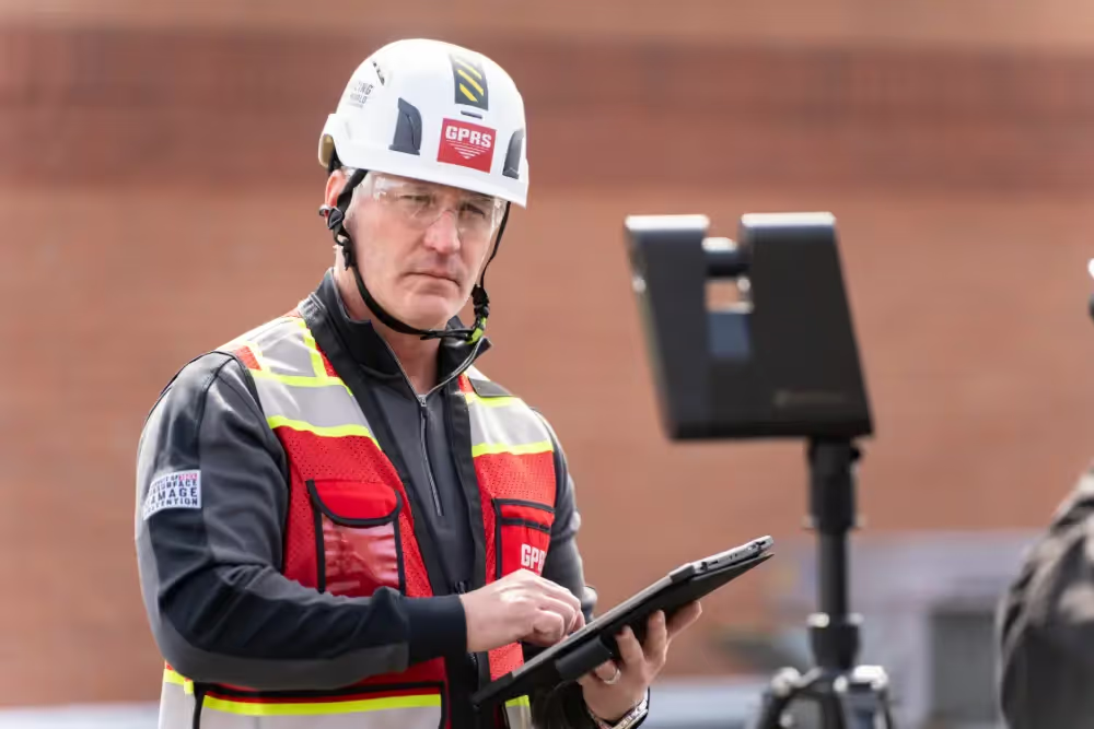
GPRS’ SIM-certified Project Managers employ cutting-edge Leica laser scanners, ground-penetrating radar, and electromagnetic locators to precisely capture as-built site conditions. Our in-house Mapping and Modeling Team then processes this data to create custom utility maps, 2D CAD drawings, and comprehensive 3D BIM models.
This array of deliverables is integrated flawlessly into SiteMap® (patent pending), our proprietary cloud-based infrastructure mapping software. SiteMap® features an intuitive interface that provides access to georeferenced utility data, CAD files, and BIM models, all in one unified platform. This integration ensures smooth collaboration and enhances informed decision-making throughout the project lifecycle.
From skyscrapers to sewer lines, GPRS Intelligently Visualizes The Built World® to keep you on time, on budget, and safe.
What can we help you visualize? Click below to schedule a service or request a quote today!
Frequently Asked Questions
How long does 3D laser scanning take?
An individual scan usually takes between 1-2 minutes. Your GPRS Project Manager will set up the scanner in multiple positions around your building or site. Most building scanning projects can be laser scanned in as little as a couple of hours, but larger sites may take a few days. Entire facilities or campuses can take several weeks to capture.
How much does 3D laser scanning cost?
The cost of 3D laser scanning a building or site depends on the size and complexity of what is being scanned. 3D building information modeling (BIM) costs are based on the size of the area being modeled, level of detail (LoD), and features needing to be included. 3D laser scanning can bring tremendous cost savings to a project. Quality data can lead to a faster design process and fewer change orders, ultimately saving time and money.
Is BIM only suitable for large projects?
No. Building information modeling (BIM) provides comprehensive site information that brings value to projects of all shapes and sizes. BIM management will expedite planning, improve workflows, and increase collaboration – which means that implementing BIM laser scanning will lead to cost and time savings, regardless of the project scale and complexity.
