

.svg)
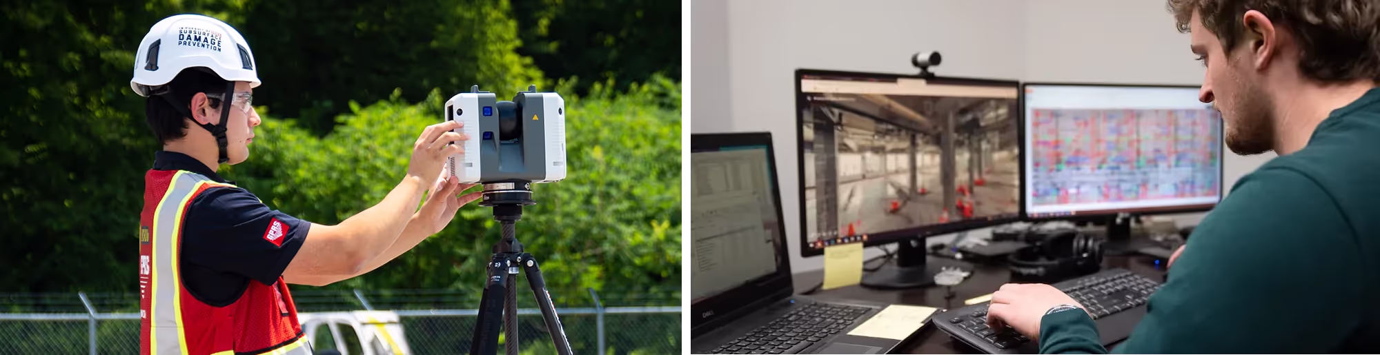
Equipment Used For GPRS 3D Laser Scanning Services
GPRS offers a wide range of laser scanning, photogrammetry, and visualization services. We work closely with each client to define the project scope and use the right tools to achieve the accuracy and as-builts needed to successfully complete each project. Beyond the point cloud data, we provide 2D CAD drawings, 3D BIM models, 3D meshes, and virtual tours to the highest quality standards for construction, design, prefabrication, clash detection, facility modifications, asset management, and more. All GPRS data, drawings, maps, and models are delivered per the client's request to cloud-based data platforms, Sharefile, hard drives, or it can be uploaded to SiteMap®, our industry-leading infrastructure software platform. All GPRS customers receive a complimentary SiteMap® personal subscription with every GPRS service.
3D Laser Scanning Equipment GPRS Project Managers Utilize

Leica ScanStation P50 | P40: Long-range, highest level of detail, dual-axis compensator
Leica P-Series ScanStations deliver the highest quality point cloud data and HDR imagery at an extremely fast scan rate of up to 1 million points per second and ranges of more than 1 kilometer. The P-series Leica laser scanners can tie to survey control, achieve 2-4mm accuracy and have real-time liquid filled dual axis compensators to help mitigate movement and ensure level scans. With unsurpassed range, survey-grade accuracy, and low range noise, these scanners deliver highly detailed point clouds mapped in realistic clarity.

Leica RTC360: Fast, precise, in-field registration
The Leica RTC360 3D laser scanner combines a high-performance laser scanner with Cyclone FIELD 360, a mobile-device app on a tablet computer, to capture and automatically pre-register scans in real time. With a measuring rate of up to 2 million data points per second and advanced HDR imaging system, you can have 3D colorized point clouds with 2-6 mm accuracy in under 2 minutes. Automatic targetless field registration (based on VIS technology) and the seamless transfer of data from site to office reduces time spent in the field, maximizing project productivity.

Matterport Pro 3: LiDAR and camera
Matterport Pro3 allows you to create virtual 3D models, point clouds, layouts, and floorplans of physical spaces, with the ability to edit and share them using the Matterport app and digital twin technology cloud service. The Matterport Pro3, updated with LiDAR-based scanning, offers 20mm accuracy within a 10m range, and has a maximum 100m scanning range. Data is collected at 100k points per second in under 20 seconds per sweep. The Matterport Pro3 features a custom 30-megapixel sensor and 12-element lens covering an ultra-wide angle to produce full-color digital twins.
Data Platforms For Laser Scanning Projects
3D laser scanning data platforms help clients visualize, extract, analyze, and share point cloud data. There are many platforms available to manage laser scan projects and scan-to-BIM workflows. GPRS uses the following data platforms:

BIM 360
BIM 360 is an Autodesk cloud-based solution that allows project teams to effectively work in a collaborative environment. In the AEC industry, it connects all project stakeholders to execute projects from conceptual design through construction and ultimately project turnover. BIM 360 is the overarching concept that is comprised of various modules focusing on different aspects of the project lifecycle: (Docs, Build, Design, Coordinate, Layout, Plan and Ops).

Cintoo Cloud
Cintoo Cloud is a SaaS platform that make your laser scans fully cloud-compatible, shareable, distributable and enrichable with measurements and annotations. Cintoo Cloud is cloud connected to BIM 360, BIM Track, and Procore to enable QA/QC and issue tracking workflows when you need to compare your as-builds to your designs. Cintoo Cloud uses a unique core point cloud-to-mesh engine to bridge the gap between the physical and digital worlds. Accurate data of buildings, factories, plants, or any other asset, becomes accessible and easily interpretable, by experts and non-experts alike, from a simple web browser from anywhere at any time, using Cintoo’s 3D mesh streaming technology.

Matterport
Matterport is a 3D data platform trusted by thousands of businesses to securely store and manage 3D digital twins of their properties. The Matterport cloud service requires a separately obtained login and provides collaboration, and customization such as metadata tags, modeling file export, and editing tools.

Equipment Used For GPRS 3D Laser Scanning Services
GPRS offers a wide range of laser scanning, photogrammetry, and visualization services. We work closely with each client to define the project scope and use the right tools to achieve the accuracy and as-builts needed to successfully complete each project. Beyond the point cloud data, we provide 2D CAD drawings, 3D BIM models, 3D meshes, and virtual tours to the highest quality standards for construction, design, prefabrication, clash detection, facility modifications, asset management, and more. All GPRS data, drawings, maps, and models are delivered per the client's request to cloud-based data platforms, Sharefile, hard drives, or it can be uploaded to SiteMap®, our industry-leading infrastructure software platform. All GPRS customers receive a complimentary SiteMap® personal subscription with every GPRS service.
3D Laser Scanning Equipment GPRS Project Managers Utilize
Leica ScanStation P50 | P40: Long-range, highest level of detail, dual-axis compensator
Leica P-Series ScanStations deliver the highest quality point cloud data and HDR imagery at an extremely fast scan rate of up to 1 million points per second and ranges of more than 1 kilometer. The P-series Leica laser scanners can tie to survey control, achieve 2-4mm accuracy and have real-time liquid filled dual axis compensators to help mitigate movement and ensure level scans. With unsurpassed range, survey-grade accuracy, and low range noise, these scanners deliver highly detailed point clouds mapped in realistic clarity.
Leica RTC360: Fast, precise, in-field registration
The Leica RTC360 3D laser scanner combines a high-performance laser scanner with Cyclone FIELD 360, a mobile-device app on a tablet computer, to capture and automatically pre-register scans in real time. With a measuring rate of up to 2 million data points per second and advanced HDR imaging system, you can have 3D colorized point clouds with 2-6 mm accuracy in under 2 minutes. Automatic targetless field registration (based on VIS technology) and the seamless transfer of data from site to office reduces time spent in the field, maximizing project productivity.
Matterport Pro 3: LiDAR and camera
Matterport Pro3 allows you to create virtual 3D models, point clouds, layouts, and floorplans of physical spaces, with the ability to edit and share them using the Matterport app and digital twin technology cloud service. The Matterport Pro3, updated with LiDAR-based scanning, offers 20mm accuracy within a 10m range, and has a maximum 100m scanning range. Data is collected at 100k points per second in under 20 seconds per sweep. The Matterport Pro3 features a custom 30-megapixel sensor and 12-element lens covering an ultra-wide angle to produce full-color digital twins.
Data Platforms For Laser Scanning Projects
3D laser scanning data platforms help clients visualize, extract, analyze, and share point cloud data. There are many platforms available to manage laser scan projects and scan-to-BIM workflows. GPRS uses the following data platforms:
BIM 360
BIM 360 is an Autodesk cloud-based solution that allows project teams to effectively work in a collaborative environment. In the AEC industry, it connects all project stakeholders to execute projects from conceptual design through construction and ultimately project turnover. BIM 360 is the overarching concept that is comprised of various modules focusing on different aspects of the project lifecycle: (Docs, Build, Design, Coordinate, Layout, Plan and Ops).
Cintoo Cloud
Cintoo Cloud is a SaaS platform that make your laser scans fully cloud-compatible, shareable, distributable and enrichable with measurements and annotations. Cintoo Cloud is cloud connected to BIM 360, BIM Track, and Procore to enable QA/QC and issue tracking workflows when you need to compare your as-builds to your designs. Cintoo Cloud uses a unique core point cloud-to-mesh engine to bridge the gap between the physical and digital worlds. Accurate data of buildings, factories, plants, or any other asset, becomes accessible and easily interpretable, by experts and non-experts alike, from a simple web browser from anywhere at any time, using Cintoo’s 3D mesh streaming technology.
Matterport
Matterport is a 3D data platform trusted by thousands of businesses to securely store and manage 3D digital twins of their properties. The Matterport cloud service requires a separately obtained login and provides collaboration, and customization such as metadata tags, modeling file export, and editing tools.
GPRS SiteMap® Software Delivers As-Builts, Maps & Models
When you partner with GPRS, the data we collect is instantly uploaded to SiteMap®, a cloud-based software that stores up to date as-built records and site assets, geolocated and layered in an easy-to-use interface for project planning.
Every member of your team can have their own login to SiteMap®, to access accurate site information via desktop or mobile devices to make critical decisions. You can share data with subcontractors, engineers, and stakeholders to keep your project on time, on budget, and safe. GPRS’ data in SiteMap® improves project planning, mitigates risk and improves communication for your team.
SiteMap® software can house a great amount of your site’s data. Almost any location data and documentation can be uploaded and organized. Examples of information clients can store, access and share include:
- Subsurface Utility Maps
- Concrete Layout and Imaging Maps
- Point Cloud Data
- 2D CAD Drawings
- 3D BIM Models
- 3D Mesh
- TruViews
- Virtual Tours
- Drone Imagery
- Subsurface Void Information
- Sewer and Manhole Inspection Data


.avif)


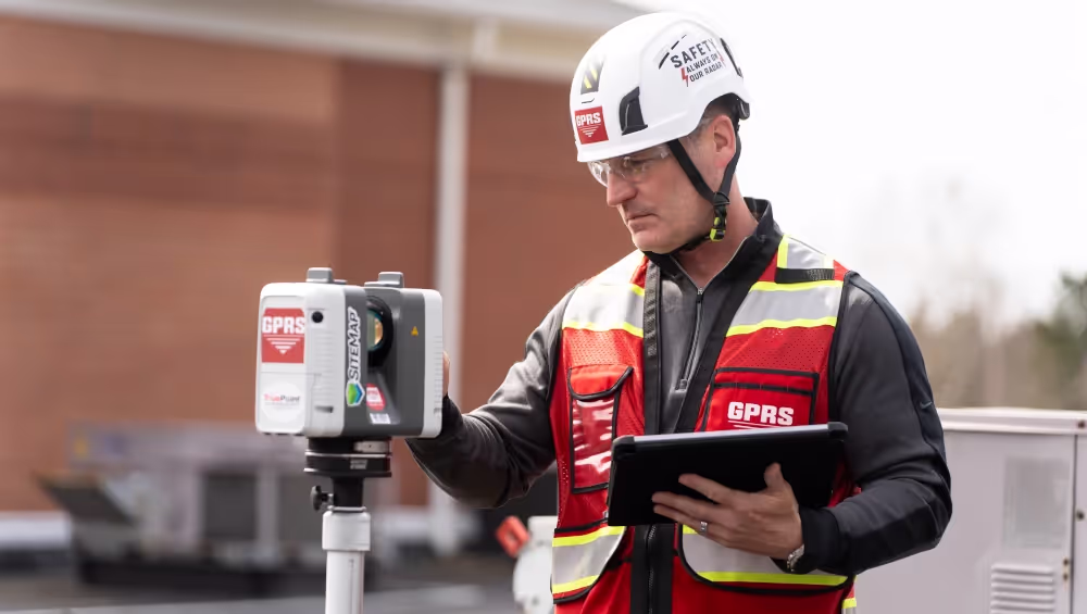
The GPRS Difference. Why Choose GPRS?
GPRS is the nation's leading 3D laser scanning company. We have Project Managers in every major U.S. market equipped with 3D laser scanners to quickly document accurate site data. Our Project Managers undergo an extensive training program to ensure their competence in laser scanning equipment, field knowledge, and providing the best possible results for every project. Data is then compiled into customized data, maps and models and quickly delivered for project planning. When you hire GPRS, you know you’re hiring the most accurate in the business who will get the job done right – and fast – the first time.
///INDUSTRIES We serve

Power Transmission & Distribution

Telecom

Renewable Energy

Oil & Gas

Power Generation

Facilities

One Call

Environmental Due Diligence

Civil, Road & Bridge

Design Builds & Remodels

Education

Retail & Restaurant Construction

Water & Sewer
Electric Vehicle Charging

Engineering & Surveying
Other


.avif)
Articles
"[The Technician] did a good job of getting up to speed and working with little or no direction, which helped us concentrate on our other needs on site."
Steve H.
Project Manager
"The scan helped tremendously and has saved us quite a bit of time and trouble."
Gene A.
Mechanical Integrity Engineer
"Thanks for jumping into this assignment so quickly. What a great and productive trip. You guys work tirelessly, non-stop with all aspects of the set-up and execution. Your ability to master the technology is a game changer for us."
Don A.
Executive Vice President, Director of Architecture, Engineering & Technology
"We have been very pleased with the results of the scanning process. The product has been very useful. And has certainly helped in the development of the project. I would certainly use GPRS again on future projects."
John G.
President & Principal Architect
"Our disciplines have been utilizing the Point Cloud and TruView information and it has been of value. We have discovered a few clashes with our structural steel, which may not have ever been caught, so I feel the service has already paid for itself."
Joseph G.
P.E., Project Manager

Scan-to-BIM technology helps you take any project from inception to completion with accurate and easy to understand data integration to ensure smooth communication and avoid cost overruns and delays. What project can GPRS help you visualize?
Laser scanning is an unmatched facility documentation and management tool with benefits that span the life of any facility. Our Project Managers, model designers, and CAD designers work together to help you Intelligently Visualize The Built World™ to help you reduce downtime and costs so that your projects come in on time and on budget.
USIBD is an organization dedicated to creating standards for building documentation. GPRS 3D Laser Scanning strongly believes in the importance of creating specifications and guidelines for the US construction industry. These established criteria drive quality excellence, improve efficiencies, establish expectations and build credibility. For these reasons, GPRS is proud to be a member of US Institute of Building Documentation.
GPRS 3D Laser Scanning is an unmatched facility documentation and management tool with benefits that span the life of any facility. Our Project Managers, model designers, and CAD designers work together to help you Intelligently Visualize The Built World™ to help you reduce downtime and costs so that your projects come in on time and on budget.