

.svg)

Highlights
THE BOTTOM LINE
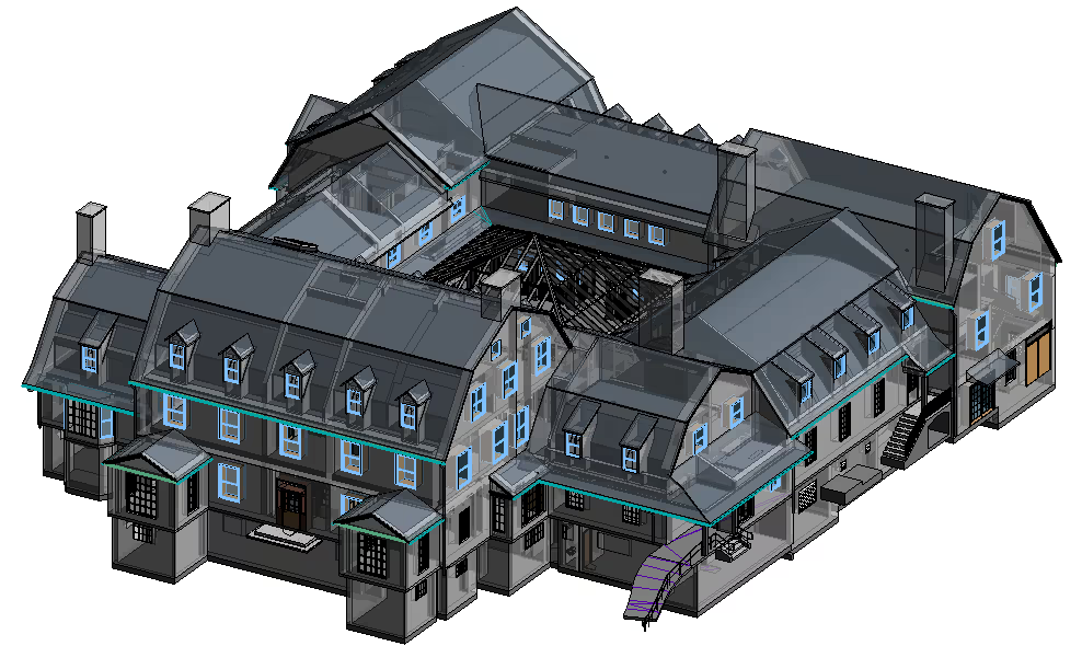
292 individual interior and exterior LiDAR scans were completed in a single day, capturing existing conditions including all historical features, all without disrupting the historic site's operations or impacting its valuable contents so that a renovation could be designed and planned without requiring time consuming hand-measurements.
Industry
Historic Preservation, Construction, Architecture
Service
3D Laser Scanning, Mapping and Modeling
Location
Amherst, Massachusetts
GPRS Project Manager Insight
Deliverables
PROJECT APPLICATION
3D laser scanning allowed the architect to preserve the architectural integrity of an historic building while accurately capturing its existing conditions, keeping daily operations intact, and causing no damage to a unique art gallery required the most advanced non-destructive data capture available.
ASK
Create an accurate 3D BIM model of an historic Massachusetts library to preserve architectural features in a planned renovation
Task
3D laser scanning a historic Massachusetts library to create a 3D BIM model.
PROBLEM
- Built in 1919: there were no existing as-built details available
- It was likely that the existing condition of the building included unsquared architectural features
- The library’s historic features had to be preserved and intact during and post-renovation
- The library needed to remain open to patrons and conduct regular operations while visualization was completed
- Paintings of Emily Dickinson and Robert Frost, plus local historical exhibits, were contained in a gallery on site that needed to remain untouched
Solution
- Laser scanning was executed on Patriot’s Day, a Massachusetts state holiday. The library was closed so all scans could be completed without disrupting operations
- 292 laser scans were completed of the interior and exterior of the library; approximately 47,000 sq. ft. of space spanning four levels
- An intensity map point cloud and 3D BIM model were delivered to the client, giving them accurate data of the current as-built conditions
Benefits
- 3D scanning provided updated floor plans and captured existing conditions via a 3D BIM model to speed redesign and planning
- Architects, designers, and contractors could access and utilize the BIM model and 3D laser scanning data at any stage of the restoration process for reference
- 3D laser scanning is non-contact; scanning from a distance minimized the risk of damaging historical art work and exhibits and was completed in a single day on site
CASE STUDY GALLERY


.avif)
.avif)


.avif)

