3D Laser Scanning Services in Oregon

As an architecture, engineering, or construction professional, you understand that projects require a tremendous amount of planning and coordination. GPRS 3D Laser Scanning can deliver accurate as-builts, point clouds, 2D CAD drawings, 3D photogrammetry, and 3D BIM models to expedite project planning and reduce change orders, delays, and costs.

Whether you are a general contractor or facility manager planning renovations or modifications, or an architect or engineer who requires precise project data, GPRS provides accurate existing conditions documentation, reality capture, and scan-to-BIM services to bring your design and construction projects in on time, and on budget.

When you need accurate architectural, structural, and MEP system dimensions, locations, and layouts for design, prefabrication, clash detection, facility modifications, or asset management, call GPRS. 3D laser scanning minimizes shutdowns and disruptions, eliminates the need for site revisits, and provides accurate as-built data to reduce risk and increase project efficiency.
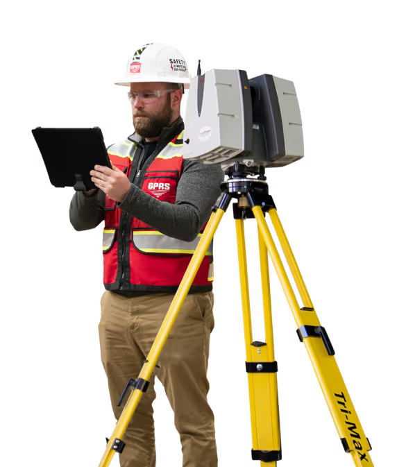
A man in a hard hat holding a tablet.

Portland 3D Laser Scanning

503-313-2755laser@gprsinc.com

GPRS Project Managers

GPRS is the leading provider of 3D laser scanning services in Oregon. Our Project Managers document your site with the Leica ScanStation P-Series and the Leica RTC360 3D laser scanners, capturing up to 2 million data points per second with 2-4 millimeters accuracy. Each Project Manager completes the most extensive training program in the industry, with 80 hours of hands-on classroom training and 320 hours of mentorship in the field, plus another 40 hours of LiDAR training to deliver expertise in 3D laser scanning equipment and field knowledge.

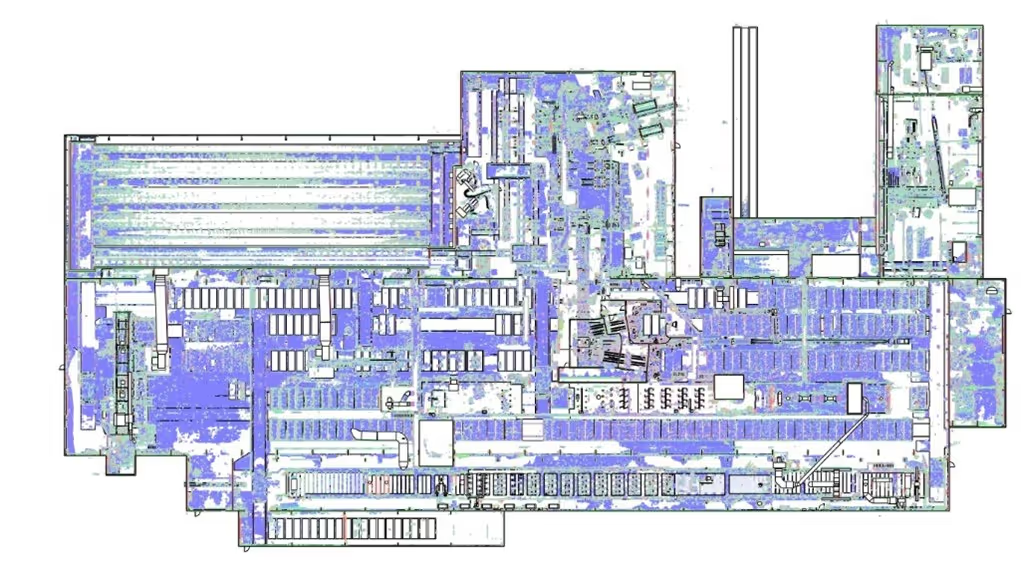
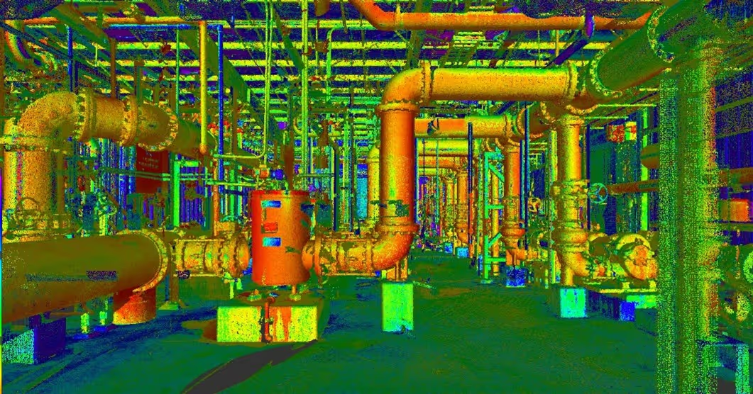
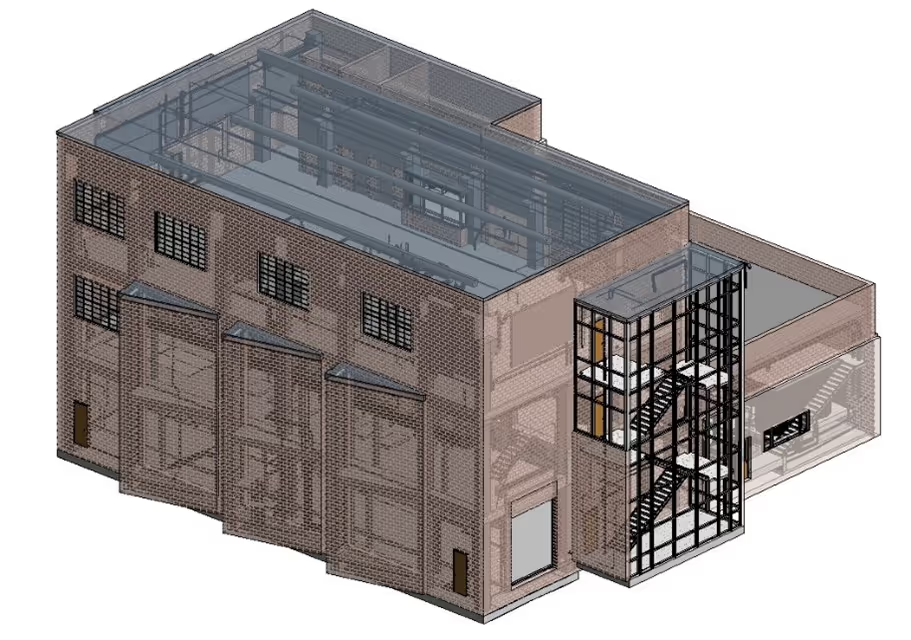
A 3D image of a factory with pipes and valves.A drawing of a road with a red line on it.A 3D drawing of a building with a staircase.

GPRS Mapping & Modeling Team

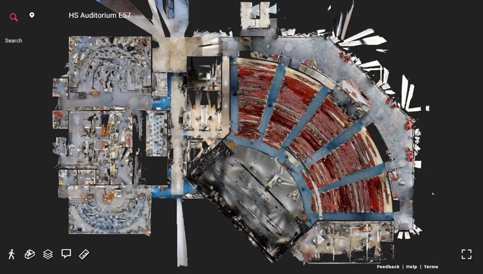
Construction drawings and models streamline planning, visualization, and coordination on your project because they provide a single source of truth for designers, architects, engineers, and contractors. GPRS’ in-house Mapping & Modeling Team can customize as-built data, 2D CAD drawings, 3D BIM models, 3D mesh models, virtual tours via WalkThru 3D, digital twins, floor plans via FLRPLN, and more to ensure you have all the information you need to get the job done right, delivered via GPRS’ SiteMap® digital storage software and app.

Maps and models can be produced at any level of detail in a variety of formats such as Revit, AutoCAD, ReCap, Navisworks, Civil 3D, BIM360, A360, Bentley, Leica Cyclone, Cintoo, and more. We have optimized workflows for importing data, registration, creating deliverables, quality checks, and transferring data to clients.

Not sure what you need? Not a problem. Our experienced Project Managers will work closely with you to define the project scope and use the right equipment and software to accurately map and model your project to accomplish your goals.

WHY CHOOSE US? 

THE GPRS DIFFERENCE.

With GPRS, clients can rest assured that our rigorously trained Project Managers use state-of-the-art technology to deliver the accurate as built information you need to do the job right. GPRS leads the industry to deliver precise as built information to enhance communication and collaboration among your project teams.

GPRS 3D Laser Scanning Services can bring these benefits to your project:

  • Collect up to two million data points per second with the highest-quality survey-grade laser scanners
  • Capture exact dimensions and measurements of your project site
  • Expedite planning and design with accurate as-builts
  • Eliminate site disruption and revisits
  • Receive precise point clouds, 2D drawings, and 3D models to improve collaboration and coordination
  • Tour the location, add digital notes, and even measure with a virtual tour
  • Reduce project risks, change orders, delays, accidents, and costs
GPRS main Logo: Intelligently Visualizing the built world | GPRS

GPRS 3D Laser Scanning Services in Oregon

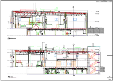
A blue and white drawing of a building with a lot of wires.
As-Built Services
As-built services capture exact architectural, structural, and MEP system dimensions and layout of existing buildings, facilities, and sites, making them invaluable for design, construction, renovations, and modifications.
Learn More
A green and blue image of a factory with pipes and valves.
Point Clouds
3D laser scanners record highly accurate digital measurements of sites and assets in the form of a point cloud and can be used to create 2D CAD drawings and 3D BIM models that improve project workflows, shorten turnaround times, and reduce costs.
Learn More
A 3D model of a building with a staircase.
3D BIM Modeling
Intelligent 3D Building Information Models (BIM) provide contractors, engineers, architects, and facility managers an accurate digital twin of buildings and infrastructure to collaborate on design, construction, and operations.
Learn More
A picture of a building with a red circle in the middle.
3D Photogrammetry
3D rendered images can be used to create virtual tours, floorplans, topographic maps, point clouds, 3D models, and more for planning, analysis, and calculations.
Learn More
A drawing of a building with a red roof and a green roof.
2D CAD Drawings
GPRS can translate 3D laser scan data into 2D CAD drawings that provide your team with up-to-date floor plans, elevations, sections, details, isometric drawings, reflected ceiling plans, and more.
Learn More
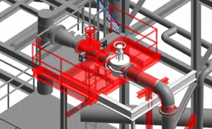
A red pipe with a blue wire running through it.
Clash Detection
3D laser scanning captures as-built site conditions with 2-4 mm accuracy, helping to identify potential clashes, prefabricate components, and plan a flawless installation.
Learn More
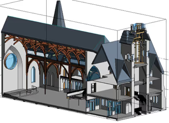
A 3D drawing of a church with a steeple.
Design-Build
3D laser scanning provides accurate as-built site data to prevent expensive rework by identifying any mistakes early in the design through the construction phase.
Learn More
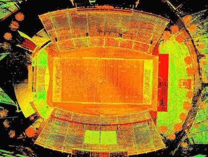
A stadium seating chart with a red line on the field.
Drone Imagery
GPRS offers rectified photogrammetry, aerial video and images, LiDAR scans, 2D orthomosaic images, CAD drawings, 3D models, and 3D fly throughs thanks to a wide-range of drone services operated by FAA Licensed pilots.
Learn More

We provide 3D Laser Scanning Services to these Oregon counties & many more:

  • Multnomah County
  • Washington County
  • Clackamas County
  • Lane County
  • Marion County
  • Jackson County
  • Deschutes County
  • Linn County
  • Douglas County
  • Yamhill County

Our portfolio of work includes projects in these Oregon cities & many more:

  • Portland, Oregon
  • Eugene, Oregon
  • Salem, Oregon
  • Gresham, Oregon
  • Hillsboro, Oregon
  • Bend, Oregon
  • Beaverton, Oregon
  • Medford, Oregon
  • Springfield, Oregon
  • Corvallis, Oregon

Construction Laser Scan of Office Building

ClearEdge3D Edgewise software was used to process piping and quickly create a 3D MEP BIM model for the client.
GPRS 3D laser scanned 40,000 square feet of office space on the 6th floor of a building in Cincinnati, Ohio. The area was recently renovated, and the objective was to capture MEP features to create an accurate as-built survey for the client. GPRS’ Project Manager used a Leica P40 ScanStation to capture 3D point cloud data for the GPRS’ Mapping and Modeling team to create a 3D BIM model.
GPRS 3D laser scanned 40,000 square feet of office space on the 6th floor of a building in Cincinnati, Ohio.
Meta Title: Construction Laser Scan of Office Building Meta Description: GPRS 3D laser scanned 40,000 square feet of office space on the 6th floor of a building in Cincinnati, Ohio. Header: A GPRS Case Study: Laser Scan Office Building to Capture MEP Features Images: Link: https://www.gp-radar.com/services/3d-laser-scanning Alt Tag: A 3D laser scanner in an under-construction office space. Caption: GPRS 3D laser scanned 40,000 square feet of office space. Link: https://www.gp-radar.com/services/3d-laser-scanning Alt Tag: 3D laser scan data of an office space. Caption: The objective was to capture MEP features to create an accurate as-built for the client. Link: https://www.gp-radar.com/services/3d-laser-scanning Alt Tag: Autodesk Recap plan view of office building. Caption: Autodesk Recap Plan View of the office building. Link: https://www.gp-radar.com/services/3d-laser-scanning Alt Tag: Autodesk Recap Real View of office’s HVAC equipment. Caption: Autodesk Recap Real View of HVAC equipment. Link: https://www.gp-radar.com/services/3d-laser-scanning Alt Tag: Autodesk Recap Real View of office hallway. Caption: Autodesk Recap Real View of the hallway. Location: Cincinnati, OH Task: GPRS 3D laser scanned 40,000 square feet of office space on the 6th floor of a building in Cincinnati. The area was recently renovated, and the objective was to capture MEP features to create an accurate as-built survey for the client. GPRS’ Project Manager used a Leica P40 ScanStation to capture 3D point cloud data and GPRS’ in-house engineers created a 3D CAD model. Challenge: The client wanted to complete the laser scan after the space had been framed in, but before the ceiling grid and tiles were installed. This gave the client a very limited window of time to capture the above ceiling piping. They wanted to quickly and accurately capture all MEP components and pipes, so they could install the ceiling and begin to populate the space. Solutions: GPRS maintained constant communication with the client to schedule the scanning just before ceiling grid was installed. With just a few days’ notice, the Project Manager mobilized to the site. GPRS’ experienced technician could ensure that 3D laser scan technology would completely and accurately capture the as-built site conditions. Laser scanning was completed while other contractors continued their work, and complex areas were scheduled during the hours when contractors were off-site. Deliverables: GPRS provided the client with Autodesk Recap files and Black and White Leica TruViews. Also, using preliminary EdgeWise extraction, GPRS engineers provided an AutoCAD .dwg file to the client. Added Value: The scan technician worked during off-peak times, which expedited GPRS’ time on site. Additionally, GPRS’ engineers are trained and experienced in numerous software applications and can create custom deliverables for each client quickly. In this case, ClearEdge 3D Edgewise software was used to process piping and quickly create a 3D model.
All
3D Laser Scanning
3D Laser Scanning
Mapping & Modeling

Oil Tank 3D Laser Scan

For oil tank replacement, the true shape and condition of the tank can be critical for ensuring that the new design fits the existing conditions; reducing costly delays or rework.
GPRS provided terrestrial-based 3D laser scanning services for a 25' x 25' x 30' oil tank near Topeka, Kansas. The objective was to capture the existing conditions of the tank, piping, flanges, nozzles, structural steel, pipe supports, and grade.
3D laser scanning by GPRS for an oil tank replacement.
3D laser scanning by GPRS for an oil tank replacement. Case Study: Oil Tank 3D Laser Scan Location: Emporia, Kansas TASK: GPRS provided terrestrial-based 3D laser scanning services for a 25' x 25' x 30' oil tank near Topeka, Kansas. The objective was to capture the existing conditions of the tank, piping, flanges, nozzles, structural steel, pipe supports and grade. PROBLEM: The client was upgrading the oil tank and needed 3D laser scanning to plan for the removal and replacement. For tank replacement, the true shape and condition of the tank can be critical for ensuring that the new design fits the existing conditions; hence reducing costly delays or rework. All piping, nozzles and structural steel around the tank was reality-captured so the new tank could be designed with proper fit and without interruptions to the unit. SOLUTION: 3D laser scanning provides a way to quickly and accurately obtain the existing condition information. The exact dimensions of a tank can easily be determined to ensure that fabrications match the existing structure. In less than 5 hours on site, the GPRS Project Manager captured the as built conditions of the existing tank and nozzles. Once the point cloud was registered, GPRS Mapping & Modeling CAD technicians delivered the point cloud data for the client to incorporate into their design model. GPRS delivered Intensity Map Point Cloud files, RCS Files and PTG Files to the client. BENEFITS: GPRS uses Leica Laser scanners, which can also capture images to further enhance the collected data. These images, called TruViews, were provided to the client and offer factual record of the areas inspected. GPRS is an experienced 3D laser scanning company. Our knowledgeable Project Managers confidently scan complex jobs with extreme safety requirements. For this job, the technician used an intrinsically safe laser scanner, since any spark would cause an explosion for this particular tank farm. Delivering the point cloud data gives the client the ability to do clash detection for interferences, saving them time and money in the field. GPRS Intelligently Visualizes The Built World® for customers nationwide. What can we help you visualize? For 3D laser scanning services in Kansas, call GPRS. Isometric view of scan area captured from a tripod mounted scanner. Perspective view of the hexane tank. Perspective view of piping surrounding the oil tank.
All
3D Laser Scanning
3D Laser Scanning
Mapping & Modeling

Pharmaceutical Upgrades Completed With the Help of Laser Scanning

The use of laser scan technology has resulted in accurate and efficient data collection, precise as-built documentation, cost savings due to improved design accuracy, and improved project visualization and collaboration.
A pharmaceutical company was installing some new equipment in various areas of the facility. Existing machinery was being removed, new machinery was being installed and MEP piping was being re-routed throughout the area. GPRS provided laser scanning services to collect point cloud data on four levels and generate a 3D model for the client. Before starting renovations of this existing facility, the client desired to document existing conditions to plan layout and process flow upgrades.
The use of laser scan technology has resulted in accurate and efficient data collection, true as built documentation, cost savings due to improved design accuracy, and improved project visualization and collaboration.
Location: Social Circle, GA Project Manager Insight: “The cost of laser scanning and modeling should easily be offset by the cost savings from reduced re-work during the facility renovations.” Andy Foshee, TruePoint Southeast Regional Manager. Task: A pharmaceutical company was installing some new equipment in various areas of the facility. Existing machinery was being removed, new machinery was being installed and MEP piping was being re-routed throughout the area. TruePoint provided laser scanning services to collect point cloud data on four levels and generate a 3D model for the client. Before starting renovations of this existing facility, the client desired to document existing conditions and plan layout and process flow upgrades. Challenge: Upgrading existing pharmaceutical manufacturing sites can be challenging. The space available is restricted and bringing in new equipment is sometimes tricky. Our client needed to make several tie-ins and requested a Revit model for planning. Solution: Using the Leica P50 ScanStation, TruePoint captured structural features, MEP piping and equipment ½ inch and above. An LOD 300 Revit model was requested to ensure more accurate, efficient and cost-effective execution of the project. With planning, the client was able to install the new machinery and re-route piping without any field rework. This also resulted in reduced downtime and significant savings by returning the facility to production quickly. Deliverable: TruePoint delivered a point cloud .rcp file, JetStream Viewer file and an LOD 300 Revit model to the client. TruePoint's team of CAD technicians modeled the following details for the client: Pipe - 72,000 linear feet Conduit - 75,000 linear feet Duct - 11,000 linear feet Pipe modeled down to 1/2 inch in diameter. Added Value: The use of laser scan technology has resulted in accurate and efficient data collection, true as built documentation, cost savings due to improved design accuracy, and improved project visualization and collaboration. For 3D laser scanning services in Atlanta, GA call 404-665-7252 or email atlanta@truepointscanning.com. TruePoint is a leader in 3D laser scanning and scan to BIM services. Our experienced professionals are dedicated to delivering the highest quality point cloud data, 2D drawings and 3D models, using state-of-the-art equipment, technology and processes. Keywords: laser scanning to complete pharmaceutical plant upgrades, laser scanning for plant documentation, Revit model for design planning, laser scanning to re-route piping, scan to BIM MEP.
All
3D Laser Scanning
3D Laser Scanning
Mapping & Modeling

We Have Two Ways To Request An Online Quote:

  1. If you are familiar with Laser Scanning, fill out the form below
  2. If you are new to Laser Scanning, click here for more detailed prompts

GPRS
INTELLIGENTLY VISUALIZING THE BUILT WORLD®

3D Laser Scanning Services in

As an architecture, engineering, or construction professional, you understand that projects require a tremendous amount of planning and coordination. GPRS 3D Laser Scanning can deliver accurate as-builts, point clouds, 2D CAD drawings, 3D photogrammetry, and 3D BIM models to expedite project planning and reduce change orders, delays, and costs.

Whether you are a general contractor or facility manager planning renovations or modifications, or an architect or engineer who requires precise project data, GPRS provides accurate existing conditions documentation, reality capture, and scan-to-BIM services to bring your design and construction projects in on time, and on budget.

When you need accurate architectural, structural, and MEP system dimensions, locations, and layouts for design, prefabrication, clash detection, facility modifications, or asset management, call GPRS. 3D laser scanning minimizes shutdowns and disruptions, eliminates the need for site revisits, and provides accurate as-built data to reduce risk and increase project efficiency.
A man in a hard hat holding a tablet.

GPRS Project Managers

GPRS is the leading provider of 3D laser scanning services in . Our Project Managers document your site with the Leica ScanStation P-Series and the Leica RTC360 3D laser scanners, capturing up to 2 million data points per second with 2-4 millimeters accuracy. Each Project Manager completes the most extensive training program in the industry, with 80 hours of hands-on classroom training and 320 hours of mentorship in the field, plus another 40 hours of LiDAR training to deliver expertise in 3D laser scanning equipment and field knowledge.

A 3D image of a factory with pipes and valves.A drawing of a road with a red line on it.A 3D drawing of a building with a staircase.

GPRS Mapping & Modeling Team

Construction drawings and models streamline planning, visualization, and coordination on your project because they provide a single source of truth for designers, architects, engineers, and contractors. GPRS’ in-house Mapping & Modeling Team can customize as-built data, 2D CAD drawings, 3D BIM models, 3D mesh models, virtual tours via WalkThru 3D, digital twins, floor plans via FLRPLN, and more to ensure you have all the information you need to get the job done right, delivered via GPRS’ SiteMap® digital storage software and app.

Maps and models can be produced at any level of detail in a variety of formats such as Revit, AutoCAD, ReCap, Navisworks, Civil 3D, BIM360, A360, Bentley, Leica Cyclone, Cintoo, and more. We have optimized workflows for importing data, registration, creating deliverables, quality checks, and transferring data to clients.

Not sure what you need? Not a problem. Our experienced Project Managers will work closely with you to define the project scope and use the right equipment and software to accurately map and model your project to accomplish your goals.

WHY CHOOSE US? 

THE GPRS DIFFERENCE.

With GPRS, clients can rest assured that our rigorously trained Project Managers use state-of-the-art technology to deliver the accurate as built information you need to do the job right. GPRS leads the industry to deliver precise as built information to enhance communication and collaboration among your project teams.

GPRS 3D Laser Scanning Services can bring these benefits to your project:

  • Collect up to two million data points per second with the highest-quality survey-grade laser scanners
  • Capture exact dimensions and measurements of your project site
  • Expedite planning and design with accurate as-builts
  • Eliminate site disruption and revisits
  • Receive precise point clouds, 2D drawings, and 3D models to improve collaboration and coordination
  • Tour the location, add digital notes, and even measure with a virtual tour
  • Reduce project risks, change orders, delays, accidents, and costs
GPRS main Logo: Intelligently Visualizing the built world | GPRS

GPRS 3D Laser Scanning Services in

A blue and white drawing of a building with a lot of wires.
As-Built Services
As-built services capture exact architectural, structural, and MEP system dimensions and layout of existing buildings, facilities, and sites, making them invaluable for design, construction, renovations, and modifications.
Learn More
A green and blue image of a factory with pipes and valves.
Point Clouds
3D laser scanners record highly accurate digital measurements of sites and assets in the form of a point cloud and can be used to create 2D CAD drawings and 3D BIM models that improve project workflows, shorten turnaround times, and reduce costs.
Learn More
A 3D model of a building with a staircase.
3D BIM Modeling
Intelligent 3D Building Information Models (BIM) provide contractors, engineers, architects, and facility managers an accurate digital twin of buildings and infrastructure to collaborate on design, construction, and operations.
Learn More
A picture of a building with a red circle in the middle.
3D Photogrammetry
3D rendered images can be used to create virtual tours, floorplans, topographic maps, point clouds, 3D models, and more for planning, analysis, and calculations.
Learn More
A drawing of a building with a red roof and a green roof.
2D CAD Drawings
GPRS can translate 3D laser scan data into 2D CAD drawings that provide your team with up-to-date floor plans, elevations, sections, details, isometric drawings, reflected ceiling plans, and more.
Learn More
A red pipe with a blue wire running through it.
Clash Detection
3D laser scanning captures as-built site conditions with 2-4 mm accuracy, helping to identify potential clashes, prefabricate components, and plan a flawless installation.
Learn More
A 3D drawing of a church with a steeple.
Design-Build
3D laser scanning provides accurate as-built site data to prevent expensive rework by identifying any mistakes early in the design through the construction phase.
Learn More
A stadium seating chart with a red line on the field.
Drone Imagery
GPRS offers rectified photogrammetry, aerial video and images, LiDAR scans, 2D orthomosaic images, CAD drawings, 3D models, and 3D fly throughs thanks to a wide-range of drone services operated by FAA Licensed pilots.
Learn More

We provide 3D Laser Scanning Services to these counties & many more:

Heading 1

Heading 2

Heading 3

Heading 4

Heading 5
Heading 6

Lorem ipsum dolor sit amet, consectetur adipiscing elit, sed do eiusmod tempor incididunt ut labore et dolore magna aliqua. Ut enim ad minim veniam, quis nostrud exercitation ullamco laboris nisi ut aliquip ex ea commodo consequat. Duis aute irure dolor in reprehenderit in voluptate velit esse cillum dolore eu fugiat nulla pariatur.

Block quote

Ordered list

  1. Item 1
  2. Item 2
  3. Item 3

Unordered list

  • Item A
  • Item B
  • Item C

Text link

Bold text

Emphasis

Superscript

Subscript

Our portfolio of work includes projects in these cities & many more:

Heading 1

Heading 2

Heading 3

Heading 4

Heading 5
Heading 6

Lorem ipsum dolor sit amet, consectetur adipiscing elit, sed do eiusmod tempor incididunt ut labore et dolore magna aliqua. Ut enim ad minim veniam, quis nostrud exercitation ullamco laboris nisi ut aliquip ex ea commodo consequat. Duis aute irure dolor in reprehenderit in voluptate velit esse cillum dolore eu fugiat nulla pariatur.

Block quote

Ordered list

  1. Item 1
  2. Item 2
  3. Item 3

Unordered list

  • Item A
  • Item B
  • Item C

Text link

Bold text

Emphasis

Superscript

Subscript

We Have Two Ways To Request An Online Quote:

  1. If you are familiar with Laser Scanning, fill out the form below
  2. If you are new to Laser Scanning, click here for more detailed prompts

GPRS
INTELLIGENTLY VISUALIZING THE BUILT WORLD®