

.svg)
GPRS Point Cloud Services
Point cloud data is transforming the way architecture, engineering, and construction projects are planned and managed, by providing accurate as-built information to all team members, including contractors, engineers, architects, and operations managers.
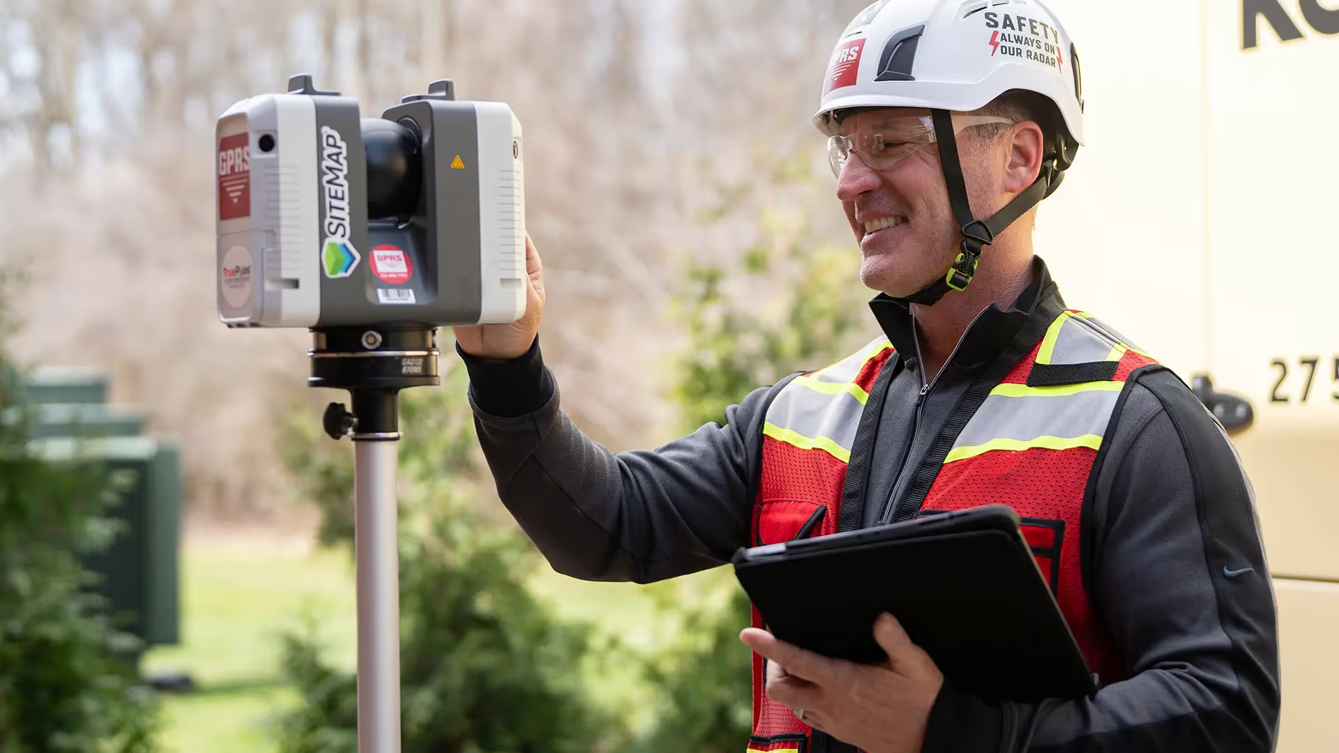
GPRS Project Managers use 3D laser scanners to record highly accurate digital measurements of sites and assets, ultimately producing a point cloud file. A point cloud is the starting point of reality capture, as-builts, and scan-to-BIM – it is a virtual 3D dataset of existing site conditions, which can be processed into 3D BIM models, 3D meshes, and 2D CAD drawings of any building or site.
At GPRS, we use industry-leading Leica survey-grade laser scanners to capture comprehensive point cloud data with 2-4 millimeter accuracy. The data produced is complete, clean, accurate, and well filtered with low range noise. Our Mapping & Modeling Team transforms point clouds into 2D CAD drawings, 3D BIM models, 3D meshes, TruViews, and virtual tours of the highest quality standards. Partnering with GPRS delivers your company accurate as-built data to expedite project planning and reduce change orders, delays, and costs.

What is a LiDAR Point Cloud?
Point cloud data is the term used to refer to the data points collected for a given geographical area, terrain, building, or space. A LiDAR point cloud dataset is created when an area is laser scanned using LiDAR, or light detection and ranging. The point cloud dataset contains the X, Y and Z coordinate of every visible detail of the project site. To visualize the project, point cloud data is imported into CAD software. Once imported, it can be parsed, manipulated, and modified to aid in visualization, design, engineering, and construction projects. Read more about point clouds, here.
How is a point cloud created?
There are two primary tools that can be used to capture a point cloud: laser scanners and photogrammetry.
A laser scanner captures point clouds with the highest accuracy. This process is completed by a trained technician to ensure proper collection of data and correct scanning methods. GPRS uses Leica professional-grade laser scanners to capture 2-4mm accurate point cloud data.
To generate a point cloud with photogrammetry, Matterport Pro 3 cameras capture a space from all angles, and images are processed with specialized software to reconstruct the space in 3D.
Read more about laser scanning equipment here.
Why is a point cloud important?
Point clouds provide powerful and dynamic information for a project. By representing spatial data as a collection of coordinates, point clouds deliver large datasets that can be mined for information. The visualization and analysis from point cloud data is invaluable for decision making. CAD technicians transform point clouds into customized deliverables used for visualization, analysis, design, construction, renovation, prefabrication, and facility modifications.
How much time does it take to create a point cloud?
It depends on the project scope. Most projects can be laser scanned in a couple of hours, or larger sites in a few days. After the scan is complete, the data must be registered and can be uploaded to the client. This process can take 2-3 days. 2D CAD sheets and 3D BIM models can be created from the point cloud data. This will take additional time from experienced CAD designers. To receive a project estimate, click here.
Can a point cloud be created in color?
Data can be captured in intensity (RGB), greyscale (black and white) and full color. Colorized point clouds combines the benefits of a photo (or photogrammetry) with the precision of laser scanning. To complete a full color laser scan, the building or site must have good lighting. Read about the benefits of scanning in color, here.

How is the point cloud processed?
Registration is the process of compiling individual scans into a cohesive point cloud. It involves taking the raw scan data collected onsite and “stitching it together” to produce a complete 3D composite point cloud of the existing conditions. Getting the registration right ensures the most accurate measurements, 2D drawings, and 3D models. This is an important part of the process, and must be completed by an experienced individual. Once complete, the registered point cloud provides accurate documentation of the as-built space with millimeter accuracy. Read more about the importance of registration, here.
What formats are point clouds delivered in?
There are many file formats and each one has particular strengths and weaknesses depending on the method of capture and software used. Different scanners produce raw data in multiple formats, and each piece of software has different exporting capabilities. Popular formats are .PTG or .E57 point cloud files and Autodesk Recap files in .RCS and .RCP format.
What deliverables can be created with point cloud data?
To create advanced deliverables, data is imported into a CAD/BIM software, such as Autodesk, where the data is turned into 3D solids and surfaces. The process of transforming point clouds into 3D models or digital twins takes time and requires an experienced CAD technician. Custom deliverables, such as 2D drawings and 3D models, can be provided at any level of detail. Read more about laser scanning deliverables, here.


GPRS Point Cloud Services
Point cloud data is transforming the way architecture, engineering, and construction projects are planned and managed, by providing accurate as-built information to all team members, including contractors, engineers, architects, and operations managers.
GPRS Project Managers use 3D laser scanners to record highly accurate digital measurements of sites and assets, ultimately producing a point cloud file. A point cloud is the starting point of reality capture, as-builts, and scan-to-BIM – it is a virtual 3D dataset of existing site conditions, which can be processed into 3D BIM models, 3D meshes, and 2D CAD drawings of any building or site.
At GPRS, we use industry-leading Leica survey-grade laser scanners to capture comprehensive point cloud data with 2-4 millimeter accuracy. The data produced is complete, clean, accurate, and well filtered with low range noise. Our Mapping & Modeling Team transforms point clouds into 2D CAD drawings, 3D BIM models, 3D meshes, TruViews, and virtual tours of the highest quality standards. Partnering with GPRS delivers your company accurate as-built data to expedite project planning and reduce change orders, delays, and costs.
What is a LiDAR Point Cloud?
Point cloud data is the term used to refer to the data points collected for a given geographical area, terrain, building, or space. A LiDAR point cloud dataset is created when an area is laser scanned using LiDAR, or light detection and ranging. The point cloud dataset contains the X, Y and Z coordinate of every visible detail of the project site. To visualize the project, point cloud data is imported into CAD software. Once imported, it can be parsed, manipulated, and modified to aid in visualization, design, engineering, and construction projects. Read more about point clouds, here.
How is a point cloud created?
There are two primary tools that can be used to capture a point cloud: laser scanners and photogrammetry.
A laser scanner captures point clouds with the highest accuracy. This process is completed by a trained technician to ensure proper collection of data and correct scanning methods. GPRS uses Leica professional-grade laser scanners to capture 2-4mm accurate point cloud data.
To generate a point cloud with photogrammetry, Matterport Pro 3 cameras capture a space from all angles, and images are processed with specialized software to reconstruct the space in 3D.
Read more about laser scanning equipment here.
Why is a point cloud important?
Point clouds provide powerful and dynamic information for a project. By representing spatial data as a collection of coordinates, point clouds deliver large datasets that can be mined for information. The visualization and analysis from point cloud data is invaluable for decision making. CAD technicians transform point clouds into customized deliverables used for visualization, analysis, design, construction, renovation, prefabrication, and facility modifications.
How much time does it take to create a point cloud?
It depends on the project scope. Most projects can be laser scanned in a couple of hours, or larger sites in a few days. After the scan is complete, the data must be registered and can be uploaded to the client. This process can take 2-3 days. 2D CAD sheets and 3D BIM models can be created from the point cloud data. This will take additional time from experienced CAD designers. To receive a project estimate, click here.
Can a point cloud be created in color?
Data can be captured in intensity (RGB), greyscale (black and white) and full color. Colorized point clouds combines the benefits of a photo (or photogrammetry) with the precision of laser scanning. To complete a full color laser scan, the building or site must have good lighting. Read about the benefits of scanning in color, here.
How is the point cloud processed?
Registration is the process of compiling individual scans into a cohesive point cloud. It involves taking the raw scan data collected onsite and “stitching it together” to produce a complete 3D composite point cloud of the existing conditions. Getting the registration right ensures the most accurate measurements, 2D drawings, and 3D models. This is an important part of the process, and must be completed by an experienced individual. Once complete, the registered point cloud provides accurate documentation of the as-built space with millimeter accuracy. Read more about the importance of registration, here.
What formats are point clouds delivered in?
There are many file formats and each one has particular strengths and weaknesses depending on the method of capture and software used. Different scanners produce raw data in multiple formats, and each piece of software has different exporting capabilities. Popular formats are .PTG or .E57 point cloud files and Autodesk Recap files in .RCS and .RCP format.
What deliverables can be created with point cloud data?
To create advanced deliverables, data is imported into a CAD/BIM software, such as Autodesk, where the data is turned into 3D solids and surfaces. The process of transforming point clouds into 3D models or digital twins takes time and requires an experienced CAD technician. Custom deliverables, such as 2D drawings and 3D models, can be provided at any level of detail. Read more about laser scanning deliverables, here.
What industries use point cloud data?
Point cloud data has become the new standard for the architecture, engineering and construction industry. Having a virtual model of the project gives companies the ability to effectively plan, design, construct, and manage projects. Point cloud data aids in analysis, design, construction sequencing, renovation, prefabrication, asset management, and facility modifications to name a few. Precise point clouds expedite design planning and reduce project costs and change orders.
Industries Utilizing Point Cloud Data


.avif)


Why GPRS? The GPRS Difference
With GPRS, clients can rest assured that our elite Project Managers use state-of-the-art 3D laser scanning and photogrammetry technology to document accurate existing conditions in point cloud formats. GPRS, an industry leading 3D laser scanning company, delivers outstanding service with cutting-edge technology – to keep your projects on time, on budget, and reduce risk.
///INDUSTRIES We serve

Power Transmission & Distribution

Telecom

Renewable Energy

Oil & Gas

Power Generation

Facilities

One Call

Environmental Due Diligence

Civil, Road & Bridge

Design Builds & Remodels

Education

Retail & Restaurant Construction

Water & Sewer
Electric Vehicle Charging

Engineering & Surveying
Other
Case Studies
.avif)


.avif)

Scan-to-BIM technology helps you take any project from inception to completion with accurate and easy to understand data integration to ensure smooth communication and avoid cost overruns and delays. What project can GPRS help you visualize?
Laser scanning is an unmatched facility documentation and management tool with benefits that span the life of any facility. Our Project Managers, model designers, and CAD designers work together to help you Visualize The Built World® to help you reduce downtime and costs so that your projects come in on time and on budget.
USIBD is an organization dedicated to creating standards for building documentation. GPRS 3D Laser Scanning strongly believes in the importance of creating specifications and guidelines for the US construction industry. These established criteria drive quality excellence, improve efficiencies, establish expectations and build credibility. For these reasons, GPRS is proud to be a member of US Institute of Building Documentation.
GPRS 3D Laser Scanning is an unmatched facility documentation and management tool with benefits that span the life of any facility. Our Project Managers, model designers, and CAD designers work together to help you Intelligently Visualize The Built World™ to help you reduce downtime and costs so that your projects come in on time and on budget.