Accident Reconstruction

GPRS Laser Scanning experts use state-of-the-art laser scanning equipment and drone photogrammetry platforms to reconstruct complex accident sites and incident scenes in 3D with millimeter accuracy. With conventional techniques, subjective judgments can be made about what information should be recorded at the scene, whether it be a crash investigation or collision reconstruction.

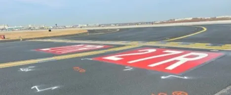
By using a 3D laser scanner, a more objective approach is used – everything within the line of sight of the laser is captured. By repeating the scan from additional positions and then merging the resulting data, a comprehensive 3D point cloud of the scene is created. This provides investigators with the ability to “revisit” the original scene for further spatial analysis or to collect additional data via their computer screen. Plus, this data can be accurately merged with any initial scene survey data captured. This technique is ideal for documenting runway, taxi and roadway layouts, flight path obstructions, accident scenes, and wreckage layouts.

GPRS Laser Scanning Project Managers use industry-leading Leica laser scanners to collect up to 2 million measurement points per second with 2-4 mm accuracy at a range of up to 270 meters for each scan taken. GPRS can also construct customized deliverables, such as 2D drawings or 3D models with the millions of sub-centimeter data points collected.

GPRS uses drone photogrammetry to improve the process of accident investigation. GPRS has optimized workflows to ensure that HD video and HD photos are quickly and accurately collected. The resulting images and maps of the scene, along with accurate distance and angle measurements, are important for the reconstructionist or the forensic specialist. Viewpoints can be changed to any location within the scene. GPRS can construct customized deliverables, such as 2D orthoimages or fly-through videos for evidence in court.

GPRS's mission is to provide the best-in-class 3D laser scanning and drone photogrammetry services, capturing unbiased data for accident investigations. Our expert Project Managers and Mapping & Modeling Team are ready to serve your needs in an accurate and efficient manner.

GPRS Services for Accident Investigations

Whether you need the simplicity of single measurements, or basic 2D drawing, comprehensive point clouds or immersive 3D flythroughs and animations, GPRS provides you the insights you need to investigate locations fast.

  • Point Clouds
  • 2D CAD Drawings
  • 3D Models
  • 2D Orthoimages
  • HD Video Documentation
  • HD Photo Documentation
  • 360° Panoramas
  • Flythrough Videos
  • Drone Photogrammetry

The images generated by laser scanning and drone photogrammetry provide irrefutable demonstrative evidence that can be used at trial or mediation. Opposing parties can be assured that subject/exemplar data and evidence will be collected, documented, and shared in a manner consistent with ASTM standards and industry best practices.

3D Laser Scanning & Drone Photogrammetry Pricing

The cost of 3D laser scanning and drone photogrammetry can vary depending on the scope of the accident site. GPRS customizes every quote specific to your project’s needs. What can we help you visualize?

Let's Get To Work
Schedule A Project

No items found.
Settings Slider icon

CUSTOM SERVICE PLANS

Rather than send a rigid rate sheet to prospective clients, GPRS can create a customized service plan. We take into account our industry experience, national footprint, and operational/scheduling capacity to craft a customized plan just for you.
Schedule Icon

Scheduling

With one single point of contact for your company, GPRS can schedule underground utility locating, 3D laser scanning, concrete scanning, video pipe inspection, and void detection services for your site with a simple phone call. There is no need to call multiple service providers across a region or nationally. GPRS has Project Managers in every major market in the US and our single point of contact will simplify your scheduling process.
Pricing

Pricing

GPRS understands that clear, understandable, and consistent pricing is a big deal. Our nationwide footprint allows us to streamline our costs on a nationwide basis. We are sure to craft a cost structure that makes sense for the scope of work. Rather than send a blanket rate sheet, we consultatively compose pricing plans for each project.
approach icon

Approach

Every campus, site, and facility pose different challenges. Since our inception, GPRS has completed hundreds of thousands of projects and relies on that experience when crafting a site-specific plan for safety, scanning, and reporting. With the SIM Specification as our guide, we will craft an individualized approach to each and every project. We Intelligently Visualize The Built World™ from facility mapping to utility locating prior to excavation, and will perform the right service for your scope of work.
Mapping and modeling  - GPRS -  Ground Penetrating Radar

mapping & Modeling

GPRS improves project planning and communication by providing clear and understandable maps and models to help you Visualize The Built World™ and share your vision with subcontractors, designers, engineers, and others, easily.

GPRS delivers the most up-to-date, accurate and comprehensive site data possible in the format required for your project. We provide complimentary KMZ and PDF maps with every utility locate we perform. Our Mapping & Modeling Team can create a wide variety of customizable maps and models, from a simple GPS-enabled map of your utility locate, to highly-detailed 2D CAD drawings and 3D BIM models, depending on your needs.

AS BUILT DRAWINGS

Existing drawings don't always show the current conditions of a site. Drawings that are produced in the design phase of a project don't always reflect the exact location of the underground utilities and current as built site conditions. Renovations, repairs, and additions can all render as built drawings out of date. The GPRS Mapping & Modeling Team can deliver up-to-date as built drawings that reflect the actual vertical and horizontal position of underground facilities & features, and structural, architectural, and MEP site details.

2D MAPS & 3D MODELS

Utility locates, concrete scanning, and 3D laser scan data can be processed into up-to-date 2D maps and 3D models to ensure that your team has all the information you need to get the job done right. These maps and models provide an accurate record of utility locations and as-builts for project planning.
The GPRS Mapping & Modeling Team will deliver point cloud data, 2D CAD drawings, 3D BIM models, 3D meshes, TruViews, and virtual tours produced with the highest quality standards. We provide high-precision custom analysis and calculations such as dimensional callouts, tank calibration analysis, floor flatness and levelness analysis, deviation analysis, deformation analysis, volume calculations, wall plumb analysis, and more.
Maps, models, and analyses are produced and hosted for your use at any level of detail in a variety of formats such as Revit, AutoCAD, ReCap, Navisworks, Civil 3D, BIM360, A360, Bentley, Leica Cyclone, Cintoo, NavVis Ivion, and more. The GPRS Mapping & Modeling Team has optimized workflows for importing data, registration, creating maps and models, quality checks, and transferring data to clients. We deliver the data you need in the format you need to access up-to-date and accurate facility and infrastructure information.

SITEMAP® MOBILE APP

When we conduct an underground utility locate, GPRS stores all subsurface infrastructure data in SiteMap®, a secure digital platform that houses all your utility locate PDF and KMZ files. You can access your data from any laptop or mobile device and securely share it with your team. Within your files, you will find interactive subsurface maps, annotations, and more, where you can toggle layers and lines on or off to streamline information and communicate only the data you need. You can even measure site features and segment maps geographically to drill down to specific project points for prefabrication or excavation needs.
GPRS Project Managers can complete multiple mobilizations to a jobsite – before, during and after construction – to record subsurface and as built data in real-time. The data captured can be tied together into living maps and models and saved into a database for reference.
How can GPRS can help you streamline your next project to Intelligently Visualize Your Built World™?
One Call Program

One Call Program

GPRS exceed industry performance when it comes to the accuracy of our utility locating. Our team of Project Managers can continue the support of your project by crafting a one-call program from when your project transitions to the O&M phase.
Public Property

Public Property

Damage prevention is critical when excavating in a public right-of-way. Using the 811, call before you dig system, is an essential step to take when trying to avoid underground utility strikes. It's the law! GPRS is able to contract and perform one-call type utility locating for your underground assets.
Public Property

Private Property

A utility locate on private property is not complete until a private utility locator like GPRS has been called to comprehensively locate the entire campus. GPRS can create a one-call type program for your facility or campus in the case that you have utilities that lie within public property.
Embedment

Embedment

Our highly trained Project Managers have extensive experience locating conduits, rebar, cables, pipes, ducts, sleeves, and other hazards embedded in concrete slabs and other structures with ground penetrating radar technology. Cutting, coring, or drilling into these objects can cause damage to utilities and jeopardize the health and safety of workers on site.

FREQUENTLY ASKED QUESTIONS

right arrow  - GPRS -  Ground Penetrating Radar

Will you be able to work with my schedule to avoid disrupting business operations?

Yes! GPRS tailors our services to meet your needs, and that includes working nights and weekends to help limit disruptions to normal business operations. The equipment that GPRS uses is battery operated, emits less radiation than a cell phone, and less noise than a household vacuum cleaner, allowing us to work discreetly.

right arrow  - GPRS -  Ground Penetrating Radar

Can you provide services quickly?

Yes! Our nationwide presence means that a GPRS ProjectManager will be on your jobsite as quickly as 24 hours after initial contact.

right arrow  - GPRS -  Ground Penetrating Radar

Do you have enough manpower to cover multiple stores/sites at one time?

Yes! With over 500 Project Managers strategically stationed across every major market in the U.S., we can respond rapidly to as many sites as needed.

right arrow  - GPRS -  Ground Penetrating Radar

What do I get when you conduct a service for me?

GPRS provides a Job Summary report with basic project information for very project we complete. We also provide complimentary KMZ and PDF maps with every utility locate we perform. And, when we perform a utility locate for you, you receive a complimentary Personal subscription to SiteMap®, our industry-leading, cloud-based infrastructure management platform where you can access, view, and securely share your digitized, layered utility maps 24/7. Beyond that, our Mapping & Modeling Team can create anything from a simple, GPS-enabled locating map of your utility locate, to highly detailed, 2D CAD drawings and 3D BIM models, depending on your needs.

right arrow  - GPRS -  Ground Penetrating Radar

Can you complete your work without my team on site?

Yes, GPRS Project Managers have the capability to complete work with, or without your team present on site, as long as access is granted to the work area. Details of our findings will be communicated to your team immediately upon completion of each project.

GPRS Employees at work | GPRS Image