industry insights
Featured Articles
Is Utility Mapping Worth the Cost?
Why Do You Need Updated As-Builts on Your Next Project?
industry insights
3D Laser Scanning Expedites BOMA Floor Measurement

What is BOMA?
BOMA, The Building Owners and Managers Association, has established standards for operational best practices for commercial real estate owners and managers for office buildings, industrial buildings, medical buildings, commercial buildings, and mixed-use buildings. BOMA standards help property owners and managers maximize the value of their assets and tenant operations.
What are BOMA Floor Measurement Standards?
Over 100 years ago in 1915, BOMA created and established the first standard for measuring floor area in commercial real-estate, it has since established itself as the global authority in building measurement.
BOMA has established standards for measuring and documenting the size and area of commercial buildings. These standards provide guidelines for consistent and accurate measuring methodologies, which are important for many purposes, such as leasing, property management, and facility assessment.
The BOMA floor measurement standard is used by building owners, facility managers, leasing professionals, tenants, appraisers, architects, planners, and building measurement professionals to compute floor area in a building using an agreed-upon, standard method of measurement.
BOMA standards are not a regulatory requirement. They have been adopted, recognized, and approved by the American National Standards Institute (ANSI). Tenants who are not aware of these building measurement standards could make the mistake of renting inadequate space for their business or paying more than anticipated to rent the space they actually need.
The BOMA standards provide a method of calculating rentable area, defined by multiplying the total floor area by a ratio that represents the tenant's portion of the floor.
There are several different BOMA standards for measuring various types of commercial property:
- Industrial
- Gross Area
- Multi-Unit Residential
- Retail
- Mixed-Use
- Office
Each standard is designed in accordance with the specific needs of that industry and the specific architecture of the measured buildings. You can purchase the latest edition of the BOMA standards for measuring commercial property from the BOMA website.
How Does 3D Laser Scanning Aid BOMA?
Accurate building dimensions are critical when conducting BOMA assessments. 3D laser scanning is the most effective method to capture and accurately record a building's dimensions, geometry, and spatial layout. 3D laser scanners use LiDAR technology, where a scanner emits a laser beam to calculate distance measurements with millimeter accuracy. The laser scan data collected is tied together in the form of a point cloud, providing highly detailed and accurate three-dimensional representation of the building, including both interior and exterior spaces. Commercial buildings, office buildings, industrial buildings, retail buildings, and storage premises are some of the more common buildings that use data to calculate BOMA assessments.
3D laser scanning improves the accuracy and efficiency of the measurement process. Traditional manual measurements are time consuming and prone to errors, especially for complex building structures.
Laser scanning enables fast data capture and reduces the likelihood of human measurement errors. The LeicaRTC360, for example, collects 2 million data points per second with 2-6 mm accuracy in less than two minutes. GPRS 3D laser scanning Project Managers work their way around a building or site, capturing accurate project layout and dimensions for BOMA calculations.
As buildings undergo modifications, renovations, or expansions, updated documentation is required. 3D laser scanning can be employed to accurately capture the changes, ensuring BOMA assessments reflect the current state of the building.
3D laser scanning is the most effective method to capture and accurately record a building's dimensions, geometry, and spatial layout.

Can You Use 3D Laser Scanning to Calculate Rentable Area, Usable Area and Load Factor?
Calculations can be made for rentable area, usable area, and load factor from the data collected by 3D laser scanning. Rentable square footage differs from usable square footage in that usable square footage is the tenant's specific space they occupy. Whereas rentable square footage also includes a portion of the property's common or shared spaces. Load factor is the percentage of the space that is not usable.
It is very important for all parties to know the leasable area of a building and the amount of common space. The BOMA standard delivers support to building developers, facility managers, and tenants to calculate the terms of leasable areas and avoid unjustifiable rent charges. 3D laser scanning is critical for these calculations.
BOMA standards provide guidelines for consistent and accurate measuring methodologies.
.webp)
The GPRS Difference
GPRS is the nation’s largest 3D laser scanning company with over 500 Project Managers located in every major city in the United States. GPRS performs expert 3D laser scanning services to deliver complete and accurate as built data of a project site. We work closely with each client to define the project scope and use the right tools to accurately document each project for visualization and coordination.
3D laser scanning provides critical building dimensions and measurements for BOMA assessments. The GPRS Mapping and Modeling Team can create 2D CAD drawings and 3D BIM models of projects for management and tenant reference.
Clients will receive clear and understandable as built site data in the form of a point cloud, 2D site plans, and/or 3D models. 2-6mm accurate data allows clients to extract 3D coordinates and measure distances, along with the ability to mark-up and share this data with project teams. Receiving critical site information will maximize the value of building and tenant operations.
For facilities management, clients receive reliable, accurate 3D industrial mapping for facility upgrades and expansions. 3D laser scanning can aid in design, construction sequencing, and scheduling; while reducing change orders, costs and delays.
GPRS also performs utility locating, concrete scanning, video pipe inspection, and leak detection services to capture subsurface information.
With GPRS, clients can rest assured that our rigorously trained Project Managers use state-of-the-art technology to deliver the most accurate as built and subsurface information. GPRS leads the industry –providing outstanding service, cutting-edge technology and accurate data.
SiteMap®: An Online Platform to View As-Builts
With SiteMap® (patent pending), clients can visualize and securely share as-built, subsurface, and utility data, CAD drawings and BIM models, and more – all collected, layered, and organized for easy reference on any project.
With all GPRS utility locating or scanning services, clients receive a free SiteMap® Personal subscription, allowing quick access to all site information. Once the job has been completed, all building information is quickly uploaded into the easy-to-use SiteMap® platform, to expedite calculations and communication. This allows every member of the team to collaborate instantly, with the same information, measurements, and specifications. Clients can easily view and share all this data with the people who need it.

What Can GPRS Help You Visualize?
Accurate building and facility data is essential for property owners and managers. 3D laser scanning provides efficient and accurate building measurement documentation for BOMA surveys and calculations. BOMA standards allow owners to clearly calculate the rentable area, usable area, and load factor of a building, correctly estimating rent and profit.
GPRS offers multiple technologies such as 3D laser scanning, utility locating, concrete scanning, video pipe inspection, and leak detection services to deliver complete and accurate as-builts and subsurface data of a project site. When you hire GPRS, you are hiring the most accurate data collection experts in the business who will get the job done right – and fast – the first time.
SiteMap®: Revolutionizing Facility Management and Construction Site Data Analysis with All-In-One Solution
A 2015 Accenture Survey revealed that 82% of organizations approach innovation just as they do incremental performance improvements. This frequently results in numerous challenges, with 72% acknowledging they miss key growth opportunities and 60% finding it difficult to learn from past errors.
In the fast-paced, often competitive world of construction and facility management, staying ahead demands both innovation and precision. SiteMap® (patent pending), powered by GPRS, is revolutionizing the industry by providing comprehensive solutions for stakeholders, project managers, and professionals to navigate underground assets and analyze construction site data. With cutting-edge technology and an intuitive, user-centric design, SiteMap® streamlines utility and infrastructure mapping, enhancing decision-making processes. Innovation is crucial, and SiteMap® is leading the way.

Understanding the Need for Precision Utility Mapping
Before diving into the specifics of SiteMap®, it's essential to grasp why precise utility mapping is vital for its success. Recent statistics show that utility damage during excavation activities costs over $40 billion annually, with more than half of reported utility strike incidents resulting from inadequate or inaccurate mapping information. These figures highlight the importance of having reliable underground utility data to mitigate risks, minimize disruptions, and ensure safety.
While many services claim to map areas, both above and below ground, only one can do so with the thoroughness and accuracy needed to nearly eliminate the risk of striking a utility: GPRS, with data delivered through its user-friendly platform, SiteMap®.
Precision utility mapping removes the guesswork from identifying underground utilities, providing data on private utilities that 811 cannot. Although 811 is a legally required and valuable tool, its contractors can only locate public utilities, missing critical information needed to reduce significant risks. 811 only holds data for public utilities, and while these are numerous, 10% of the US population relies on private water utility lines. Many properties in the U.S. have 65% private lines and just 35% public lines.
The nation has thousands of miles of accurately mapped utility lines, both private and public. GPRS aims for a world with 100% subsurface damage prevention. With a 99.8% accuracy rate for ground penetrating radar services (GPR), utility locating services, and utility mapping services, GPRS can eliminate the guesswork, providing precise data that is transformed into easy-to-navigate, aggregated digital maps delivered via SiteMap®.

SiteMap®: Your All-In-One Utility Mapping Solution
SiteMap® is more than just a utility mapping delivery service – it's a comprehensive infrastructure management platform designed to meet the diverse needs of construction professionals, facility managers, and utility operators. At its core, SiteMap® offers three key components:
Precision, Layered Utility Mapping: Leveraging many different advanced technologies, GPRS provides accurate and real-time mapping of underground utilities, including gas pipelines, electrical cables, water mains, sanitary and storm sewers, and telecommunications infrastructure, among others. With high-resolution imaging capabilities, SiteMap® enables stakeholders in many industries to visualize underground assets with unparalleled clarity and precision, reducing the risk of excavation-related incidents and costly repairs.
With SiteMap®'s interactive underground utility map, users can explore underground assets in a dynamic and intuitive interface. Featuring customizable layers, advanced search functionalities, and more, each interactive map empowers stakeholders to analyze construction site data, identify potential conflicts, and optimize project workflows with ease. See your site simply, in a new, exciting way, by seeing your site with SiteMap®.
Through SiteMap®, professionals may also see their aboveground structural assets via a WalkThru 3D Virtual Tour, or other 3D product offered by GPRS, which can provide workers, stakeholders, and potential customers a self-guided reality capture experience of your project from anywhere in the world, also delivered via SiteMap®.
Utility Mapping Anywhere: In complex construction environments, access to data on-the-go is essential. SiteMap®'s utility mapping mobile app puts the power of precision mapping in the palm of your hand, allowing field team members to view, download and share, annotate, and utilize utility maps directly from their mobile devices. Whether conducting on-site inspections, performing emergency repairs, or collaborating with remote teams, the mobility of SiteMap® ensures seamless communication and decision-making across all project phases.
Accurate Underground Utility Maps: Gone are the days of static paper maps and cumbersome, inaccurate software. With SiteMap®'s interactive underground utility maps, and structural reality capture, users can explore underground and aboveground assets in a dynamic and intuitive interface. However, what good would all these maps be without accuracy? SiteMap® is different from other GIS platforms, because SiteMap® is backed by GPRS, which provides 99.8%+ accurate data, and has maintained this rating on over half a million jobs nationwide.
Every decision you make can cost time, money, and even lives. Having accurate documentation before you build, cut, core, or dig – accessible at the touch of a button, whether you’re on site or across the country – helps you plan, design, dig, manage, and build better.
GPRS specializes in Intelligently Visualizing The Built World® for clients in virtually every industry, and delivers 99.8%+ accurate utility maps & concrete scans, rectified 3D photogrammetry & walkthrough tours, and 2-6mm accurate 2D CAD drawings, 3D point clouds, meshes, and BIM models via our SiteMap® platform.
The Power of Data-Driven Decision-Making
In an industry where every decision can have far-reaching implications, having immediate access to reliable data is one of the most important aspects of construction, facility management and related AEC industries. SiteMap® equips stakeholders with the insights they need to make informed decisions and drive project success. By harnessing the power of data-driven decision-making, SiteMap® enables:
Risk Mitigation: By accurately mapping underground utilities and identifying potential hazards, SiteMap® helps mitigate the risk of excavation-related incidents, ensuring the safety of workers and the integrity of infrastructure. Excavation damage continues to be a leading cause of pipeline incidents, which can lead to destruction of property, injury, and fatalities
Resource Optimization: With easy-to-understand data on utility locations and conditions, project managers can optimize resource allocation, streamline workflows, and minimize downtime, leading to increased efficiency and cost savings.
Regulatory Compliance: Compliance with regulatory requirements is non-negotiable in the construction industry. SiteMap®'s comprehensive mapping solutions facilitate compliance with safety regulations, environmental standards, and permitting processes, reducing the risk of costly fines and legal liabilities.
As the construction industry continues to evolve, embracing innovation and leveraging the power of technology will be essential for staying competitive and driving growth. SiteMap® by represents the future of facility management and construction site data analysis, offering all-in-one solutions that empower stakeholders to navigate the complexities of underground assets with confidence and clarity.
By combining advanced ground-penetrating radar technology with intuitive design and user-friendly interfaces, SiteMap® redefines the way professionals interact with construction site data, enabling them to make smarter decisions and achieve better outcomes. Whether you're a construction professional, facility manager, or utility operator, SiteMap® provides the tools you need to succeed in an increasingly complex and dynamic environment.
GPRS SiteMap® team members are currently scheduling live, personal SiteMap® demonstrations. Click below to schedule your free SiteMap® demo today!
Mixed Reality Featured in College Football Playoff & National Championship
The Famous Group collaborated with Mercedes-Benz USA, ESPN, The College Football Playoff, The Peach Bowl, Disney Advertising, and Merkley+Partners to develop a mixed reality experience for fans during the College Football Playoff Semifinal at the Chick-fil-A Peach Bowl on Dec. 31, 2022.
GPRS 3D Laser Scanning is pleased to have played a part in this massive mixed reality collaboration.
The Georgia Bulldogs faced The Ohio State Buckeyes at Mercedes-Benz Stadium during the Chick-fil-A Peach Bowl in Atlanta, Georgia. Fans in the stadium and viewers at home witnessed a live virtual car race before the second half kickoff.

Mercedes-Benz AG USA planned the mixed reality experience to announce its new electric vehicle line up during the Chick-fil-A Restaurants Chick-Fil-A Peach Bowl on ESPN. The stadium was transformed into a futuristic, electrifying multiverse, featuring four 3D replicas of the new Mercedes-Benz electric vehicles speeding for 45 seconds across the field, goalposts and Halo video board at Mercedes-Benz Stadium.
The Famous Group’s mixed reality technique incorporated three tracked cameras, including two fixed cameras and an overhead SkyCam, to convert the fantasy race into the physical stadium.
This collaboration marks the first time that mixed reality technology has been used on a live broadcast during a college football game and is the latest in a string of innovations for the Mercedes-Benz USA brand.

Mixed Reality Recreated During National Championship Game
The Famous Group recreated the Mercedes-Benz mixed reality experience during the National Championship game on January 9, 2023 at SoFi Stadium. Similar to the first airing, the experience featured four virtual electric Mercedes-Benz vehicles racing for 45 seconds across the playing field, through the goalposts and up to SoFi’s signature Oculus board.
"The field’s going to rip up, and the cars are going to drive out," according to The Famous Group Partner, Andrew Isaacson. "But instead of that Mercedes Benz logo being attached to that halo board, it’s going to be inside that Oculus inside SoFi."
New camera locations, including a Skycam tucked inside SoFi Stadium’s Oculus, were utilized to match the contours of SoFi and the magnificent Oculus video board. The experience aired live on ESPN during the halftime break.
“Our Mixed Reality team has created some of the most impactful activations for leagues, teams, and brands across the industry,” says Isaacson. “We’re thrilled to help bring this innovative technology to a live college football broadcast for the first time. This campaign will showcase an iconic brand while also providing fans with a unique and immersive experience.”
The Famous Group was selected as one of this year’s 10 Most Innovative Sports Tech Companies. They were also nominated in the Best in Extended Reality and Best in Fan Experience categories for the Sports Business Awards.


3D Laser Scanning for Mixed Reality
GPRS 3D Laser Scanning provided 3D data to make this mixed reality moment come to life. By 3D laser scanning the stadiums, the existing spatial layout was captured with great accuracy. The computer-generated experiences were able to precisely interact with the physical environment.
From skyscrapers to sewer lines, GPRS Intelligently Visualizes The Built World® to keep your projects on time, on budget, and safe.
Top 10 Reasons to Hire an Experienced Laser Scanning Company
Laser scanning looks easy – you just push a button, right?
Not quite.
The truth is that not all 3D laser scanning companies are created equal. Here are the top 10 reasons to hire an experienced laser scanning company:

10. EVOLVING TECHNOLOGY
Technology, workflows and software are constantly evolving. Hire a company that is performing these services every day and staying up on the latest trends.
9. TRAVEL COSTS
Reduce internal travel costs by using a company with nationwide service and allow more focus on revenue generation and project management vs. data collection.
8. LIABILITY
Limit your exposure by hiring a professional. Does your firm want to take on the risk of making a subtle mistake that could be costly?
7. SOFTWARE LICENSES
Specialized software such as Cyclone, EdgeWise, Scene, Build-It, Revit, AutoCAD, etc., cost substantial dollars and take time to properly learn.
6. REDUCE EXPENSES
Experienced laser scanning companies absorb the expenses associated with purchasing hardware, firmware, training, maintenance and calibration year-in and year-out.
5. POST-PROCESSING EXPERTISE
Trust that experienced companies have developed the most efficient workflows possible to construct 2D and 3D deliverables with great accuracy.
4. REGISTRATION
There is a significant learning curve to attaining proficiency in data registration. Quality checks, removing noise, setting the coordinate system and validating the precision of registration by an experienced team ensures the most accurate measurements.
3. COST-EFFECTIVE
For those who may have thought that 3D scanning wasn’t cost-effective for their application, experience can reduce operating costs. It’s not a bad time to take another look at it.
2. ACCURATE DATA
Experience assures accurate documentation of existing conditions. This is of critical importance for design planning, cost estimation and scheduling. It reduces errors and improves efficiency.
AND THE #1 REASON TO HIRE AN EXPERIENCED LASER SCANNING COMPANY IS…
1. FIELD EXPERIENCE
Trust companies whose core competency is laser scanning. They have completed formal training and have field experience in your industry-specific setting, allowing you to focus on your core competencies. Experienced companies will understand your work processes and business objective and give you the tools to fulfill them.
GPRS Provides 2-4mm Accurate 3D Laser Scanning Services
Accurate measurements help you avoid expensive mistakes, reworks, and change orders. GPRS 3D Laser Scanning services provide 2-4mm accuracy by capturing 2 million data points per second, for efficient planning, design, and construction.
From skyscrapers to sewer lines, GPRS Intelligently Visualizes The Built World® to keep your projects on time, on budget, and safe.
Top 6 Misconceptions About Laser Scanning
3D laser scanning is still a relatively recent addition to the construction industry’s tool kit. Because of this, many still have misconceptions about the technology’s capabilities, and when to hire a professional 3D laser scanning company.

Let’s debunk six of the most common misconceptions that we encounter:
1. We don’t need to use scanning until there is a problem
The opposite is actually true. You need to use laser scanning proactively at the very beginning of a project – even before RFP’s go out. By scanning early in the process, potential bidders can have more information to provide a more accurate proposal for their services. The less “unknowns” a subcontractor has, the less “fluff” or contingency they need to build into their proposal. In addition, potential issues can be uncovered long before the design is implemented in the field, potentially saving exponentially over the cost of scanning. Scanning can also reduce site visits and loss of production due to being in the field instead of working on design or other aspects of the project.
2. Scanning is too expensive
It’s too expensive NOT to use laser scanning. It is true that the cost of laser scanning comes at the front end of a project instead of the end, but it can pay dividends. Scanning can help eliminate possible change orders and delays related to unknowns that could have been identified with scanning early in the design process, before changes become costly. All too often we hear clients say, “If only we would have used scanning on this project….” Unfortunately, hindsight’s 20/20. In other words, you never really know how much laser scanning would have saved you until it’s too late.
3. All point clouds are created equal
Many factors determine the quality of the point cloud data, including the type of scanning equipment and workflow used; the scan technician’s expertise regarding knowing how many scans are appropriate, as well as where and what to scan; and the scanning resolution used.
4. The point cloud is useless
On the contrary, the point cloud is a very rich and powerful tool and, in fact, can be a very cost-effective way of working with laser scanning. Since the point cloud contains everything the scanner was able to “see,” it is a more complete “picture” of the entire site; a model, on the other hand, only contains those items that are specifically modeled – and those are only an interpretation of the point cloud. The point cloud, however, is reality.
5. Modeling is too expensive
It is true that a significant portion of the cost of scanning can be in the modeling, but it does not always have to be. One of the reasons this myth exists is because often times clients tell service providers that they want “everything” modeled when, in reality, they only need a small area or certain specific features modeled. For example, there is no reason to model every piece of steel in a building or every ½” pipe and conduit when the client may only need the steel of a particular platform or no conduit at all and only pipes that are greater than 2”. Some minor tweaks to the scope of the modeling can radically change the price of the modeling services.
6. You have to have a model in order to use the data
In reality, most projects do not need a model. In fact, many deliverables – like clash detection, floor flatness analysis, prefabrication, wall plumbness, and orthoimages – are extracted directly from the point cloud. In addition, some 2D drawings (floorplans, elevations, framing plans, reflective ceiling plans) can also use the point cloud directly instead of needing to do line work by plotting the point cloud directly on the drawing, and it can even be used for construction documents.
From skyscrapers to sewer lines, GPRS Intelligently Visualizes The Built World® to keep your projects on time, on budget, and safe.
The Importance of Registration in 3D Laser Scanning
Registration is the process of compiling individual laser scans into a cohesive point cloud. It involves taking the raw scan data collected onsite and producing a point cloud that can be used for modeling and measuring. Getting the registration right ensures the most accurate measurements, and the best drawings and models.
This process is so vital that GPRS has a team dedicated to ensuring your scan data is properly registered. Our Project Managers are trained to acquire data in ways that allow for good, tight registration. Our modeling and registration team performs quality checks on every point cloud, removing noise, setting the coordinate system, and validating the precision of that registration. We make sure all the scans fit together exactly as they should, so that your cloud and models will have tight lines and accurate measurements.
GPRS can register data sets of any size. We have completed projects with literally thousands of individual scans, on sites that are tens to hundreds of acres large, and mapping miles of piping. No matter how big or small your project, GPRS provides you with the most precise point clouds for the most accurate models.


From skyscrapers to sewer lines, GPRS Intelligently Visualizes The Built World® to keep your projects on time, on budget, and safe.
Design Intent vs. As-Built Models
GPRS is a leading provider of 3D laser scanning services. We work closely with each client to provide the exact CAD deliverables to meet their virtual design and construction needs.
One of the first questions we ask clients is “Do you want create the perfect model reflecting the original design intent or a model to reflect the as-built field conditions?” When this question is understood and answered, GPRS’ in-house Mapping & Modeling Department can create the best model for your project.

What is the Difference Between a Design Intent and As-Built Model?
DESIGN INTENT: Deliverables will be shown as a "best fit" to the point cloud working within customary standards, such as walls being modeled 90 degrees perpendicular to floor, pipes and conduit modeled straight, floors and ceilings modeled horizontal, and steel members modeled straight. This will produce cleaner 2D drawings and will allow for easier dimensioning of the scan area. The deliverables will not exactly follow the scan data to maintain design intent standards. Most clients will want this option for their deliverables.
AS-BUILTS: Deliverables will be shown as close as possible to actual field capture. If walls are out of plumb, pipes and conduit show sag, floors and ceilings are unlevel, steel members show camber, etc., this will be reflected in the model. This will produce reality-capture deliverables, but 2D drawings may show “crooked” or out of plumb lines, floors will be sloped or contoured, steel members may show camber, twisting or impact damage. Dimensioning will not be as easy due to being out of plumbness/levelness, etc. This option should be used when the exact conditions of the scan area is imperative. Clients using the data for fabrication, forensic analysis, bolt hole patterns, camber/sag/deformation analysis, and similar needs would require this option.
From skyscrapers to sewer lines, GPRS Intelligently Visualizes The Built World® to keep your projects on time, on budget, and safe.
What can we help you visualize?
How ESG is Impacting Facility Management
Environmental Social Governance (ESG) – what does that term mean? Much like Diversity, Inclusion, and Equality (DEI) initiatives gaining ground in business, ESG could become just another acronym that managers throw around. However, when you put ESG principles into practice for your facility, it can have an immediate impact on several fronts.

WHAT IS ESG?
Sustainability is quickly becoming a watchword across every industry. That is certainly true of facility management as stakeholders, staff, and customers – whether students in higher education or medical personnel and patients in medical centers – put increasing pressure on facility managers to find solutions to mitigate or offset the consequences of construction, utility use, and infrastructure management on the environment.
Facility management companies are keen to demonstrate that they’re at the forefront of socially and environmentally responsible decision-making, and it is informing everything from what types of supplies they purchase to the carbon footprints of the vendors they contract with.
WHY ADOPT ESG PRINCIPLES?
Are facility managers “going green” because they’re committed to combating manmade pollution’s effect on climate change? Many are, certainly. But there are also a wide swath who are looking at ESG through a purely commerce-based lens because practicing strong environmental and social governance can provide exponential positive publicity, while failing to embrace a greener social and facility management approach can impact your reputation and your bottom line. An added benefit, no matter what the root cause in choosing to adopt ESG principles, is that facilities managers may see reduced utility costs and market opportunities that can give them significant leeway in budgetary concerns.
CREATING YOUR FACILITY ESG MAP – THE STARTING POINT
The International Facility Management Association (IFMA), recommends asking three specific questions as you consider implementing ESG planning and execution into your workflows and contracts:
Does your organization minimize the impact of its activities on nature and its surroundings?
Does your organization improve its interactions with its workforce and the broader community?
Does your organization focus on decision-making processes, report on activities, and ensure ethical behavior?
Answering the above questions for your facilities and management team can help you to zero-in on the activities and practices that comply with ESG principles, and those on which you can improve to ethically and sustainably reduce your environmental impact while increasing your positive impact on your staff, customers, and community.
Once you have the map your facility needs to head in a more sustainable direction, you need to drill down into specific operational practices to execute the vision. Here are five ways you can integrate ESG principles into your facility management, operations, and maintenance:
1. Implement Energy Efficiency and Renewable Energy Solutions
Facility managers can significantly reduce energy consumption by upgrading to energy-efficient systems and integrating renewable energy sources such as solar panels or wind turbines. Utilizing smart building technologies and conducting regular energy audits will help identify areas for improvement, aligning operations with governmental sustainability practices aimed at reducing carbon footprints.
2. Adopt Sustainable Resource Management Practices
Effective resource management includes reducing water usage through the installation of low-flow fixtures, smart irrigation systems, and annual water loss surveys, as well as optimizing waste management by implementing comprehensive recycling programs and conducting sanitary and storm sewer assessments on a regular basis. Facility managers should prioritize the use of eco-friendly materials and products, ensuring compliance with environmental regulations and certifications like LEED.
3. Enhance Indoor Environmental Quality
Improving indoor air quality, lighting, and acoustics can contribute to the overall well-being and productivity of occupants. Facility managers should ensure proper ventilation, use low-VOC (volatile organic compounds) materials, and integrate biophilic design elements. These practices not only meet societal expectations for healthy work environments but also adhere to standards set by organizations like the EPA and WHO.
4. Promote Social Responsibility and Community Engagement
Facility managers can foster a culture of social responsibility by supporting local communities and engaging with stakeholders. This can be achieved through initiatives such as creating green spaces, offering community workshops on sustainability, and partnering with local businesses for sustainable sourcing. Such efforts demonstrate a commitment to societal governance and contribute to positive community relations.
5. Ensure Compliance and Reporting Transparency
Maintaining compliance with environmental laws and regulations is essential. Facility managers should implement robust monitoring and reporting systems to track ESG performance metrics. Regularly publishing sustainability reports and engaging in third-party audits enhance transparency and accountability, aligning with best practices in corporate governance and building trust with investors and stakeholders.
Integrating ESG principles into facility management does take time, practice, and effort to achieve buy-in from all parties. Once you have achieved a solid ESG policy, however, it can have longstanding positive effects on your brand, reputation, and facility function for decades to come.
GPRS helps customers Intelligently Visualize The Built World® and can support your ESG efforts. What can we help you visualize?
Frequently Asked Questions
How do renewable energy sources contribute to improved ESG implementation in facility management?
Renewable energy sources, such as solar, wind, and geothermal, significantly reduce greenhouse gas emissions, aligning with environmental governance goals. By decreasing reliance on fossil fuels, facilities lower their carbon footprint and contribute to global sustainability efforts. Additionally, utilizing renewable energy can lead to long-term cost savings and improved energy security, demonstrating a commitment to sustainable practices that attract environmentally conscious stakeholders and investors.
Why are accurate existing conditions documents crucial for effective ESG implementation?
Accurate existing conditions documents provide a comprehensive understanding of a facility’s current state, including structural integrity, energy usage, and resource management. These documents are essential for identifying areas needing improvement, planning sustainable upgrades, and ensuring compliance with environmental regulations. Precise documentation helps facility managers make informed decisions, track progress, and demonstrate due diligence in their ESG initiatives, thereby enhancing transparency and accountability in their operations.
How can streamlined communications enhance ESG implementation in facility management?
Streamlined communications facilitate better coordination and collaboration among stakeholders, including facility managers, employees, contractors, and community members. Clear and efficient communication channels ensure that ESG goals, policies, and progress are effectively conveyed, fostering a shared understanding and commitment to sustainability initiatives. By reducing misunderstandings and improving information flow, streamlined communications support timely and accurate reporting, stakeholder engagement, and the successful implementation of ESG strategies, ultimately leading to more cohesive and impactful outcomes.
What is 3D Laser Scanning?
3D laser scanning delivers complete and accurate as-built site information prior to the design and planning of your construction project.
3D laser scanners capture every detail of your site – the structural, architectural, and MEP features, plus underground utilities and concrete reinforcements – at incredible speeds with unparalleled accuracy. 3D laser scanning delivers an overall site plan capturing exact building dimensions, locations, and layout.

How Does a 3D Laser Scanner Work?
3D laser scanners employ LiDAR (Light Detection and Ranging) technology to map millions of data points across a project site. The core mechanism involves emitting rapid pulses of light that bounce off objects and return to the scanner’s sensor. By measuring the time it takes for each pulse to travel to the object and back, the scanner calculates the distance between itself and the object. Each data point is then converted into a pixel with known x, y, and z coordinates.
Scanners capture millions of these data points from various positions and angles, which are then compiled into a point cloud. This point cloud forms a highly accurate 3D as-built dataset of the site. Modern scanners, like the Leica RTC360, can capture and process up to 2 million data points per second with an accuracy of 2-4 mm. The result is a comprehensive, real-time dataset that can be analyzed or converted into detailed 2D CAD drawings and 3D BIM models.
3D laser scanning technology offers a precise, cost-effective solution for as-built documentation and facility visualization. It minimizes costly errors and accelerates design, engineering, and construction processes. This technology provides the detailed information necessary for construction, renovation, design planning, prefabrication, asset management, and facility modifications.

What are the Applications of 3D Laser Scanning?
As-builts, reality capture, and existing conditions data
- Construction verification, sequencing, scheduling, and simulations
- Design engineering for facility upgrades or expansions
- 2D and 3D laser map of a building
- Prefabrication
- Clash detection
- Architectural documentation or historical preservation
- Calculating volumes, deformation analysis, and overhead clearances
- Virtual design and construction
- Laser scanning for facility coordination
- Collecting geospatial data
- Creating a digital twin
- Performing advanced analysis to easily aggregate, query, visualize, and analyze data in a 3D model
- Augmented & Mixed Reality (AR & MR) for video games, television, film, and sports enhanced fan experiences
Knowing which application you need determines what 3D laser scanner is used on site, the necessary resolution of the point cloud and photography, and what kind of maps, models, drawings, or other deliverables your project requires.
What are the Benefits of 3D Laser Scanning?
3D laser scanning accelerates the as-built data capture process compared to traditional surveying methods. Laser scanners can quickly capture millions of data points within minutes, providing comprehensive data of the building or site.
- Fast collection of site data with the highest-quality, survey-grade laser scanners
- Expedite planning and design with accurate as builts
- Capture exact dimensions and measurements of your project site
- Eliminate site disruptions and revisits
- Receive precise point clouds, 2D CAD drawings, and 3D BIM models to improve collaboration and coordination
- Tour the location, add digital notes, and even measure with a virtual tour
- Reduce project risks, change orders, delays, and costs
What Can Be Created from the Point Cloud?
Point clouds can be transformed into custom 2D CAD drawings, 3D BIM models, 3D mesh models, TruViews, and virtual tours, delivering the exact dimensions, locations, and layout of your site.
- Point clouds can be delivered in a wide range of file types to be used in many different software packages, including Bentley, Autodesk, and more.
- 2D CAD Drawings can be generated by importing the point cloud data into AutoCAD software to create floor plans, sections, and elevations to use for construction planning and building modifications.
- 3D BIM Models deliver a geometrically accurate model of a building or site, capturing infrastructure, spatial relationships, maintenance information, product models, as well as additional property and layer information.
- 3D Mesh Models allow you to view a site’s geometry inside a CAD environment without having to navigate a point cloud.
- TruViews are 3-dimensional photographs overlaid on top of the point cloud data. A TruView lets you navigate a site, add markups and GeoTags, plus visualize designs in context to check design models against real work conditions.
- 3D Virtual Tours allow your team to virtually walk through a site or facility in minutes, take basic measurements, estimate clearances and distances, and add digital notes.
How Much Does 3D Laser Scanning Cost?
Customized quotes are developed for each client based on the scope of the project and the deliverable requested. The cost of 3D laser scanning can vary widely depending on your project scope. GPRS customizes every quote specific to your project’s needs. GPRS Project Managers use 3D laser scanners to capture every detail of your site, delivering building dimensions, locations, and layout with 2-4 millimeter accuracy. This can include the aboveground structural, architectural, and MEP features, plus underground utility and concrete markings. Our Mapping & Modeling Team can deliver point clouds, 2D CAD drawings, 3D BIM models, 3D mesh model, TruViews, and Virtual Tours at any level of detail.
Why Choose GPRS?
You can trust our team to provide the best experience in laser scanning by walking you through the entire 3D laser scanning process from pre-planning through project completion.
We offer a consultative approach to project management, working with you to ensure our data, maps and models are the perfect solution for your project. The data delivered is accurate within 2-4 millimeters, and the maps and models provide complete as-built and location data.
Our elite team of Project Managers is required to complete an extensive training program before performing field services on your job site.
All GPRS team members work together to help you Intelligently Visualize The Built World® to help you reduce change orders and costs so that your projects come in on time and on budget. We are the best at what we do because it is all we do.
From skyscrapers to sewer lines, GPRS Intelligently Visualizes The Built World® to keep your projects on time, on budget, and safe.
What can we help you visualize?
3 Ways Laser Scanning is Used in Construction
3D laser scanning is one of the most innovative additions to the construction industry’s toolbox, as it has changed the way that buildings are captured, designed, and managed.
Used to document every detail – big or small – of an existing building, an industrial laser scanner improves project coordination and collaboration. This type of scanner makes use of laser light to create 3D renders, commonly known as point clouds.
The millions of data points in a point cloud are used for mapping out the dimensions of buildings. High-accuracy results make laser scanning a preferred technology in construction. From helping with design and planning, an industrial laser scanner is a huge asset that makes the entire construction process more efficient.

How Can 3D Laser Scanning Be Used by Construction Companies?
Design Planning and Quality Assurance
Every construction project starts with design, and integrating 3D laser scanning at this early stage can be incredibly advantageous. Scan-to-BIM technology provides construction professionals with detailed insights crucial for accurate design planning. Conducting a scanner survey can significantly enhance quality assurance throughout the design process.
When a building is either completed or still under construction, laser scanning can be used to validate the design against the physical structure. This process captures precise details of the building, allowing contractors to compare these with the original plans. As a result, they can verify that the construction aligns with the design and promptly address any discrepancies. This proactive approach ensures that any necessary corrections are identified and implemented efficiently, maintaining the integrity and accuracy of the project.
Planning for Renovation
One of the more obvious uses of laser scanning is in renovation projects. Architects who make designs for such projects need to base them off the pre-existing components of the building. By using 3D laser scan data, architects can get an accurate representation of the as-built dimensions. At the same time, the 3D point cloud data provided by a laser scanner will likely show flaws and capture details that even a site survey may not uncover. With the exceptional accuracy provided by 3D laser scanners, architects can create better designs and minimize the risk of change orders.
Creating 3D BIM Models
Laser scanning is instrumental in creating detailed 3D BIM models. Through scan-to-BIM technology, construction professionals can generate precise digital representations of physical spaces, useful for a variety of applications beyond just building. These 3D models are especially valuable for architects, as they facilitate more efficient communication with stakeholders and investors.
Traditional construction drawings can be challenging for those without technical expertise to interpret. By presenting digital twins, virtual models, or three-dimensional representations, architects can more effectively convey complex information. Laser scanners excel in capturing accurate data quickly, making them an ideal tool for producing the visualizations needed to engage and inform key stakeholders throughout the project.
GPRS Provides Industry-Leading 3D Laser Scanning Services
GPRS 3D Laser Scanning Services provide 2-4mm accuracy by capturing 2 million data points per second, for efficient planning, design, and construction. And our in-house Mapping & Modeling Team can export your GPR utility locates & concrete scans, 3D laser & photogrammetry data, and video pipe inspection reports to create accurate existing condition as-builts – above and below ground – to give you the accurate information you need in a format you can easily work with and share to keep your project on time, on budget, and safe.
From skyscrapers to sewer lines, GPRS Intelligently Visualizes The Built World® to keep your projects on time, on budget, and safe.
What can we help you visualize?
Frequently Asked Questions
What is the difference between a design intent and as-built model?
Design Intent: Deliverables will be shown as a “best fit” to the point cloud working within customary standards, such as walls being modeled 90 degrees perpendicular to the floor, pipes and conduit modeled straight, floors and ceilings modeled horizontal, and steel members modeled straight. This will produce cleaner 2D drawings and allow for easier dimensioning of the scan area. The deliverables will not exactly follow the scan data to maintain design intent standards. Most clients will want this option for their deliverables.
As-Builts: Deliverables will be shown as close as possible to actual field capture. If walls are out of plumb, pipes and conduit show sag, floors and ceilings are unlevel, steel members show camber, etc., this will be reflected in the model. This will produce reality-capture deliverables, but 2D drawings may show “crooked” or out of plumb lines, floors will be sloped or contoured, steel members may show camber, twisting or impact damage. Dimensioning will not be as easy due to elements of the building being out of plumbness/levelness, etc. This option should be used when the exact conditions of the scan area is imperative, such as when the data is being used for fabrication, forensic analysis, bolt hole patterns, camber/sag/deformation analysis, and similar needs.
What is As-Built Documentation?
As-built 3D documentation is an accurate set of drawings for a project. They reflect all changes made during the construction process and show the exact dimensions, geometry, and location of all elements of the work.
What are the Benefits of 3D Laser Scanning?
3D laser scanning is the most effective solution for documenting the existing conditions of any environment. The technology produces highly accurate as-built digital measurements and models quickly and easily for use in construction and engineering projects.
3D laser scanners use LiDAR technology to capture millions of data points of a project site. Scans are taken in multiple positions from varying viewpoints and processed into a point cloud. CAD technicians use the point cloud to develop 2D drawings and 3D models to expedite analysis, design planning, prefabrication, and facility modifications.

What Are the Benefits of 3D Laser Scanning?
- Fast, Accurate Data Collection: A single laser scan captures millions of 3D data points per second, providing incredibly rich detail of a building or project site. Datasets are dimensionally accurate, measurable and shareable, expediting project planning and execution.
- Eliminates Revisits and Disruption: Sites are captured in high detail the first time, eliminating the need for return visits. High speed data collection expedites projects that require minimal disruption.
- Reduces Costs and Change Orders: Accurate design plans are produced from the start expediting field work and reducing change orders, delays and costs.
- Safe and Non-Contact: 3D laser scanners collect data on tripods from a distance in hard-to-reach or hazardous locations, keeping workers out of harm’s way. The non-intrusive nature keeps historic sites and artifacts untouched.
- Improves Communication: Communication is improved, teams can discuss plans while each has access to the same information, creating a more dynamic working environment.

Why Use GPRS 3D Laser Scanning Services?
3D laser scanning is fast, accurate and reliable. Three-dimensional data provides exact measurements of sites with a level of confidence and speed not possible with traditional tools. There’s no better way to drive decision making than to have accurate and intelligent, real-time data.
GPRS 3D Laser Scanning Services provide 2-4mm accuracy by capturing 2 million data points per second, for efficient planning, design, and construction. And our in-house Mapping & Modeling Team can export your GPR utility locates & concrete scans, 3D laser & photogrammetry data, and video pipe inspection reports to create accurate existing condition as-builts – above and below ground – to give you the accurate information you need in a format you can easily work with and share to keep your project on time, on budget, and safe.
From skyscrapers to sewer lines, GPRS Intelligently Visualizes The Built World® to keep your projects on time, on budget, and safe.
9 Scan-To-BIM Terms You Need To Know

A mini glossary of basic scan-to-BIM terms, essential BIM terminology, and the difference between BIM and other concepts like VDC and digital twins.
If you’re here, you’re probably researching scan-to-BIM workflows for your business and getting a little mixed up with all the three-letter acronyms and specialized terminology. Don’t worry – this is a common problem in the 3D technology field.
To help, this mini glossary will walk you through some basic ideas you need to know so you can continue your research. We’ll cover basic scan-to-BIM ideas, get deeper into some essential BIM terminology, and then discuss the difference between BIM and similar ideas like VDC or digital twins.
Let's get started.
Part 1: Breaking Down Scan-To-BIM
BIM
This acronym can be confusing, because it refers to two separate but interrelated ideas. The first is Building Information Modeling, or the methodology of creating a building information model. The second is the outcome, or the Building Information Model itself.
BIM is a data set that includes information about the physical and functional characteristics of the building. It usually takes the form of a 3D model linked to a database with a variety of information.
BIM includes geometric models of individual building elements, like doors, windows, beams and so on. This geometric data is linked to information like materials used, the location and size of rooms and spaces, and documents related to the building and its history. BIM can also include data about how these individual elements relate to each other, and even how they function within building-wide systems such as MEP.
In short, BIM is a smart 3D model that offers a holistic view of a building to enable stakeholder collaboration. It enables a single stakeholder to make decisions at various stages in the building lifecycle and update the central model so other stakeholders can always have the latest information.
SCAN-TO-BIM
The process of using laser scanners to capture dimensional information for an existing building, and then using that information to create a BIM model.
Scan-to-BIM is becoming very popular in AEC (Architecture, Engineering and Construction) because it solves many common problems in the building information modeling process.
For instance: Many older buildings lack the up-to-date 3D CAD (Computer-Aided Design) models, or even 2D CAD drawings, needed to create a BIM model. A scan-to-BIM process makes it possible to produce a detailed, accurate model. It can also help when a new building’s physical state differs from the original model. You can just scan the changes and update the model as necessary.
Part 2: BIM Terminology
BIM LEVEL
Refers to the BIM’s maturity level, as well as the extent of stakeholder collaboration within the BIM.
Though there is no official standard for BIM level, it is generally divided into four levels. The scale starts at 0 and ends at 3.
BIM level 0 means a nearly complete absence of BIM, where stakeholders work in isolation and data is stored in 2D CAD models. This level is rare to non-existent.
BIM level 3 means full collaboration among all stakeholders. They work in a shared building information model in a centralized location, enabling them to eliminate possible conflicts. The model may include extra “dimensions” in addition to the 3D model, enabling it to represent scheduling, cost, and ongoing maintenance.
LOA
Level of accuracy. Refers to the acceptable tolerance range for the building measurements gathered during the capture process—as well as the tolerance range for how those measurements are represented in the model.
The U.S. Institute of Building Documentation (USIBD)—a non-profit standards organization—defines five levels in their LOA Specification.
LOA10 is the lowest level. It means an accuracy tolerance range between 5cm and 15cm. This might be suitable for a rough measurement, comparable to pacing off a space.
LOA50 is the highest level. It means an accuracy tolerance range between 0mm and 1mm, which approaches metrology levels of accuracy. This might be suitable for documenting artifacts on a heritage project.
The best LOA for any scan-to-BIM project will depend on the needs of the stakeholders. It will also determine the scan and modeling methodologies you use. LOA20 and LOA30 are the most common ranges specified for scan-to-BIM workflows.
LOD
Level of development. Refers to the depth of the information included in the model. BIMForum, a non-profit standards organization, defines four levels in its LOD specification.
LOD 100 is the lowest level. It means a BIM might include a generic representation of a light fixture, information about its cost, and a general indication of placement.
LOD 400 is the highest level. It means that light fixture would be modeled in high enough detail that you could fabricate a replacement. The BIM might also include information about the model of the fixture, its exact placement and orientation, and even the details of its mounting.
As with LOA, the best LOD for any scan-to-BIM project will depend on the needs of the stakeholders. Once that target LOD is established, this information will help determine the scan and modeling methodologies you use to produce the BIM itself.
What is the difference between Level of Detail and Level of Development?
How is BIM Different From…
3D CAD MODEL
A 3D CAD model is a spatial model produced in computer-assisted drawing (CAD) software.
Like BIM, a 3D CAD model is a way to represent a real-world structure. However, 3D CAD uses “dumb” lines to represent building elements. The lines are not grouped together into objects and are not linked to a databased with other information about the building.
BIM, on the other hand, uses linked geometric “objects” to represent building elements. These objects are linked to information about the functional characteristics of the building, including the location of the element, its materials, how it relates to other building elements, and so on.
DIGITAL TWIN
A digital twin is a virtual representation of a physical object or process. In relation to BIM, a digital twin can also serve as a functional model of a building.
It is much like a mature BIM in that it requires detailed dimensional information about the building, as well as data about its physical elements and systems.
However, a digital twin is a step further than BIM in that it augments this asset data with dynamic, often real-time, data from a variety of sources. It might include information on changes to equipment, or even data streams from internet of things (IoT) sensors that can measure information such as temperature, gas levels, or motion.
This extra information makes the digital twin useful for a broader range of applications than a BIM, such as cost simulations for proposed changes, or deep analysis of day-to-day operations.
VIRTUAL DESIGN AND CONSTRUCTION - VDC
The term refers to the use of digital models – including BIMs – to enable design and construction stakeholders to work on building construction projects virtually.
Specifically, virtual design and construction (VDC) is a way to plan buildings and coordinate work before crews get on site. The discipline might use a BIM to plan pricing, schedule to manage dependencies across multiple trades, and perform clash detection.
This concept is related to building information modeling but differs in the intended outcome. Where BIM is focused on the creation of the digital model itself. VDC describes the methodology of working building models during the design and construction process.
Written by Sean Higgins | May 25, 2021
Sean Higgins is an independent technology writer, former trade publication editor, and outdoors enthusiast. He believes that clear, buzzword-free writing about 3D technologies is a public service.
Thank you to NavVis for allowing us to post this blog article on scan-to-BIM terms.
All You Need To Know About Point Clouds
What is a Point Cloud in Laser Scanning?
A point cloud represents the initial step in creating an accurate 3D model of the real world. Essentially, it’s a collection of spatial points that serves as the foundation for digital reality, forming a detailed map that can be processed into 3D models of almost any object. On a large scale, this can include buildings, factories, manufacturing plants, civil infrastructure, historical sites, and much more.
3D models derived from point cloud data are increasingly used across various industries for visualization, planning, and customization. This data is revolutionizing the way buildings are designed and maintained, enhancing the accuracy of information available to everyone from architects to operations managers.
To deepen our understanding of this vital technology, let's explore the fundamentals of the point cloud process, including:
- What does point cloud scanning entail
- How it’s generated
- Some ways that point cloud data is used
- How we predict it will be used in the near future

What is a LiDAR Point Cloud?
A point cloud is a collection of an enormous number of measurements: a set of data points or coordinates in three dimensions. The measurements are made by 3D laser scanners and Light Detection and Ranging (LiDAR) technology. A laser measures where light hits surfaces within its line of sight. To give a sense of the huge number of points taken, the Leica RTC360 3D Laser Scanner has a measuring rate of up to two million points per second. It can create an HDR-colored 3D point cloud of its environment in under two minutes. Let’s look at how it creates a point cloud in more detail.
How is a Point Cloud Made?
With a 3D laser scanner, data collection is both portable and precise. Typically, the scanner is mounted on a tripod, positioned within view of the area to be measured, and operated by a technician to initiate the process. For instance, the RTC360 scanner features a high-speed rotating mirror that facilitates rapid measurements. Additionally, its Visual Inertial System (VIS) utilizes advanced algorithms to determine the scanner's relative position and orientation as it moves between different setups.
Various laser scanning systems are used to generate point clouds. Among these, GPRS employs industry-leading Leica professional-grade laser scanners, renowned for capturing top-quality 3D data. Leica Geosystems offers a diverse range of 3D terrestrial laser scanners tailored to different requirements. For example, the Leica ScanStation P-Series is ideal for long-range scanning from a safe distance, while the portable Leica RTC360 excels in mobility and speed. These advanced tools ensure the highest quality data capture for any project.

How Do You Use Point Cloud Scan Data?
A point cloud needs to be processed to create a complete 3D composite point cloud of the existing conditions. In reality capture technology, you need to register – or stitch together – the final data.
Point cloud registration is where you align overlapping point clouds – if you moved your laser scanner to different positions on site to capture a larger or more complete scene – to cover gaps formed from line of site shadows of the area.
Some of the points collected won’t be needed, and further processing can filter and refine your data. For example, if you scan a shopping center, you will capture a lot of people moving around. Cleaning the data via scanning techniques or other post-processing steps in final registration will remove these undesired ghost objects so that you have a cleaner, smaller, and less noisy dataset.
What is a Point Cloud Used For?
Point cloud data can be utilized in various formats, starting as a raw point cloud file with its associated HDR images. This data can then be transformed into 3D objects, such as surfaces, triangulated meshes, or vector objects like 3D solid models. Additionally, it can be converted into 2D drawings or customized deliverables for diverse analytical needs. For project storage and web-based 3D data visualization and collaboration, the new Cyclone ENTERPRISE serves as a centralized source of truth for project stakeholders.
Once point cloud data is converted into a composite 3D entity, its advantages become apparent, varying by industry and application but primarily hinging on the precision of site data. Here are a few industry-specific examples of point cloud applications:
- Architecture and Engineering: Professionals can leverage Revit software to accurately create a Building Information Model (BIM) of an existing structure or to update original design models with real-world conditions after construction. For retrofit design projects, a virtual site experience allows for conflict checking against existing conditions, helping to prevent critical errors that could delay or halt a project.
- Public Safety: In safety projects, point cloud data facilitates precise modeling. For instance, in flood prevention efforts, laser scanning can be used to assess the impact of proposed safety measures and landscaping experiments.
- Archaeology: Point cloud data offers detailed information on the current state of site structures, aiding in conservation and restoration planning. It also helps researchers develop a clearer understanding of a site’s scale and layout.
Each application highlights the significant impact of accurate point cloud data across different fields.

What Will the Future Look Like for Point Clouds?
The technology to create and process point clouds is getting easier to use. Ten years ago, it would take two or three surveyors a day to create a point cloud on a construction site using a laser scanner the size of a chest freezer. Today, much more portable scanners like the Leica RTC360 can obtain accurate scans within minutes.
Point clouds are becoming more accessible to more industries – and more companies within those industries. In areas like construction, where point clouds are commonly used, the scale of what’s captured will increase. We can create a digital reality from a whole city mixing airborne and earthbound data captures, creating opportunities for the future of urban planning.
Point cloud scanners will be used in more industries via visualization by virtual reality (VR). VR based on point cloud data will be more realistic, more accurate, and more engaging. VR has a wide range of applications, including allowing you to view environments that would otherwise be too expensive or dangerous to access.
Innovation will continue at pace in reality capture technology, and in point cloud processing. It’s common for scanners to be used in UAVs and mobile mapping solutions. In the future, terrestrial laser scanners will become more automated, with users needing to spend less time on site.
Using robotics, scans could be carried out by a specialist surveyor on the other side of the world. Looking even further into the future, a world of ‘big point cloud data’ machine learning and artificial intelligence will eventually automate the interpretation of point clouds. Computers will be programmed to detect certain objects in models as part of an intelligent workflow, saving a huge amount of time and increasing the amount of data that it’s possible to process.
From skyscrapers to sewer lines, GPRS Intelligently Visualizes The Built World® to keep your projects on time, on budget, and safe.
What can we help you visualize?
What is a Digital Twin?
A digital twin is an exact virtual representation of a physical space. It accurately models a building’s architecture, structure, and systems. This technology is particularly valuable during the construction design and planning phases, allowing for the anticipation of improvements, enhancement of efficiencies, and optimization of workflows. These benefits can be directly applied to the actual physical asset. In the digital twin environment, ideas can be explored and tested with minimal limitations. Additionally, digital twins are crucial after construction, linking the design process to ongoing building management and operations.

How Do You Create a Digital Twin?
- Define the Project Scope: The first step to creating a digital twin is defining the project scope. What exact details of the space do you want to capture? Provide a clear description of the project scope. This will ensure all necessary project information is collected while onsite the first time.
- Determine Data Collection Tools: Digital twin data collection is achieved through various 3D laser scanning systems. GPRS leverages top-tier Leica laser scanners, capable of capturing up to 2 million measurement points per second with an accuracy of 2-4 mm over distances reaching up to 270 meters per scan.
- Select a Software: Choosing the right software is essential. A digital twin model can be constructed in Revit, AutoCAD, ReCap, Navisworks, Civil 3D, or BIM 360, among other software, with the millions of sub-centimeter data points collected. The model will typically be created natively in whatever software is used by the end user, and most software packages are not interchangeable. So, if it’s modeled in one software, not all features may be available or work in a different software.
What Are the Benefits of Digital Twins?
Adopting digital twin technologies can significantly enhance company workflows, boost employee collaboration and communication, and eliminate tedious manual tasks. For design planning, these virtual models integrate financial data related to materials and labor costs, providing a comprehensive view that aids in making informed decisions quickly.
With access to vast amounts of real-time data and analytics, businesses can improve decision-making processes. For physical systems, a digital twin offers an immediate and detailed perspective of current conditions, accessible from anywhere. This capability allows users to remotely monitor system performance and pinpoint issues, facilitating precise predictive maintenance scheduling and reducing overall maintenance costs.
Ultimately, digital twins enable companies to operate more efficiently, reduce expenses, and stay competitive. According to the McKinsey Global Institute, digital transformation can boost productivity by up to 15% and cut costs by up to 6%. For construction firms, digital twins can be instrumental in managing high material costs and limited budgets.
Does GPRS Offer Digital Twin Services?
GPRS is a leading 3D laser scanning and Scan-to-BIM service provider. We are experts in design planning and construction technologies, offering digital twin services to architectural, engineering, and construction professionals. We help clients leverage the latest advancements in construction technology to improve project planning.
What can we help you visualize?
Frequently Asked Questions
What is BIM?
BIM stands for Building Information Modeling and is more than just a 3D model. 3D BIM scanning gives engineers the ability to manage the building data throughout its whole lifecycle. It provides accurate spatial relationships and manufacturer details, as well as geographic information and other pertinent aspects of the building.
What if my project is limited within the physical setting?
Some projects require special applications due to limitations within the physical setting. This is often due to line-of-sight issues and when a scan must be done safely from the ground or with precautionary distance. Some of these applications would include above-ceiling MEP features in hospitals where it is necessary to maintain negative airflow, or interstitial spaces that are congested with limited access. Since laser scanning is a non-contact measurement tool (i.e. we can scan from a safe distance or location), this becomes a powerful tool for solving these complex challenges.
A Complete Guide to the 3D Laser Scanning Process
3D laser scanners are powerful tools that can map a space with precise 3D detail. This level of reality capture offers significant benefits for various construction and engineering projects.
To help you understand more about 3D laser scanning, terrestrial laser scanners, and the steps involved in the laser scanning process, we've put together a detailed guide below.

What is 3D Laser Scanning?
3D laser scanning utilizes LiDAR technology to precisely capture the three-dimensional data of a structure or site. LiDAR, which stands for Light Detection and Ranging, operates by emitting light as a pulsed laser to measure distances to a target. When these laser pulses bounce back to the scanner, the distances are recorded, mapping the spatial geometry of the area. This process collects millions of measurement points, each with x, y, and z coordinates, forming what is known as a point cloud.
The intricacy of these data points allows for exact measurements between any two points within the point cloud. This data can then be converted into 2D CAD drawings or 3D BIM models, which are invaluable for construction and engineering projects. To explore more about 3D laser scanning, click here.
What Scanners are Used for Data Collection?
A terrestrial laser scanner is used for data collection, as they can easily document vertical structures, such as buildings and facilities. These scanners sit on a tripod and can take 1-3 minutes to complete each scan, depending on the project requirements. Terrestrial laser scanners are known to produce the most accurate point clouds because they are stationary. Note that a laser scanner can only capture what is in its field of view. Scanners are positioned around a site and take individual scans from varying viewpoints to capture complete site data. The captured points record everything from surface detail and texture, to color, creating a direct representation of the scanned project site. Click here to read more about the equipment used for data collection.
What are the Steps of the 3D Laser Scanning Process?
3D laser scanning captures as-built documentation of buildings and sites with 2-4mm precision in most cases. Project Managers need extensive knowledge and experience to understand the 3D laser scanning process and use it successfully. GPRS’ SIM-certified Project Managers follow these steps when conducting 3D laser scans:
- Define Project Scope: The Project Manager meets with each client to understand their project scope and provide optimal solutions based on the project requirements.
- Conduct Site Walk: The Project Manager walks the project site to familiarize themselves with the scope and create a plan for complete data capture. The Project Manager will ensure coverage of the scan area from all angles and work around obstructions. This process includes determining the scanner set-up locations, planning the workflow, documenting obstacles and intricate MEP, and estimating the time needed on site.
- Capture Data: The Project Manager positions the scanner around the site, taking individual scans from varying viewpoints to capture complete site data.
- Registration: The individual scans are aligned and fitted together. GPRS’ in-house Mapping and Modeling Team registers and processes the point cloud, removing noise and setting the coordinate system to provide the most precise measurements.
- Quality Checks: A registration QA/QC check is performed to ensure all the scans fit together, so the point cloud and models have tight lines and accurate measurements.
- CAD/BIM Development: Point cloud, 2D drawings, and 3D models are created in-house, and QA/QC checked to ensure precision. Maps and models can be provided at any level of detail in a variety of formats, including Revit, AutoCAD, ReCap, Navisworks, Civil 3D, BIM 360, A360, and JetStream Viewer.
- Transfer Data: Data is efficiently transferred to clients via SiteMap®, Sharefile, Cloud platforms, or mailed on a hard drive.
GPRS 3D Laser Scanning Services offer an accurate solution to obtaining on-site measurement data for construction, engineering, and design projects. Terrestrial laser scanners are known to produce the most accurate point clouds. Our Project Managers ensure successful data capture, registration, and CAD/BIM deliverable creation.
From skyscrapers to water treatment plants, GPRS Intelligently Visualizes The Built World® to keep your projects on time, on budget, and safe.
What can we help you visualize?
Frequently Asked Questions
What is a digital twin?
A digital twin is a highly complex virtual model that is the exact counterpart (or twin) of a physical object. GPRS uses 3D laser scanners to collect real-time data for a building or facility and create a digital duplicate. Data can be easily visualized, measured and analyzed. Digital twins can be used to improve efficiencies, optimize workflows, and detect problems before they occur.
What is LiDAR?
LiDAR is a remote sensing method used to generate precise, three-dimensional information about the shape of an object and its surface characteristics. Much like radar systems that employ radio waves to measure objects, LiDAR uses lasers to calculate the distance of objects with light pulses from 3D laser scanners, gathering 3D information about an object.
The Importance of Precise As-Built Drawings When Integrating Prefabricated Construction
Prefabricated components are becoming increasingly popular on design-build jobsites throughout the construction industry. Unlike modular homes or other factory-built components manufactured by prefabricated construction companies, design-build projects are incorporating prefabricated components into their projects to speed construction, avoid weather-related delays, and mitigate risk.
“Whatever we can do in the factory, we move to the factory because it’s a much more controlled environment,” Amit Haller, CEO of modular construction firm Veev, recently shared with Construction Dive in an article focused on the ways prefab components can potentially make jobsites safer.
However, the speed and convenience of incorporating prefabricated components requires extreme precision. Measurements and existing conditions documentation must be as accurate as possible to avoid clashes, reworks, and delays. Because the successful integration of traditional construction methods and prefabricated components hinges entirely on precise measurements.

What Are the Most Commonly Used Prefabricated Components?
What kind of prefabricated components you use in construction depends on your needs. Everything from floor or roof trusses and concrete slabs to modular office buildings, to complex wind turbines can be premade to spec when your measurements are accurate:
Bridges – With the explosion in infrastructure projects in the U.S., prefab girders, beams, pier caps, and even full deck components can be built remotely, shipped in, and installed
Paving/Roads – In the same vein as the bridge components, entire pavement segments can be prefabricated and delivered to a road project for quick installation
Drainage & Sewer – Water and Wastewater managers can save time and money by utilizing prefabricated concrete pipes, boxes, and culverts, especially when they need to route flow to avoid other infrastructure
Buildings – There are a wide variety of preconstructed/prefabricated materials in use for design-build projects. Some of these include:
• Steel framing
• Load-bearing roof & floor trusses
• Walls (interior & exterior)
• Staircases & railings
There are many more examples of prefabricated components – like wind turbines and telecommunications towers – but those listed above are the most common and sought after.
Why Accurate Measurements Matter
In prefabricated construction, components are designed to fit together with minimal adjustment on-site. This demands precision in both the manufacturing of the components and the measurements taken on-site where they will be assembled.
Enhancing Efficiency and Reducing Waste
Accurate measurements prevent the expense and delays of clashes, rework, and change orders. Misaligned or poorly fitting components can undermine the efficiency that integrating prefabricated components aims to achieve. When prefabricated components are manufactured to precise specifications and those specifications match the on-site measurements, installation is streamlined.
Ensuring Structural Integrity
The structural integrity of prefabricated buildings relies on the precise alignment and fit of each component. Any discrepancy between the design and the actual measurements can compromise the building’s safety and performance. While true of all construction, this is particularly important in public infrastructure projects like roads and bridges that have to support hundreds of thousands of vehicles annually. Accurate measurements ensure that all parts align correctly, maintaining the intended load paths and structural behavior.

The Vital Role of As-Built Drawings
As-built drawings, also referred to as plan views, record drawings, or existing conditions documentation are intended to be comprehensive records that reflect the actual conditions of a project after completion, including all deviations from the original plans. The accuracy of these documents is indispensable for several reasons:
- Facilitating Future Renovations & Maintenance:
As-built drawings provide a precise map of a building’s current state, crucial for any future renovations or maintenance. They allow engineers and contractors to understand the exact placement and specifications of existing elements, reducing the risk of damaging essential components or systems during modifications.
- Legal & Compliance Issues:
As-built drawings may serve as a legal document that verifies the completed work aligns with regulatory requirements and contractual obligations. This can be essential in resolving disputes, securing final approvals, and ensuring compliance with building codes and standards.
- Emergency Preparedness and Risk Mitigation:
Accurate as-builts can serve as the basis for accurate floor plans that provide crucial escape routes, gathering points, and shelter-in-place locations for staff and facility visitors, and can provide a roadmap to first responders in an emergency situation. Providing accurate emergency planning documents can assist insurers for your facility and prove your commitment to safety.
- Preventing Clashes and Errors:
One of the primary uses of as-built drawings is to avoid clashes between different building systems. For example, they show the precise routing of electrical conduits, plumbing, and HVAC systems. This detailed documentation is critical in prefabricated construction, where components designed off-site must integrate perfectly with on-site systems. Misalignments can lead to significant project delays and increased costs due to the need for rework or redesign.
Impacts of Clashes and Inaccuracies
In prefabricated construction, any clash between components can have a ripple effect, causing delays and escalating costs. Inaccuracies in measurements and as-built documentation can impact a project in several ways:
Delays and Increased Costs
Clashes require immediate resolution, often involving redesign and re-manufacture of components, leading to project delays and increased costs. According to industry insights, such delays can add up to 10-20% to the project costs and extend timelines by several weeks or even months.
Safety Risks
Inaccurate as-builts can pose serious safety risks. If components do not fit as intended, it can lead to structural weaknesses or the failure of safety systems. Accurate documentation ensures that all parts of the building comply with safety standards and function as designed.
Compromised Quality
Quality in prefabricated construction is highly dependent on precision. Any deviation from the specified measurements or plans can compromise the quality of the finished building. Ensuring high-quality outcomes requires accurate and up-to-date as-built drawings that reflect every change made during construction.
Before making the decision to include prefabricated components in your design-build project, it’s suggested that you run a cost-benefit analysis to determine whether prefabrication is a trend your project needs to jump on. If you decide to utilize modular or prefab components on your job, it is mission-critical that you hire a professional infrastructure visualization company to produce accurate as-builts, so you can be sure what’s built remotely will slide into place on site without issue.
GPRS specializes in Intelligently Visualizing The Built World® for customers nationwide. What can we help you visualize?
Frequently Asked Questions
What is precast construction and how does it differ from traditional construction methods?
Precast construction is another name for prefabrication and involves casting building components, such as walls and beams, in a controlled factory environment before transporting them to the construction site for assembly, which contrasts with traditional construction where components are typically built on-site. This method enhances quality control and reduces on-site labor and construction time. Learn how you can remove bottlenecks and speed project timelines, here.
How does the timeline for a project differ when using precast/prefabricated components compared to traditional methods?
According to some construction experts, using precast or prefabricated components can significantly shorten the project timeline, as manufacturing of components can occur simultaneously with site preparation, leading to faster assembly on-site and reducing overall construction time by up to 50% compared to traditional methods. Learn more about how GPRS can provide 2-4mm accurate measurements, here.
7 Tips Before 3D Laser Scanning

7 Tips Before 3D Laser Scanning
Preparing project information before laser scanning can bring huge benefits. At GPRS, we have turned our experience into advice to make your project successful. Here are 7 tips to read before you begin laser scanning.
1. Communicate the intended use of the laser scan data
The first step in using laser scanning is to communicate how the data will be utilized. Will it assist in design engineering? Verify existing conditions? Coordinate mechanical trades during the construction phase? Retrofit plant upgrades? Prefabricate building components? Adaptive reuse in architecture? With this information, we can advise you on the best method to approach the project. One common mistake is not to involve end users of the data. End users can consist of your technical team, architects, engineers or other consultants that will be utilizing the data. All stakeholders should have an involvement at the beginning of the project to ensure that the deliverables meet their needs and ensure the project’s success.
2. Communicate the environment where laser scanning is being applied
Be sure to communicate details of the physical space needing scanning. Is it interior or exterior space? Occupied or unoccupied? Finished space or demolished space? How many floors? Do you need the roof and the basement scanned? Are there any areas that are difficult to access, such as only being accessible by ladder? We need this information to prepare the best scanning plan while on site and ensure we have the appropriate equipment, tools, and personnel.
3. Determine scope of work
What exact details of the project space do you want to capture? Provide a clear description of the project scope. This will ensure we collect all necessary project information while onsite the first time. It will be time consuming and expensive to go back and collect missing information. Adding or changing scope onsite can be problematic if appropriate pre-planning is not performed. The necessary tools and equipment may not be available if the scope changes, potentially causing delays or change orders.
4. Determine the required deliverable
Do you just want the point cloud (raw scan data)? Do you want 2D CAD drawings or a 3D BIM model? Are you going to use it in AutoCAD or Revit or some other software? There are various types of software platforms used throughout the design and construction industry. Be sure to state the specific software, version and file format that you will be using the deliverables in. Do you want a fully-developed intelligent 3D BIM model or would a generic model suffice? Do you need 2D floor plans, elevations or reflected ceiling plans? Also, be sure to let us know if you want the final deliverables shipped on a hard drive or shared online. Keep in mind that data sizes can be in the hundreds of gigabytes into the terabytes so many users prefer having a drive shipped to them in lieu of trying to download and store such large files on their local machine.
5. BIM LOD (Level of Detail)
Know what space you want modeled and how detailed you want the modeling to be for each feature. Do you need all piping detailed, or pipes above a certain diameter? And know what features you want modeled. Do you need just walls, ceiling and floor, or do you need doors, windows, furniture, light fixtures, or other features – and how much detail do you need on each item? Is a generic window good enough for the project needs or do you need the exact window details? By defining LOD specifications for each area scanned, we can clearly communicate with each other without confusion for faster execution. Keep in mind that the greater detail and more features needed, especially finite details, will take longer and cost more to create the final deliverables.
6. Communicate the timeline to deliver the finished product
What is the project timeline? Data from laser scanning will be of little use if it’s not available at the crucial deadline. 2D CAD drawings and 3D BIM modeling requires technical expertise, it takes some time to create this from the point cloud data. Be sure to communicate the date you will need the finished deliverable. There is a saying that there are 3 types of service -- Good, Cheap and Fast, but you can only pick 2.
- Good & Cheap -- Won’t be Fast
- Fast & Good -- Won’t be Cheap
- Cheap & Fast -- Won’t be Good
Try to provide reasonable needs and expectations to ensure your project meets your objectives. If you have a short timeline, is it possible to prioritize which features should be modeled first and ask GPRS to provide progress models along the way to allow the project to keep moving forward while the deliverables are completed to the needed specification.
7. Communicate site access
Communicate the best time to access the site for 3D laser scanning. Are you looking to scan a site that is restricted (like a processing plant) or one that can only be scanned at night (like an airport terminal)? Is there any safety training or security clearance requirements? GPRS will develop a site access plan to efficiently complete laser scanning. Our clients should make sure the site is ready for scanning, accessible, and that anyone who needs to meet with the GPRS Project Managers are notified prior to their arrival. The faster and more efficiently the Project Managers can get on and off site will reduce costs and avoid overages and change orders for extended trips or remobilizations.
GPRS has an experienced and dedicated laser scanning team. We understand laser scanning construction processes and technology. To maximize value and minimize cost, use the tips above to make sure we have a firm understanding of the project at hand.
Why Choose Us? The GPRS DIFFERENCE.
When you hire GPRS 3D laser scanning services, you are hiring the most accurate data collection experts in the business who will get the job done right – and fast – the first time. The point cloud data captured by 3D laser scanning is accurate within 2-4 millimeters and can be processed into custom 2D CAD drawings and 3D BIM models at any level of detail.
Learn how GPRS 3D Laser Scanning Services can Intelligently Visualize Your Built World.™
What can we help you visualize?
5 Types Of Drawings Used In Building Construction
Construction drawings or 2D CAD drawings serve an important purpose in building construction. Usage of these two-dimensional depictions may include documenting existing conditions, proposing modifications, quantifying materials, and assessing compliance with local building codes. Construction drawings are critical to document owner expectations, communicate design intent and recommend work broken down by trade or discipline. Without them, visualization of the final project is impossible.
There are different types of construction drawings, and it could be confusing for someone without a construction background to differentiate all of them. Below are the five types of drawings used in building construction.
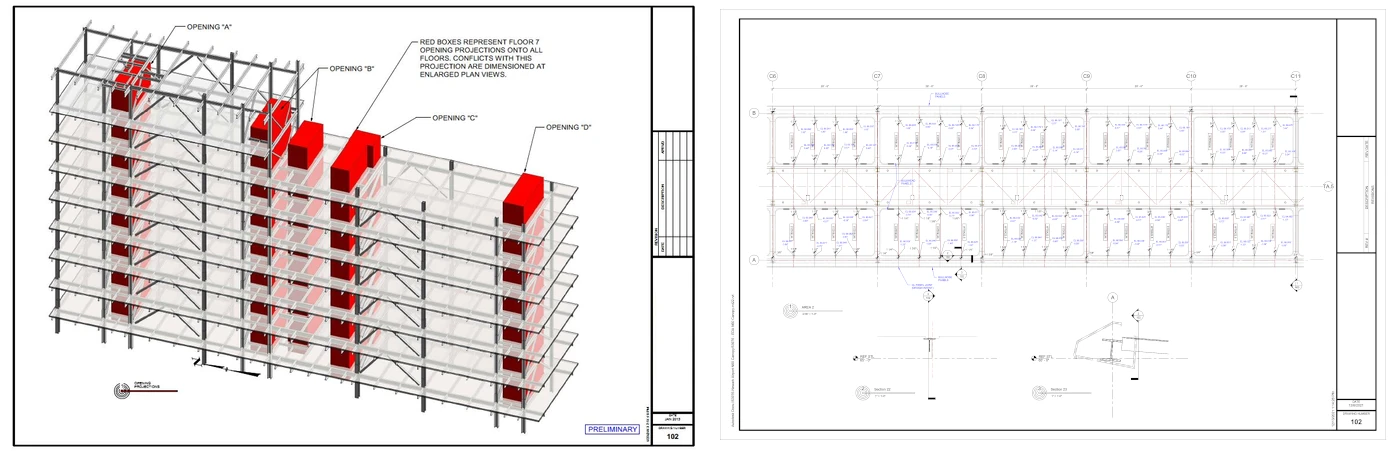
1. Architectural Drawings
Architectural drawings detail the purpose of the space, how it is perceived, and how the occupant interacts with it. Efficient use, comfort, and safe egress are documented on these sheets. These drawings may also give a preview of other aspects of the design that will be documented in more detail by other design disciplines. Common drawings or details may include: floor plans, elevation views, building sections, wall details, and other vital details. Architectural drawings are often created using 2D or 3D architectural design software.
Architectural drawings specify general arrangement and a background of the facility. These drawings are often shared with other design professionals for them to quantify fees and detail discipline's specific features. These drawings are also critical for resolving issues prior to actual construction. Architectural drawings (or BIM models) are often used for performing location collaboration and clash detection with other disciplines. Without architectural drawings, there would be no clear directive on a building’s design, increasing the likelihood of change orders and budget overruns.
2. Structural Drawings
Structural drawings are engineering documents that focus on detailing the building’s support features. A structural drawing may include the size and type of members; dimensions for a concrete structure; information and details about reinforcement bars; and other data that affects construction.
3. Electrical Drawings
Sometimes called wiring diagrams, electrical drawings give a visual description of the electrical systems in a building and how they connect to the outside power grid. The purpose of an electrical drawing is to explain the electrical design to the electricians installing the system. It will also be used as a reference for future electrical repairs. Electrical drawings fall into one of several types: schematic, wiring, block, and pictorial.
4. Sanitary and Plumbing Drawings
A plumbing drawing provides a visual representation of the building’s plumbing system. It includes the exact location of pipes, valves and fixtures; and outlines how freshwater is supplied and how wastewater is discharged. This type of drawing is used to illustrate the engineering design to those contractors installing the building's plumbing system.
5. As-Built Drawings
As-built drawings, or finished drawings, document the actual final construction completed. As-built drawings may look different from the initial architectural and structural drawings since most designs need adjustments along the way. Regardless, as-built drawings are intended to document final construction. Since most architects and engineers are not involved in the day-to-day processes and are not aware of the changes made during construction, it is often up to the contractors to submit final as-built drawings. The nature of this final process makes initial as-built documents unreliable without laser scanning after construction is complete.
Conclusion
A construction project is a rather complicated one that involves a lot of work both before and after the actual construction. To complete a building construction project, different types of drawings are needed.
An architectural drawing, perhaps including a computer-rendered 3D architectural design, is needed first. Then, based on the initial architect’s plan, a structural drawing is submitted. After that, wiring and plumbing diagrams convey the design to the workers installing these systems. Lastly, an as-built drawing is compiled by the contractors to show the final project, including any changes and adjustments done to the initial design. Another way to capture the final as-built drawing is by 3D laser scanning the project site.
Why GPRS? The GPRS Difference.
With GPRS, clients can rest assured that our elite Project Managers use state-of-the-art 3D laser scanning technology to document accurate existing conditions information. Every GPRS Project Manager completes an extensive training program to ensure their competence in laser scanning equipment and field knowledge to provide the best possible results for every project.
We use industry-leading Leica survey-grade laser scanners to capture comprehensive point cloud data. The data produced is complete, clean, accurate, and well filtered with low range noise. Point clouds provide powerful and dynamic information for a project. By representing spatial data as a collection of x, y, and z coordinates, point clouds deliver large datasets that can be mined for information.
Our Mapping & Modeling Team transforms point clouds into 2D CAD drawings, 3D BIM models, 3D meshes, TruViews, and virtual tours of the highest quality standards. Partnering with GPRS means you recieve accurate as-built data to expedite project planning and reduce change orders, delays, and costs.
GPRS leads the industry – providing outstanding service and cutting-edge technology – keeping projects on time, reducing risks, and putting relationships with our clients first.
What can we help you visualize?